I am Cat Burton, FLYER’s safety editor. I’m a veteran of a 45-year career as a British Airways captain, and now senior flight instructor at Cardiff for a professional flight training school, so I shall be trying to bring my wide perspective to these pages. I’ll look at incidents and analyse what went wrong, and what might have saved the day. I emphasise that these are my own analyses. They may agree, or disagree, with any official accident report, but I will try to draw lessons we can all learn from. Some may be brief and some much longer, depending on what suits the particular incident.
In this article we’re going to look at an accident that happened in New Zealand, but the lessons definitely apply closer to home.
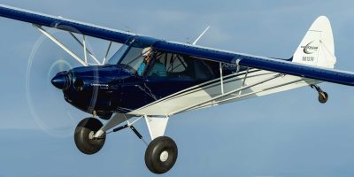
The aircraft involved was a Van’s RV-12 and it was flown by a 78-year-old pilot who held a valid and current NZ Recreational Pilot Licence and a NZ PPL. He had a total of 2,287 hours experience. Both the aircraft and the pilot were qualified VMC only.
The pilot was on a mission. He had a doctor’s appointment in Ardmore and some spares to deliver to a maintenance shop at Ardmore Airport.
To give context, This is a 2hr 15min drive around the south of the Firth of Thames, or a 23 minute flight.
The weather was low cloud and fog over the whole region, but it cleared at the departure airfield. However, looking west, a deep bank of cloud was clinging to the tops of the Coromandel Range. New Zealand Met Office calculate the tops at above 4,000ft. Meanwhile, the destination airport remained in thick fog as the pilot departed.
The aircraft was well equipped with Dynon EFIS, GPS and ADS-B. The Dynon equipment was NOT certified as primary navigation equipment but as an aid to visual navigation.
It was apparent that, for much of the flight, the aircraft did not comply with Visual Flight Rules, which require, in Class G airspace and at or below 3,000ft – clear of cloud, in sight of the surface and 5km forward visibility. The cloud covered Coromandel Range usually has visibility of less than 500m.
“The pilot was on a mission. He had a doctor’s appointment in Ardmore as well as some spares to deliver”
Having crossed the Firth of Thames at 3,000ft, the pilot seems to have realised that his destination was still unworkable. He flew south, possibly towards an alternate, for a while, then turned direct to his departure aerodrome, in an unerringly accurate straight line at 2,400ft. This suggests that he was now navigating by GPS and flying on autopilot.
He had flown between the two airports many times before, as evidenced by the Dynon’s memory and previous ADS-B traces. However, his more southerly return track took him directly over one of the peaks of the Coromandels which reaches 2,388ft.
Unfortunately, the peak is tree covered and, in the thick cloud, he hit a tree and ended up being stopped by another tree. The wreckage was found the next day by a search and rescue team, the pilot having not survived.
So what factors were at play?
‘Get there’-itis. Undoubtedly, the pilot was heavily motivated to make the flight.
IMSAFE*. Friends reported that the pilot, increasingly, was suffering from fatigue. On occasion, he was unable to egress the aircraft after a flight. He had been diagnosed with two serious medical conditions. He was also taking medication with drowsiness as a known side effect, though toxicology showed only trace levels.
Local pilots reported that the pilot had experienced VMC to IMC incidents in the past and was ‘relatively comfortable with them.’
The accident report concluded that this was a CFIT (Controlled Flight Into Terrain) incident.
How could this tragic accident have been avoided?
- Conduct an IMSAFE audit before every flight. If you’re ill, on unsuitable medications, stressed, have used alcohol, are fatigued or haven’t eaten, think again.
- Don’t get so attached to the plan that it becomes a contributor to unsafe behaviour.
- Know the limitations of your skills and your equipment. An autopilot will just as happily fly you INTO a hill as over it. Uncertified GPS is just an aid to visual navigation. And self authored let down procedures are death traps.
Footnote:
*IMSAFE is a common mnemonic for self assessing fitness before flight:
* Illness – are you suffering from any?
* Medication – are you taking any?
* Stress – are you suffering from any?
* Alcohol – when did you last drink?
* Fatigue – are you well rested?
* Eating – have you eaten recently?
From CAP 1535 Skyway Code v3


