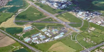
Cranfield University wants to develop the existing National Beyond visual line of sight Experimentation Corridor (NBEC) and is looking for feedback to its proposal.
The university is holding an online briefing session on the proposed airspace change on Friday 29 January at 13:00-14:00. A survey to gather feedback will also be launched on 29 January and run to 12 March.
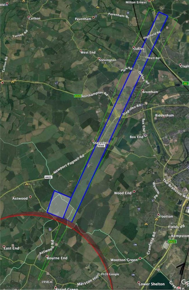
The NBEC is an unmanned aerial vehicle (UAV) development corridor extending from Cranfield Airport’s air traffic zone towards Oakley, Bedfordshire. UAV operations to develop the corridor are proposed to run from 1 July to 30 September 2021.
Professor Graham Braithwaite, Director of Transport Systems, Cranfield University, said, “NBEC provides a safe, managed environment for unmanned aircraft experimentation which will help to unlock the potential of a modernised UK airspace and the benefits drones can offer for society and the economy.
“These flights will be for research purposes only and are primarily related to developing navigation and location identification systems. We look forward to engaging with local stakeholders and welcome all feedback on the proposal.”
FLYER first reported on the NBEC flights in February 2019.
Cranfield says the route of NBEC has been designed to minimise overflight of built-up areas, roads and railways.
Electrically-powered, fixed-wing (aeroplane) type aircraft weighing less than 10kg with wingspans around three metres will be used in the trials. The maximum height of the flights will be 400 feet above ground level (AGL) and the minimum height rarely less than 200 feet AGL.
NBEC is part of the Civil Aviation Authority (CAA) Innovation Hub Sandbox and Cranfield is working with the CAA to develop this temporary airspace change proposal.
Register for the NBEC briefing session here
Cranfield’s Airspace Change Proposal is here.


