Peter Steele
11 May 2020
How does a grounded PPL pilot fill the days during lockdown? Certainly not with the dreaded DIY or daytime TV. Pilots are always learning and honing their skills. So, I wondered, could I take advantage of all this unexpected free time to brush up on part-remembered knowledge or even learn something new?
I’ve recently installed X-Plane 11 on my PC and also bought Just Flight’s PA38 Tomahawk, but have had little time to play around with it. I bought some UK scenery for X-Plane – Taburet Mesh XP which, although not ‘photographic’ scenery, had enough recognisable landmarks to help VFR navigation. I also bought scenery of my home airfield, Elstree.
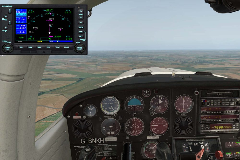
My first challenge was a spot of VOR navigation. The Tomahawk has the advantage of clickable areas on the Nav and GPS. They open into pop-up panels, making changing frequencies much easier. X-Plane also allowed me to use it in conjunction with SkyDemon, as long as my PC and iPad were on the same Wi-Fi network.
My route was from Elstree to the BPK VOR, then onto the other airfield I fly from, Fowlmere. I intercepted the Brookmans Park VOR 055 TO radial, then followed the 010 FROM radial to overhead Royston, turned to 065˚ and flew the 3.5nm to land at Fowlmere. I’d set X-Plane’s weather to mimic actual conditions, which meant I had to add a 10˚ correction angle to keep on track. Changing the weather and repeating the exercise in IMC was challenging after I’d added a bit of turbulence and stronger winds to the weather. SkyDemon helped by setting up approach chevrons for Runway 07 – a feature very useful in poor visibility as Fowlmere can be very hard to spot in anything less than 10k visibility.
I’d spent the last year mostly flying with Modernair at Fowlmere and hadn’t flown much recently at Elstree, so practising Standard Overhead Joins, while avoiding the many noise sensitive areas around Elstree, was my next challenge. Once airborne, SkyDemon’s display switched to a Pooleys plate, with the noise abatement areas and departure routes highlighted, a great feature. Adding to the challenge I then lowered the cloudbase and visibility and practised bad weather circuits.
One unexpected bonus of flying X-Plane was how much it taught me about using SkyDemon. I’d mostly used it as a planning tool, but now was able to hit that pause button and experiment. Tapping the top left SkyDemon logo gave me a list of nearest airfields. Choosing one changed the display to a ‘direct to’ route. Pressing the diversion airfield itself called up more information, distance, ETA and direction, frequency and field elevation. The information section gave approach info and access to Pooleys or AFE plates (with a subscription).
This led me to spend an afternoon on YouTube, searching ‘SkyDemon tutorials’ and practising my learnings on X-Plane. Just like real-world flying, SkyDemon produced a log of my sim flights, which I could analyse later in SkyDemon or Google Earth.
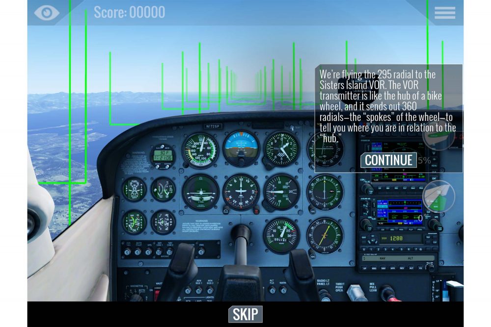
I also tried X-Plane Mobile on my iPad. The free version has three free aircraft and limited flying areas. I used the C172SP to practise the lessons in the ‘Flight School’ section. Any PPL students who are lesson-starved can learn VOR navigation and ILS approaches. It really does work very well, using the mobile device’s built-in motion detectors.
One feature I enjoyed very much was the ‘General Aviation Challenges’, which is within the ‘Challenges’ section. These included landings on a mountain top in a Piper Cub, short-field landings in Alaska, engine failures, engine fires, bad weather landings and even dealing with a bird strike! If you want to explore further afield beyond the ‘free’ areas, you can subscribe to whole-world scenery, airports and aircraft for £5.49 a month. I think we’re going to need a bigger iPad!
Much as I enjoyed X-Plane mobile, I really wouldn’t want to try this on anything smaller than an iPad Air. Changing frequencies, switches and flying a single engine prop aircraft was difficult. The rudder control is a thumb-activated circle on the right of the screen, along with similar trim and flap control areas, but the overall experience was surprisingly positive. Plus, it’s free!
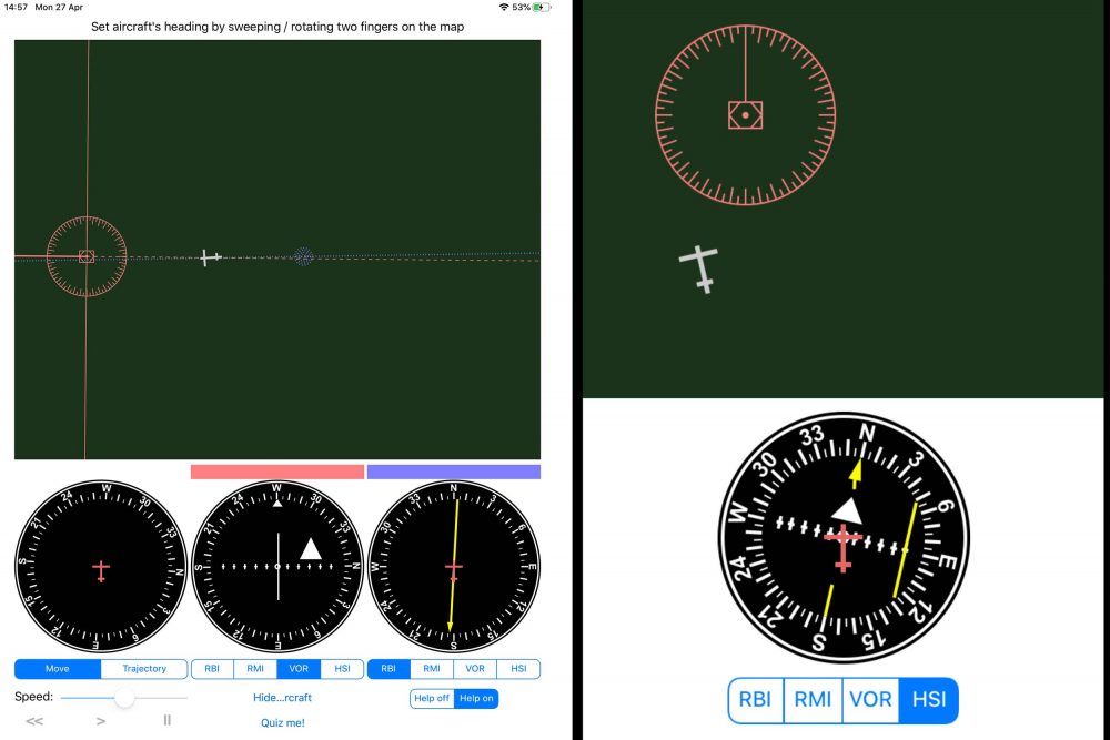
Having had enough of simulators, I took a look at some of my IMC apps on the iPad. A free radio navigation app, Radionav Sim, has always struck me as a beautifully simple way for students to visualise how RBI/RMI/VOR/HSI instruments work. I wish it had been available 14 years ago when I was studying for my PPL. The full version is available for £1.99, which adds far more options, including the ability to draw a
course on the screen and have the aircraft follow it while tracking two VORs, plus a ‘where am I?’ quiz.
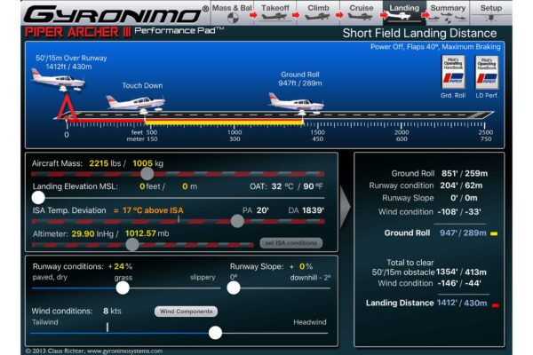
Another series of apps I’ve found useful are the Gyronimo Performance ones for individual aircraft. They are very cleverly designed, allowing input of weight and balance, runway elevation, temperature, pressure, runway conditions, wind components etc. They also give performance information on take-off, climb, cruise and landing. There are two modes: ‘Individual’ and ‘Plan’. ‘Individual’ allows calculations to be performed separately from each other, ‘Plan’ takes into consideration data added from previous pages, allowing complete performance planning from departure to landing.
I fly a Piper Archer II from Elstree and two Archer IIIs from Fowlmere. I had already set up weight and balance profiles on the Archer II, so I also set up profiles for the IIIs. It’s very interesting to change the conditions, using the sliders, to see what difference is made to the landing or take-off distances. The app also includes links straight to the relevant section of the operating handbook on each page. They aren’t cheap at £17.99 for an Archer II app but I like them a lot.
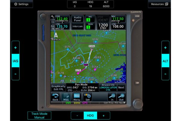
Both aircraft types I fly have Garmin GTN 750 or 650s, and I thought it would be worth learning more about them. Garmin have a free app trainer, just search for ‘Garmin GTN Trainer’. You can choose between the 650 and 750 on the start-up screen. I used this to learn how to set up a flight plan, edit it by dragging the route line around, change map settings etc. I’ve only just scratched the surface with this app, but delving deeper into it is on my To Do list.
Somehow, I think I’ll find the time… There is also a free trainer for the newer GTN Xi series.
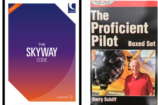
One free publication well worth reading is the CAA’s Skyway Code. It is a concise publication and contains quick access to key information that pilots need.
It was updated in 2019 and can be downloaded free from:
www.caa.co.uk/General-aviation/Safety-information/The-Skyway-Code/
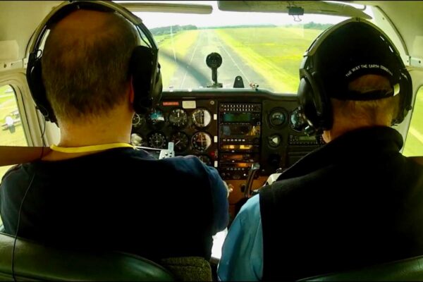
A long-standing hobby of mine has been video, and since action cameras became available I’ve used them to record my flights. I’ve been fortunate to fly with some excellent instructors, among them John Baines MBE at Elstree and Derick Gunning at Fowlmere. I always make a point of recording video and audio on check rides. Reviewing the video footage of flights of these vastly experienced teachers inevitably leads to even more learnings. I flew with John on a short-field lesson in a 172 seven years ago and watched the video recently, picking up some lost tips on short field techniques. A year ago I had a lesson with Derick in an Archer III, which is equipped with a GNS 530.
I’d not flown the aircraft since then, but watching the video means I’m now familiar enough with the GNS to feel comfortable using it next time round.
All of which leads me to YouTube again… There are so many videos out there – if you have a problem, there is a video with the answer. Searching for GNS 530 or GTN 750 tutorials gives so many options, including free training videos by Garmin. There are also some excellent subscription channels such as The Flying Reporter, which is definitely worth a watch.
I’ve a pretty large library of aviation books, but one trilogy sticks in my mind as the best collection of flying ‘wisdom’ I’ve come across: The Proficient Pilot series by Barry Schiff. If I was only allowed three aviation books on my desert island, these would be the ones. They are still available from Flightstore and Amazon. Certainly worth reading.
There is so much information, on many different platforms, for grounded pilots to soak up and apply in practice once we are all back in the air.
Stay safe and see you in the skies…