glacier flying
FLYING ADVENTURE

Glaciers of the Alps

Garrett Fisher spends an intense 83 hours flying his Cub in just 48 days, utterly entranced on a mission to photograph every non-polar glacier on Earth from an aerial perspective

The genesis for the project at hand has an origin that began some years ago, just before shipping my PA11 Cub to Europe. At the time, I was living in a residential airpark south of Jackson Hole, Wyoming, USA. My expectation was to continue living there for some years, so I held in the back of my mind that the first glaciers of the Rockies began within a 100-mile radius of the place, barring a few small ones in northern Colorado. It is logical that I did not expect to dive in and photograph every glacier I could find as soon as possible. I initially set a goal to visit the glaciers of Wyoming that year, which would be ambitious enough, given their locations near Yellowstone and Grand Teton National Parks, and two other profound wilderness areas. Montana, with her eponymous Glacier National Park, would just have to wait until another time.

While I was aware that summer offers a limited window where annual snows melt to reveal glaciers clearly below, I had not, until that point, ever laid eyes on a glacier from the air, nor had I made any attempts at completing a contrived list inside a limited season. As I made exploratory trips into the Wind River Range and the Teton Range, I was finally able to get started in early August… only to get blocked by thick wildfire smoke for almost three weeks. I had made two profound flights into the mountains, getting up close and personal like never before – and seeing for the first time the immensity of detail available when the surface of the glacier is visible. I call it ‘centuries of snowfall’, as layers and layers of seasons are visible much like tree rings. Did this snow fall before America was even a nation? Possibly…

It confirmed that summer is, by far, the only season to photograph glaciers. Now with the wildfire smoke problem, I was approaching September with much more to do in the State of Wyoming. What further complicates things is that the property shenanigans that timed with the visit of the Germans in 2015 struck precisely during smoke season, which meant that when the air cleared, I had an informal plan to move to Europe later in the year. It would be my first and last season in Wyoming. Suffice it to say, the weather cooperated, and I decided to photograph every glacier in Montana as well. September 2015 remains my record for flying, clocking up 65 hours.

Glaciers do not reappear in my flying obsessions again until 2018. Germany, Spain, the Pyrenees, and flying in Europe in general was so much to comprehend that I was satisfied with my endeavours for a three-year period, until I came to Switzerland, where I first set out to photograph the 82 peaks over 4,000 metres (FLYER March 2021). What is fascinating is that, while I was appropriately awe-inspired by the immensity, length, depth, and amazing beauty of the large glaciers of the Alps, I was so single-mindedly focused on the peaks that I got a bit snooty… I said to myself that having seen the largest glaciers, what was the excitement about chasing the small ones? While I knew that if enough time was spent in the Alps, I would eventually photograph them all, I had to slap myself and recall that the ‘small’ glaciers of the Alps are immense compared to those of the American Rockies. In any case, it did not help that the time in Switzerland came to an end for almost a year.

In the summer of 2019, I was back at it and decided to photograph the glaciers of the Bernese Alps, plus write a book about it. It had taken some time to decide how to approach the glacier problem, as the simple fact was that there are enough for 10 books. I also did not want to binge consume them and have nothing left over, which is always an ironic – yet lingering – terror in the back of my mind that I would run out of things to explore.

I chose the Bernese Alps for a few reasons: the largest glaciers existed there, some of the most profound terrain in the Alps are in this range, it was closest to my base airport, and it contains some of the most recognisable tourist destinations. It also meant enhancing my skills around glacier flying. To fly a peak is one thing… they tend to be small at the top and can be viewed from above, laterally, or below, and usually from any side, which helps with the wind. Glaciers hug the slopes of mountains and follow gravity into profound terrain below, which means that clouds, shadows, and wind are a problem. One must be much more tenacious, patient, daring, and skilled to photograph each of the glaciers in an area than each of the peaks.

While the Bernese Alps season in 2019 was transcendental, it did not lead to much in the way of concerted glacier effort in 2020. Between Covid, poorly timed summer snows, and a dose of my own malaise, I merely worked on the glaciers of the Valais Alps (where the Matterhorn is located), which I had already photographed many of in 2018, 2019, and in the offseason.

Übeltalferner, South Tyrol Italy
Übeltalferner, South Tyrol Italy, August 11

Tall peaks
By the end of 2020, I had photographed the bulk of the glaciers of the Massif du Mont Blanc, the Bernese Alps, and the Valais Alps. This terrain, while it comprises possibly only 8% of the surface area of the Alps, contains the highest concentration of tall peaks and the largest glaciers. I had visited almost all glacial features in a combination of targeted effort, chipping away at it incrementally, and frolicking for pleasure because the mountains were pointy and big, while the glaciers were pretty (and I needed something to fly to). While there were already pre-tremors of what was coming in 2021, as I had articulated an early fear of ‘flying to them all and then having nothing to do’ in 2018, I still had no knowledge of what was brewing mentally.

I still do not fully recall each step of how the decision was made. I do know that I was evaluating my motivation behind flying and what I was hoping to accomplish. Glaciers featured high on the list as something that consistently was satisfying, and that I couldn’t seem to get enough of. One evening in early February 2021, I decided that I was going to form a ‘non-profit’ and ‘fly to every non-polar glacier on earth and photograph them’.

Months of project management ensued, including nonprofit applications and other such ephemera, before the realities of the pandemic restrictions set in – ‘You’re not going far in 2021, so you might as well get the Alps done’. Could it be done in one season? Or should I take it a bit slower? If it took two years to complete the Alps, then I dare say I would be dead before the glacier project would be completed. The Alps it would be.


Venedigerkees, Höhe Tauern National Park, Austria
Venedigerkees, Höhe Tauern National Park, Austria, August 12

I had started aeroplane shopping for a Super Cub, having decided in May 2021 that the PA-11 would not work for the glaciers of Norway and Sweden. It is 15 hours each way of flying with one tank, just to get there. Iceland was out of the question… even if I spent $10,000 or more to install a second wing tank. I couldn’t get my head around the North Atlantic in that aircraft. I needed a Super Cub… which I still haven’t found yet. The PA-11 would have to do.

At first glance, it seemed doable. Then when I thought about it in practical reality, imagining each flight, including the transit flights to get to various glacier areas, factoring the reality of alternating weather, fuel limitations, and sparse airports, it started to seem silly. My response was not to think about the specifics, but to instead dive right in and do what I could. I couldn’t control the weather nor many other factors, so I got on with it.

Premature melting
In early July, I was wandering around the base of the Matterhorn to alleviate my boredom when I noticed that it appeared the Valais Alps glaciers had some premature melting. As the Bernese Alps had been utterly slammed with snow the prior winter, I figured that the ridges to the south might have had a lighter season, so perhaps I could knock off a few in that range that I had discovered I had missed. In mid-July, I set off for a three-hour flight, only to find that a recent rainstorm was a snowstorm over the glaciers, rendering the flight useless from a photography standpoint.

A week later, I was over Mont Blanc, again alleviating my boredom, when I noticed the glaciers to the south over Italy, where they looked much more visible. “That would make sense, it is closer to the Mediterranean and warmer,” I thought to myself.

A few days later, at the end of July, I decided to take a flight from Switzerland to Italy and back. While I enjoyed knocking off quite a few glaciers, winds were 30kt, and I had to fight them with lots of added power as the glaciers were on the wrong side of the ridge. Roughly two hours into the flight, a glance at the fuel gauge induced a wave of panic, whereby I turned the nose back to Switzerland. After doing some calculations over Aosta, Italy, I determined I could make it, not back to base, but to Sion, which I did, breaking my European record for fuel consumption, although I still had the 30-minute reserve, despite unpleasant readings on the gauge.

Tolerable weather
The weather went south in early August, with a brief window where I could check out the snowpack on the Aletschgletscher. While it was not perfect, it was tolerable for glacier photography. It was time to begin. I did an oil change, timing check, plug clean and rotation, compression check, lubrication, brake fluid top off, comprehensive check of the Cub, and loaded a pile of tools and other materials in the back, at the ready for a batch of coming good weather. I considered diving into Italy and decided instead to head to Austria, to get the farthest glaciers completed first. The most distant glacier was almost 350 miles east. If I did not get it done now, I might never get it done…

It was off to St. Moritz, Switzerland for the first night, where I chipped away at many glaciers around Piz Bernina. The next morning, amid a passing rain shower, I climbed into the Ötzaler Alps of Austria, under an overcast deck, sandwiched in 30kt winds. “You’ll never get it done if you wait for sunshine,” I said to myself, and got to work.

Samedan Airport
Samedan Airport, St Moritz

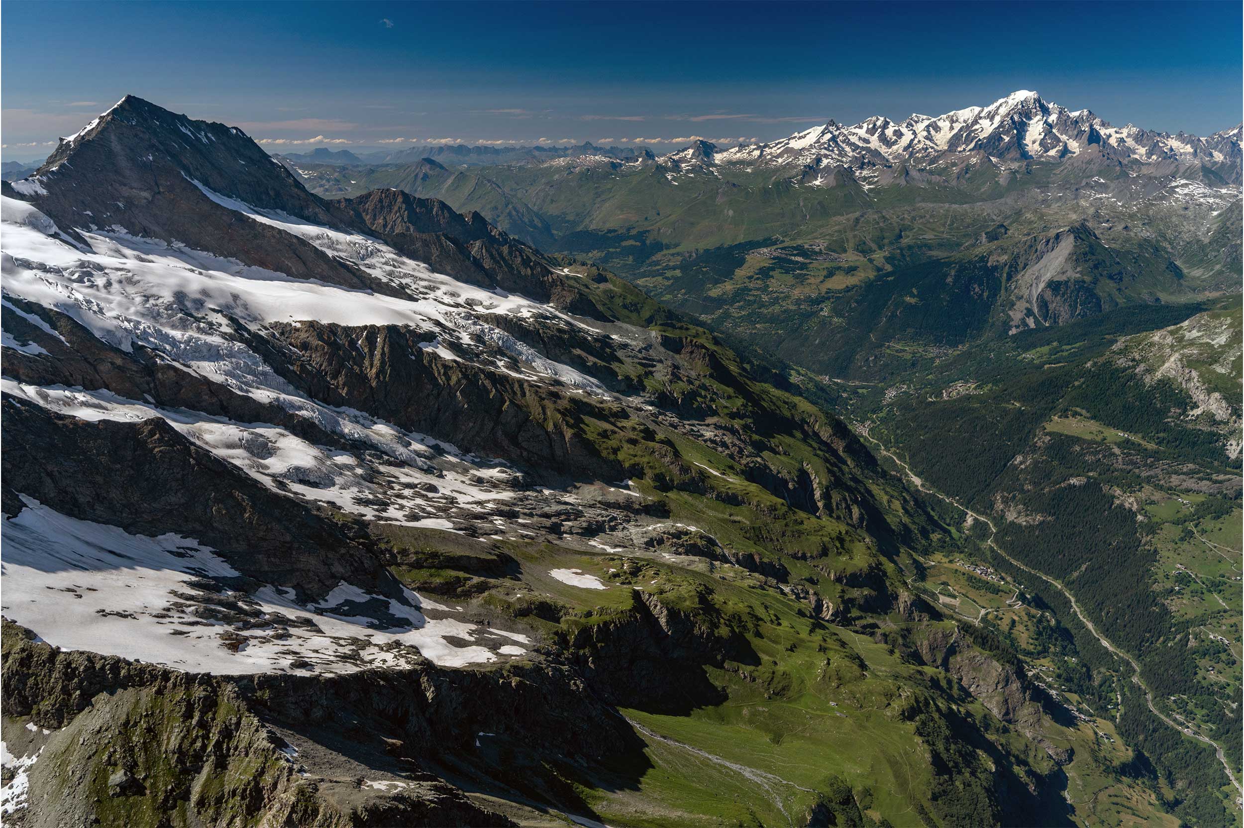
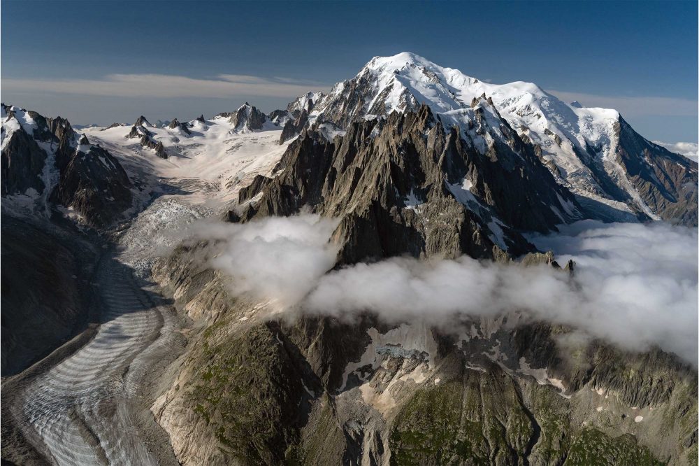
It was quite gruelling, with more glaciers than I expected, lots of turbulence, and not enough fuel. I completed half of what I expected before landing in Innsbruck, Austria, for fuel, 10,500ft below. While I was painfully cold in the cockpit, it was 29°C on the ground. After a 45-minute climb, I was back up into the Alps, freezing cold and getting beaten up by the wind, for another three-hour photography binge. Back down to Innsbruck, up again to the few glaciers around the Zugspitze in Germany, and back to Innsbruck for the night. At this point, my backside hurt so much from the bumps and uncomfortable Cub seat, so a final large pothole on the taxi-ride back to the hotel had me thinking I might need a proctologist…

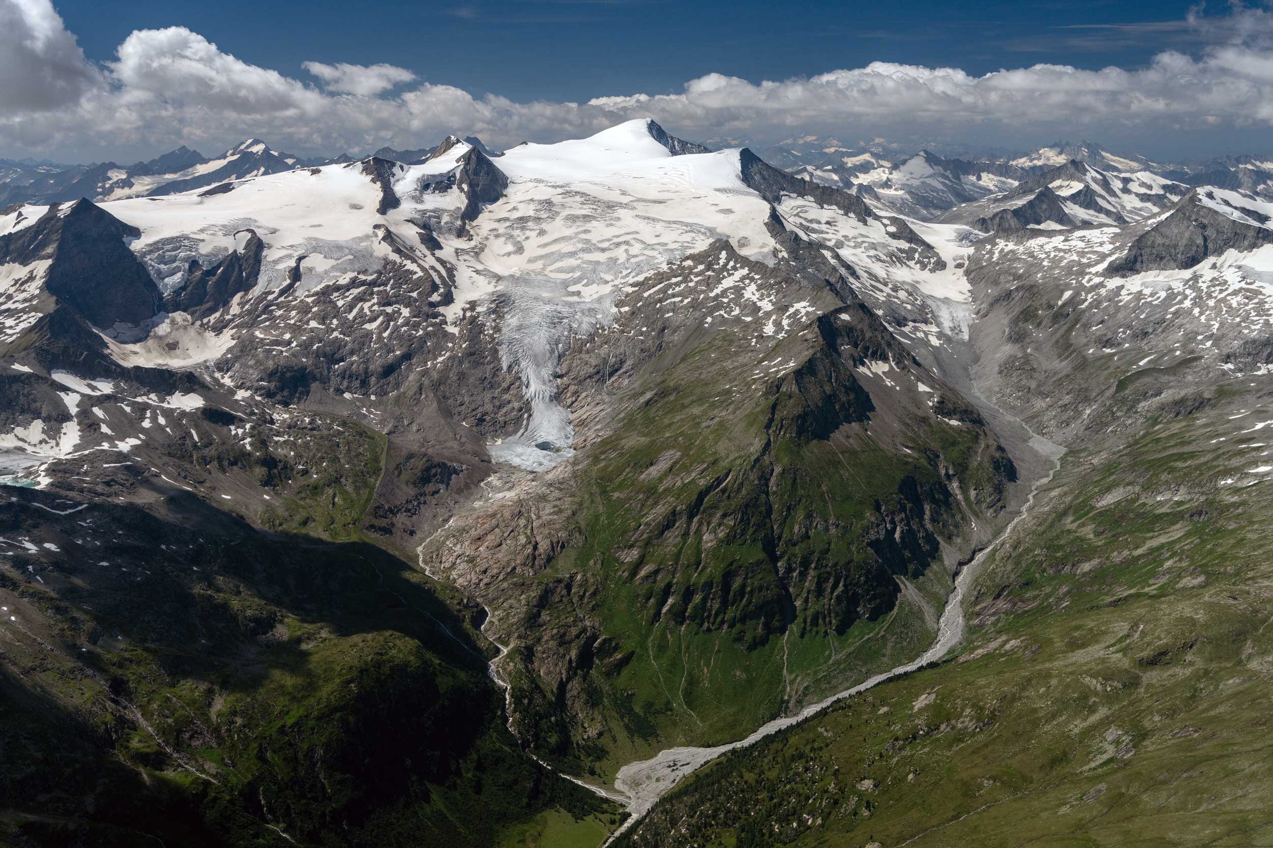
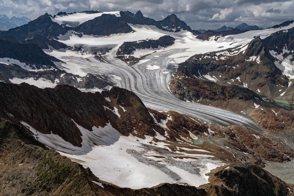
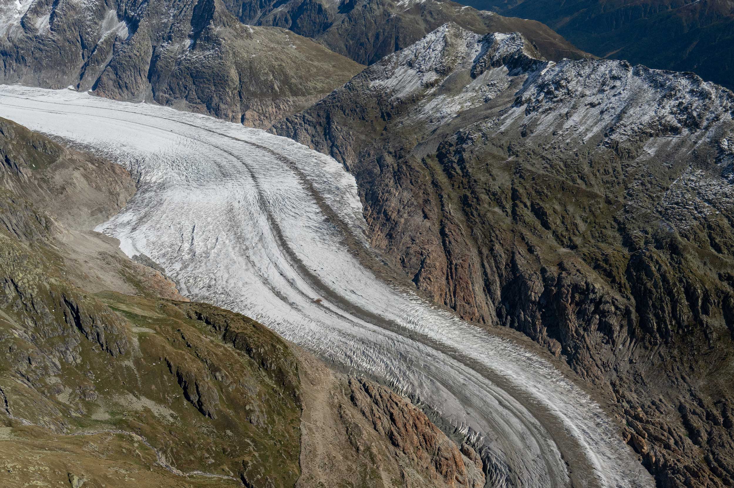
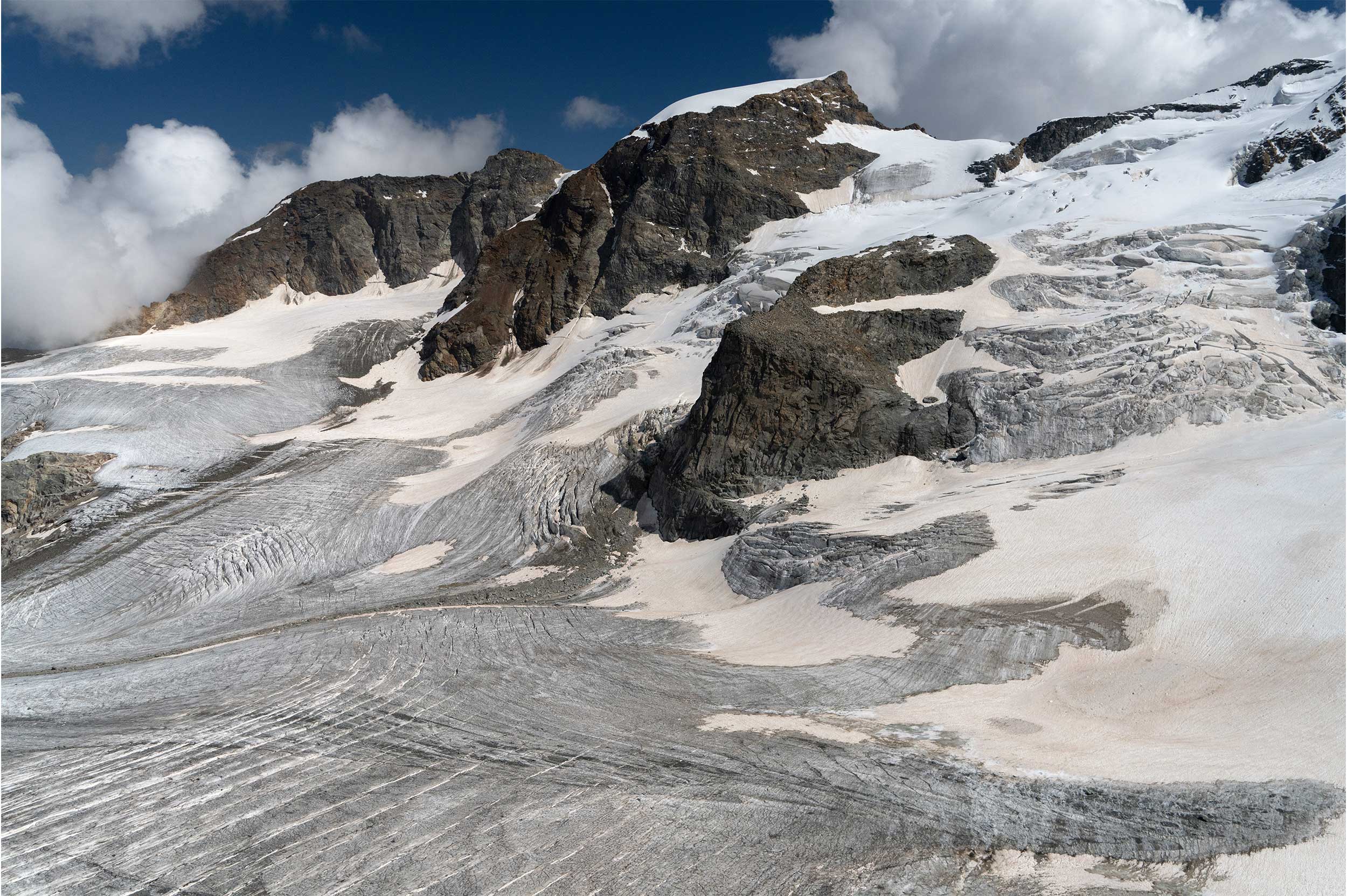
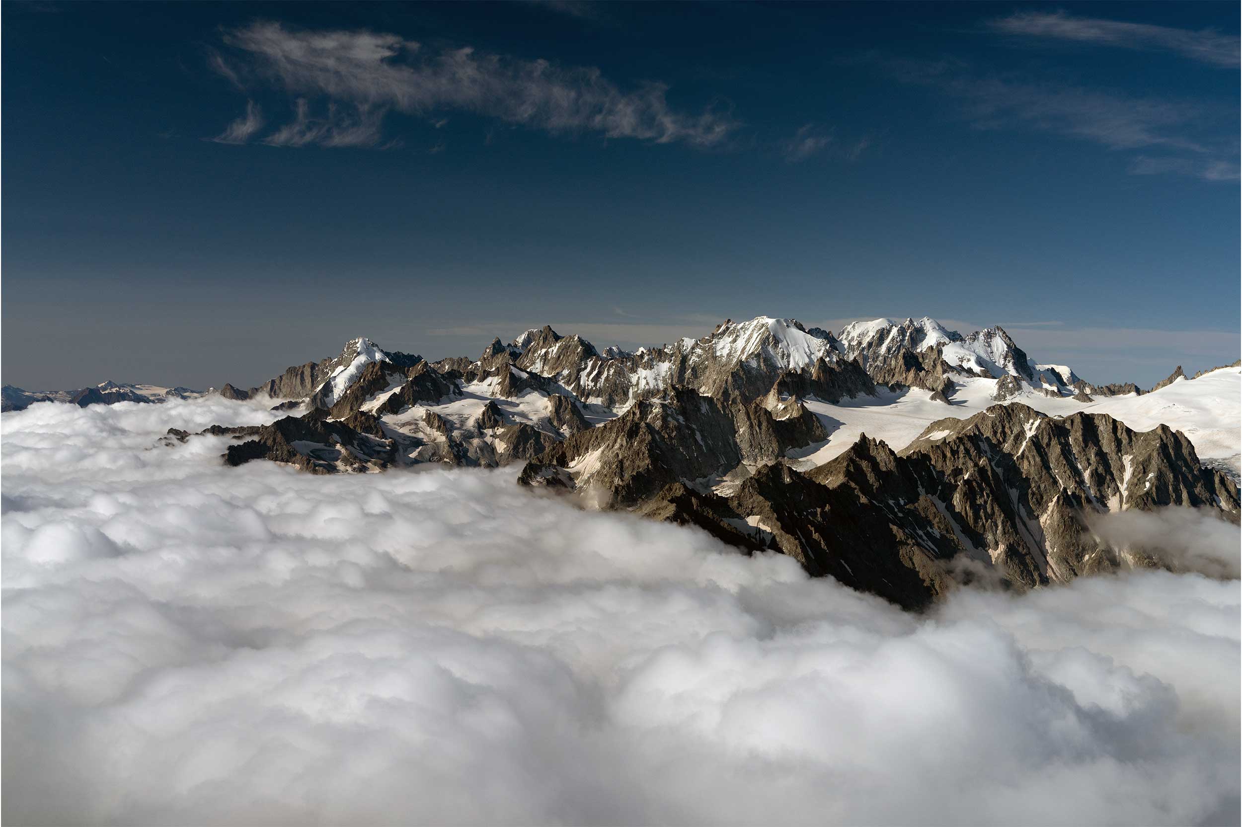
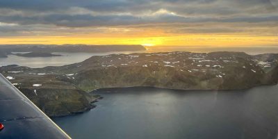
The next day, it was a three-hour session getting half of the glaciers of the Höhe Tauern National Park in Austria, which contains the highest peaks in the country. The glaciers have nice coverage, though there is a rather strict zone where one must maintain 2,000ft agl, though it allows for some valley areas that work. The problem was that 2,000ft agl over most lower ridges was the altitude of the cumulus clouds, which made for some immensely difficult flying, photography, and calculations.
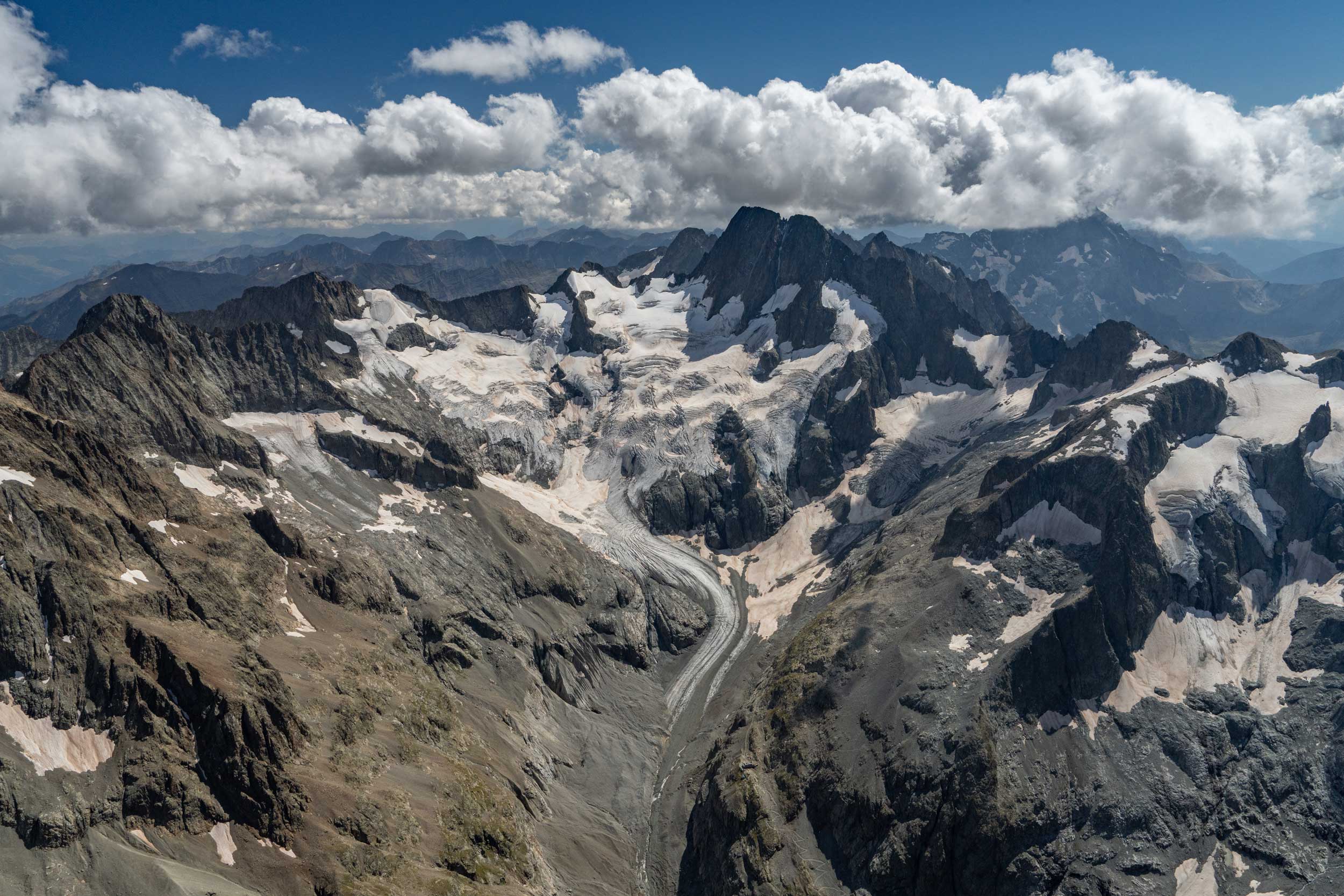
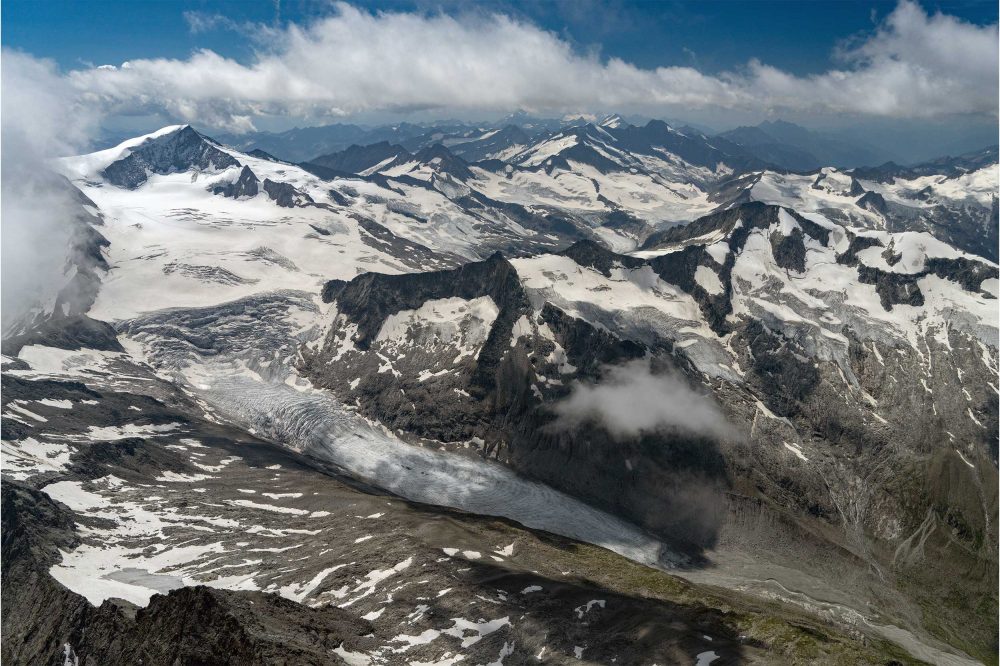
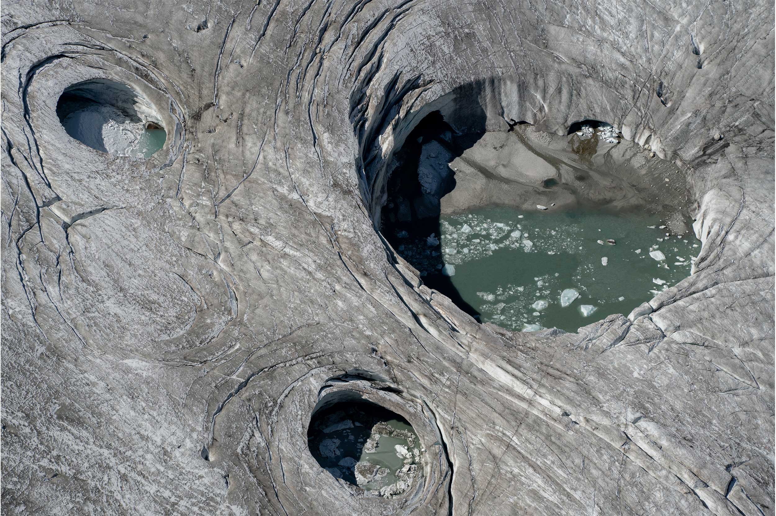
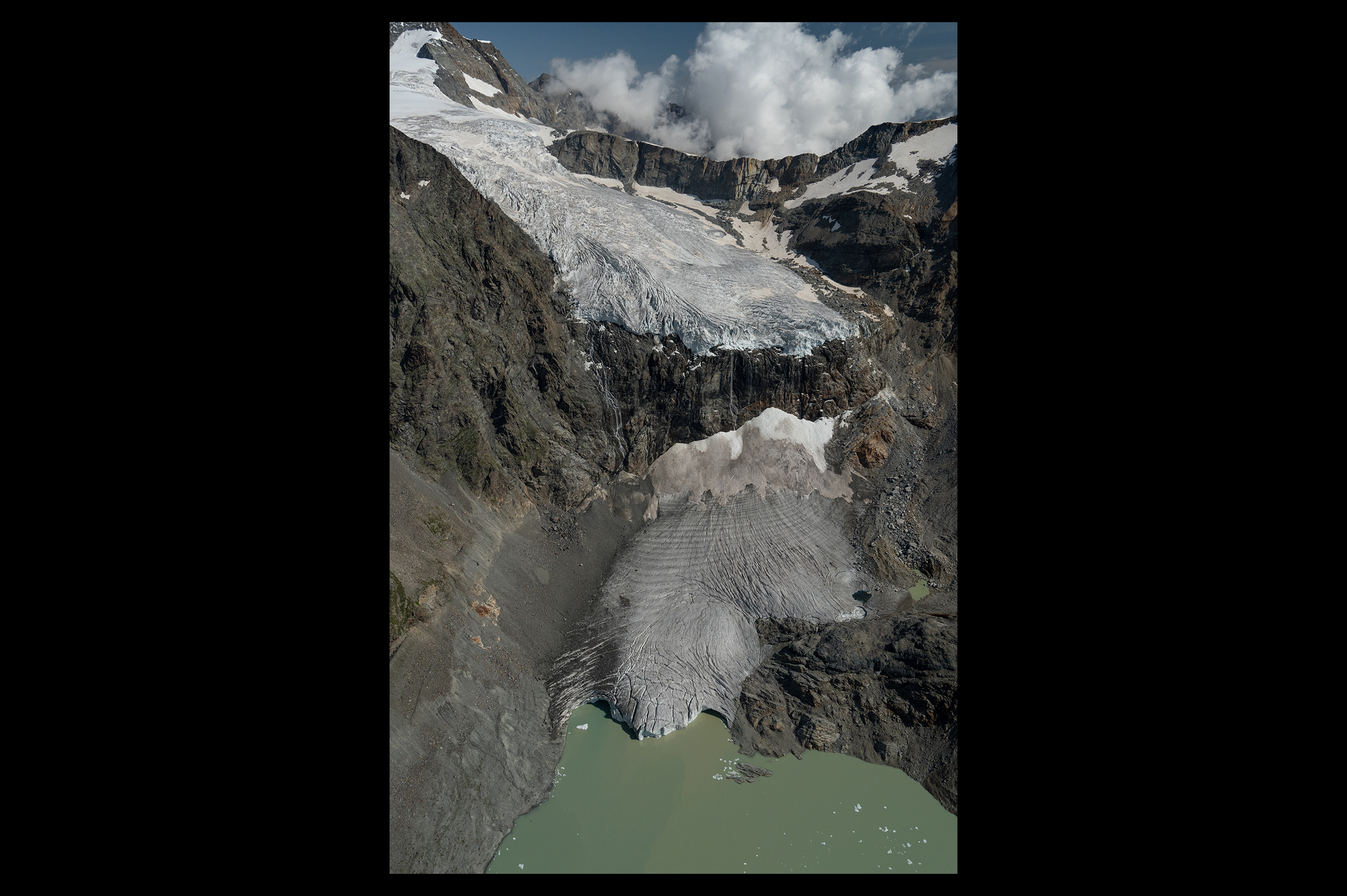
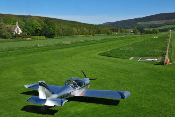
Small glaciers
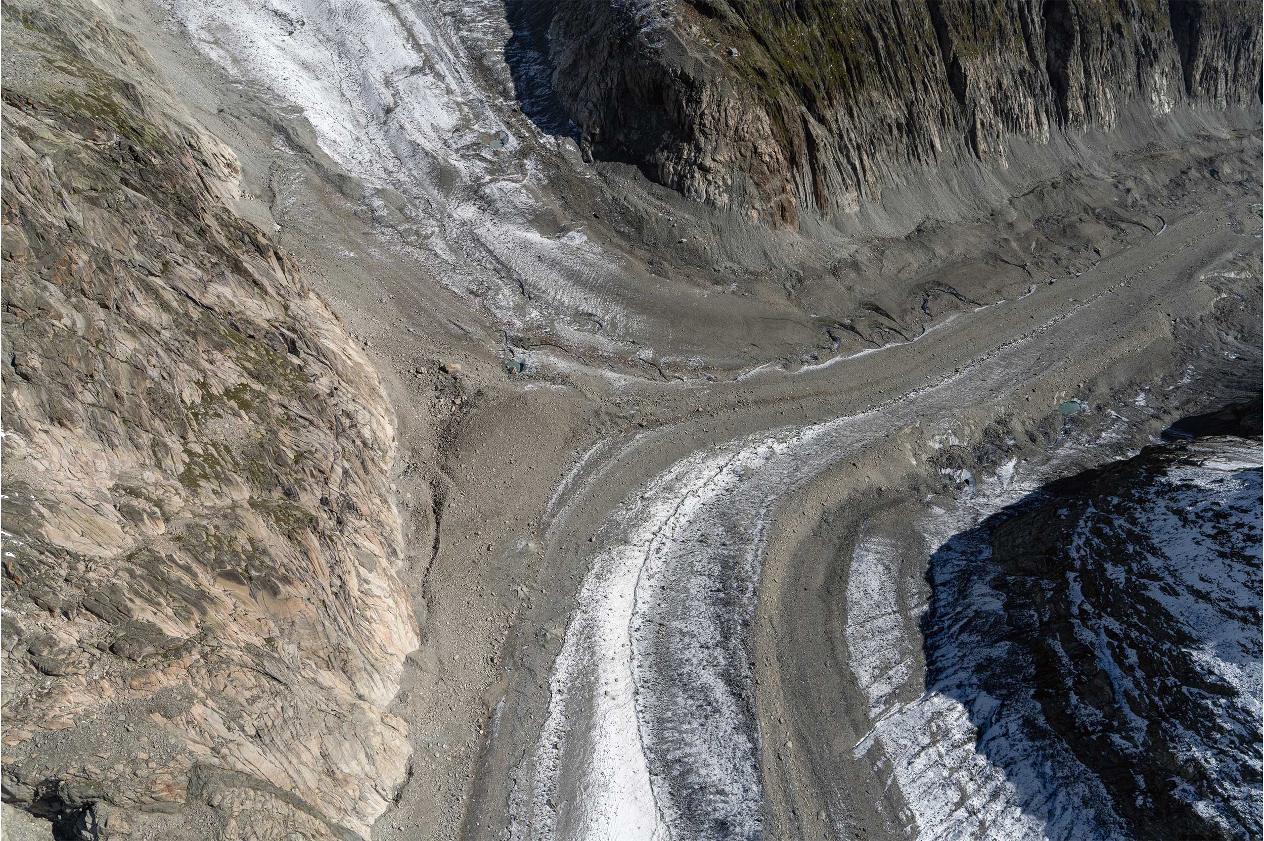
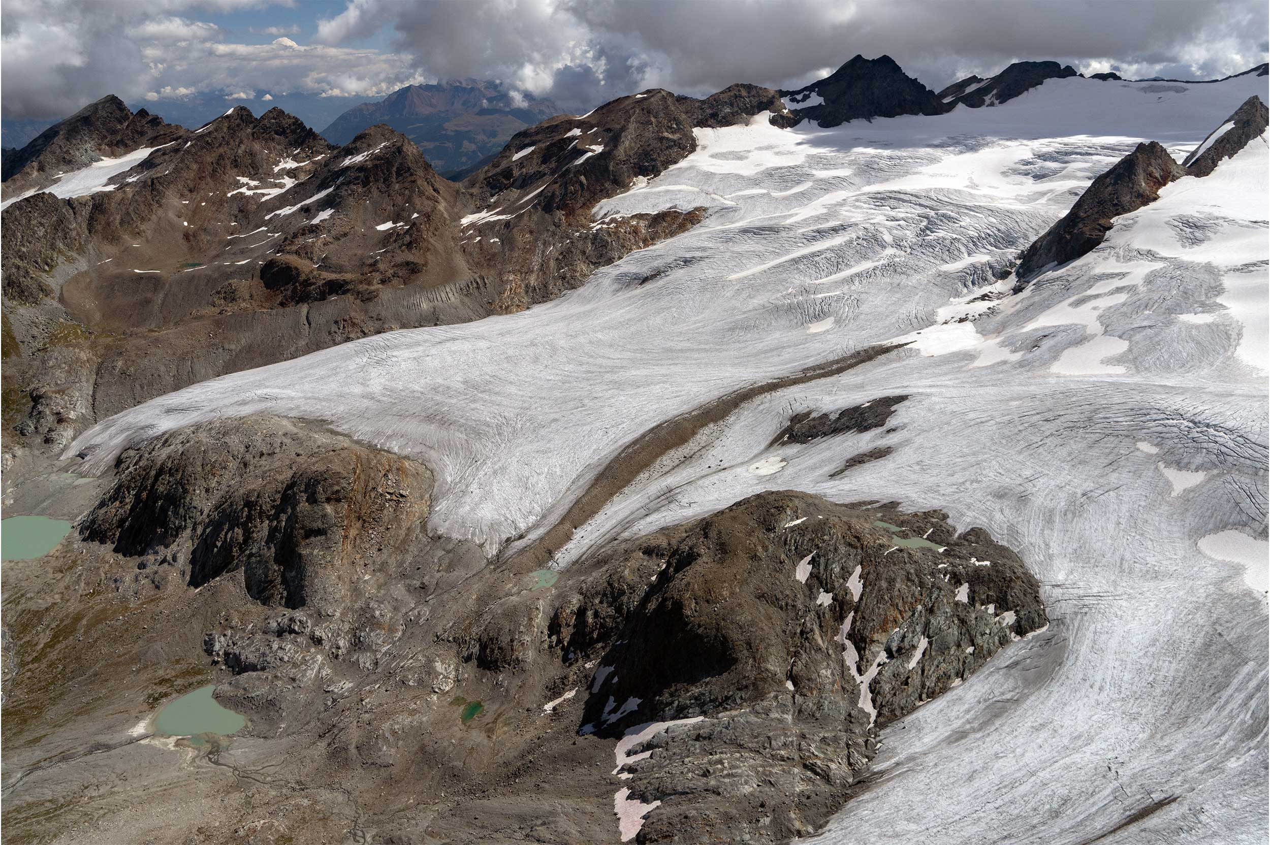
Down to Zell am See, 10,000ft below, and back up again for the eastern half of the park and back down for more fuel. I had to fly back to Innsbruck due to hotel availability, so I sideswiped a few more glaciers on the way. The next morning, I had to return east as I ran out of opening hours the day before to get the few small glaciers farthest east in the Alps. I also needed to get a few in Berchtesgaden, Germany, where at that moment, the only thunderstorm in Central Europe was sitting. By the time I got there, it had moved on, so I was able to photograph some glaciers in lingering light rain, which was a first. Eastward I went to get the farthest one, then down to Zell am See for fuel.

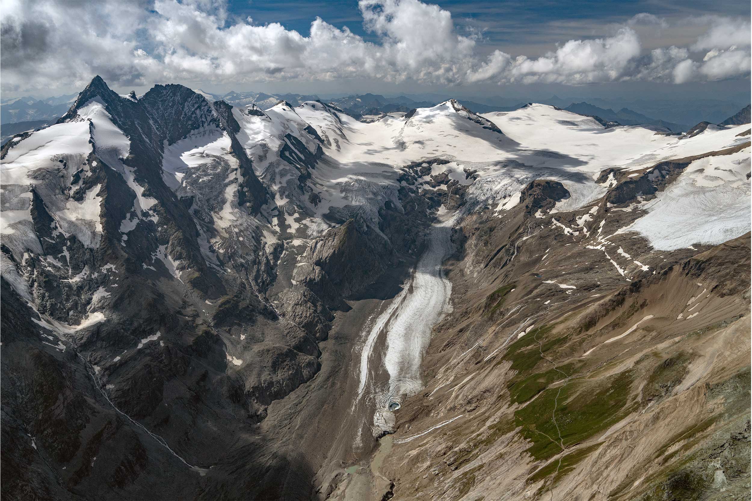
Annoyingly, headwinds, plus a closed airport in western Austria, meant that I had to land at Innsbruck again, roughly an hour away for fuel, which messed up the chance to get back to base. I decided to make the best of it, pick off a few glaciers in western Austria, and overnighted in St. Gallen, Switzerland. By the time I got back the next day, it had been 23 hours on the tach in four days which, in Europe, is much more complicated than flying the same number of hours in the US. I was extremely tired.

That didn’t prevent a morning flight two days later to see Mont Blanc above the clouds in morning light, as I was up unusually early due to all the travel resetting my sleep cycle. Three days after that, I stayed three nights in St. Moritz, with the goal to pick off the remaining glaciers of the eastern Alps. While I was able to fight most of the Mediterranean and summer towering cumulus, the clouds were too petulant to get the few glaciers in South Tyrol, Italy, which meant I would have to come back and fly quite a lateral distance. Since there were so few and since they were so close to the Adriatic, I figured I could get them in late September, when a high-pressure zone forces the Italian haze down, even if there is a bit of snow on them. And that’s exactly what happened.

The flight back involved some foul weather, to the point of MVFR flight in rain in the Alps to a diversion point on the Italian side of Switzerland, before sneaking over a windy pass, landing, and getting to the flat before the heavens unleashed a fury an hour later.

Five days later, I was in the air for a two-day flying binge all over the Alps of southern France, fighting clouds, French airspace, and park restricted areas, along with more petulant Mediterranean clouds, only to get 40% of the glaciers in the area. I had to return three more times, this time in brutally long day trips, involving customs aggravations, four landings per day, and Covid restrictions, to be able to chip away at these stubbornly difficult glaciers.

Mer de Glace and Mont Blanc, Chamonix
Mer de Glace and Mont Blanc, Chamonix France, August 23

There was still the matter of the glaciers on the northern ridge of the Alps, east of the Bernese Alps. They were so close, and I had not yet done them, yet the cloud situation was not cooperating. I finally found a day where it would work. There was a solid cloud deck below, which was forecast to burn off, and some puffy clouds above. I took off, got halfway through my glacier flying sandwiched between the layers, until I realised that the clouds were not burning off… at all. “We have a situation now,” I said to myself, calculating St Moritz as a back-up (fumes) and then checking the webcam, where I found Bad Ragaz would work. A runway is a runway when you need it. Fortunately, I found a hole over Canton Glarus, dived under, fuelled at Wangen-Lachen as planned, and returned, climbing through the same hole and doing the ‘VFR on top’ routine for two hours, with the Alps (and the glaciers I needed) sticking out above.

When time came for the final flight east, again to St Moritz, a high-pressure zone had arrived in late September, which cleared the clouds and brought in astonishing 170-mile visibility, while I frolicked in the skies over Cortina d’Ampezzo, Italy. On the flight back after two nights in St Moritz, I picked off a few small glaciers on the Continental Divide, happy as a lark that I had done it… That was, until I flew into a dust storm that had blown up from the Sahara. That was not in the forecast, though so be it, if one is in the air enough, interesting things happen.

The flying bender from 10 August 10 to 27 September was an unabated binge of 83 hours on the tach. Hopscotching from roughly 1,500ft for fuel to 12,000ft to photograph glaciers, with only 18 gallons of fuel and 70kt cruise was a tiring but rewarding feat, which turned out to be far more involved than I originally anticipated. What remains is a better aircraft to acquire, and continuing seasons of glacier photography.

Footnote: The Global Glacier Initiative was formed as a non-profit corporation in 2021 with a mission to photograph every non-polar glacier on Earth from an aerial perspective. Images will be shared for free for academic, scientific, climate, and glacier outreach purposes, to share a compelling, stirring, and personable view of these majestic features that are hard to reach, owned by the public, and disappearing rapidly. Future generations will not know what it is like to experience the glaciers as we have them now. More information at globalglacieriniative.org.

Garrett Fisher has published 31 books, 27 of which relate to aviation. He blogs regularly about his glacier and non-glacier flying adventures at www.garrett fisher.me


Share

Leave a Reply

Share
Topics
  • 2
  • 3
Enjoy 3 Free articles OR Join today to enjoy unlimited access to all content
Join today

We use cookies to give you the best online experience. Please let us know if you agree to all of these cookies.