Hammerfest
Flying Adventure

Defying Dawn to Dusk

When Adam Jackson and Martina Petkov planned to enter Pooleys’ annual Dawn to Dusk competition, they came up with a novel idea: challenging the very notion of ‘dusk’ by flying to Norway in mid-summer…

New Year’s Eve 2021. I’m sitting looking at maps searching for inspiration for a project to try to reinvigorate my passion for flying. I’d only flown a handful of hours during each of the preceding years, as various lockdowns restricted the opportunity, and later my enthusiasm, for flying. The very next day I came across an email about the Dawn to Dusk competition. The rules were simple; flights may start and finish from any place in the world, and must have a minimum of four hours airborne time between the hours of dawn and dusk. All that was needed was for me to come up with a theme and a challenging goal. Defying Dawn to Dusk was born.

Our objectives were three-fold:

  1. Depart the UK for Norway and fly far enough north to avoid dusk until we returned to the UK.
  2. Fly around the North Cape – this is arguably the most northerly point in mainland Europe.
  3. Fly at local midnight under the midnight sun, therefore ‘defying’ Dawn to Dusk.

Dawn to dusk

At the summer solstice the days are at their longest in the northern hemisphere. The Arctic Circle at 66°33’50” north of the equator marks the southernmost latitude at which the sun will not set on this date. The latitude at which there will be no dusk (the end of evening civil twilight) is 6° further south. So, to avoid dusk after leaving the UK we must get somewhere north of 60°33’50” (with some margin to account for the fact that we would not be flying precisely on the summer solstice).

flying
The team! Adam Jackson, Martina Petkov and the Cherokee!

The aircraft My flying experience is almost entirely in Piper PA-28-140 Cherokees, so this seemed like a natural choice of aircraft. I could have hired an aeroplane with better performance… but making life easier would not have made for the same adventure! The limitations of the Cherokee made the trip a more interesting challenge. Also, an aircraft designed for flight training made this adventure accessible to anyone with a PPL.

Interestingly the aircraft that we hired, G-AYJR, was not just any Cherokee. At the time of our trip G-JR had logged more than 28,600 hours, the most of any PA-28 in the UK!

The pilot I completed my PPL in February 2018. While I had a night rating (which was of little use in the land of the midnight sun), crucially I lacked an instrument rating. The whole trip would have to be flown VFR. Even at the height of summer, this makes flying 200 miles across the North Sea an interesting challenge. I also had no support team, I was doing all of the planning and making all of the weather decisions myself.

Before taking off from Oxford at the start of the trip I had logged a total of 183 hours, of which 50% was as PIC. My passenger, Martina, had zero flying hours and only a handful of hours as a passenger.

 The prep We couldn’t plan arrival times with any certainty because of the weather. We opted to take camping gear and freeze-dried food with us to give us options. The total payload mass of the fully fuelled aircraft was 208kg. After accounting for pilot and passenger, that left just 67kg for everything else. Accurate weight and balance calculations would be crucial.

Weight and balance Several weight distributions had to be considered. Immersion suits and life-jackets weighed approximately 13kg. When we were wearing the survival gear rather than stowing it, the centre of gravity would be substantially further forward, and other items had to be moved rearwards to compensate.

Risk assessment A trip like this is very different from anything which I had attempted before, and clearly there were some hazards which I would not encounter in my ‘day-to-day’ flying. We created a risk register to identify the additional risks we were taking on, plus figure out sensible mitigations.

One of the obvious risks is ditching. Quite apart from two crossings of the North Sea, for many areas in Norway the only suitable emergency landing option is to ditch along the shore in the fjords. The water temperature would be less than 13°C everywhere. The time to rescue could be several hours. Wearing immersion suits, similar to those worn by helicopter crews operating in the North Sea, was a sensible precaution. Helicopter Underwater Escape Training (HUET) and life-raft training also seemed like a good idea. HUET turned out to be one of the most enjoyable aspects of our preparation.

cockpit
All packed, carefully weighed and located

Oxford – Dundee. Distance: 329nm Start of the trip! Sunshine, showers, clouds and rainbows. A busy flight with various bits of controlled airspace to pass through. North of Newcastle there was a distinct change – everything gets much more peaceful..

Dundee – Wick. Distance: 162nm First change of plan! Bad weather in Shetland (who would have thought?!). We set out for Wick instead, sporting our immersion suits for the first time and dodging showers en route. Our clearance past Aberdeen was spectacular (remain offshore, not above 1,000ft) – seeing the coastline from 800ft was stunning.

Wick – Sumburgh. Distance: 134nm We decided to take a scenic diversion over the beautiful Orkney Islands, and only later found out that we had flown abeam the delightfully named Twatt (much to the amusement of my friends following our trip).

Sumburgh – Bergen. Distance: 207nm It was the height of summer, however, blue skies and sunshine were reserved for the rest of the UK, which were basking in their first heatwave of the year. We were stuck for several days and felt like we were very far north. Just two days before the summer solstice Defying Dawn to Dusk began (finally!). The weather at take-off was far from ideal, but it was legal, and just a few miles offshore the clouds parted to reveal blue skies as predicted. Phew!

Sumburgh
Take-off from Sumburgh and about to set off across the North Sea to Bergen

Bergen – Ørsta. Distance: 162nm A quick stop off at Bergen, as required for customs. With no airside toilet facilities for transiting GA pilots like us, the next challenge was finding a spot out of sight of the control tower. We left as soon as possible… we had to get further north before the sun got too low. Arriving at Ørsta was spectacular, and a little tricky as the big mountains felt very close. This was nothing like flying around flat Oxfordshire!

Ørsta – Brønnøysund. Distance: 274nm Getting up early was out of the question after a night camping. The airport was closed between 1035 and 1540L, so we spent the day at the flying club in gorgeous sunshine. The club chairman gave me some invaluable routing advice for this leg of the trip. Now we could confidently fly through an incredible landscape to Brønnøysund. Curiously every garden in this small town was patrolled by a robot mower.

Weather delayed us for a day, which was helpful as I had to get PPR for the next airfield, Bardufoss Air Station. At one stage rebranded as ‘Snowman International Airport’, Bardufoss is the oldest operating air station in Norway and is home to the Royal Norwegian Air Force 139 Air Wing and two helicopter squadrons. After some back-and-forth I was told, “If you could please send us your traffic permission from the CAA, your request will soon be in order.” What the **** was a ‘traffic permission’? Cue stress – if we couldn’t go to Bardufoss our trip might be over. Tromsø was the only real alternative for fuel, but that had been closed to GA by Notam just a few days earlier. I hurriedly researched the issue, contacted the Norwegian CAA, and came up with a back-up plan…

Brønnøysund – Bardufoss. Distance: 293nm Morning came, and both the Wing Ops assistant and the CAA had been in touch to give us permission to visit Bardufoss. Phew!

There is a mandatory briefing as (for commercial flights at least) ENDU is considered to be a challenging airport due to the high terrain surrounding the airport. The airport lies in a valley bed surrounded by mountains rising to 5,000ft, mainly to the south and northeast. A normal touchdown on Runway 10 is around 1,000 metres from the beginning of the runway. If the threshold was not displaced, the high ground would be just 65ft below the approach path! As luck would have it Runway 10 was in use when we arrived – the approach over the lake and the high ground was stunning.

This flight took us into the Arctic Circle for the first time and being just one day after the summer solstice we found ourselves in the land of the midnight sun.

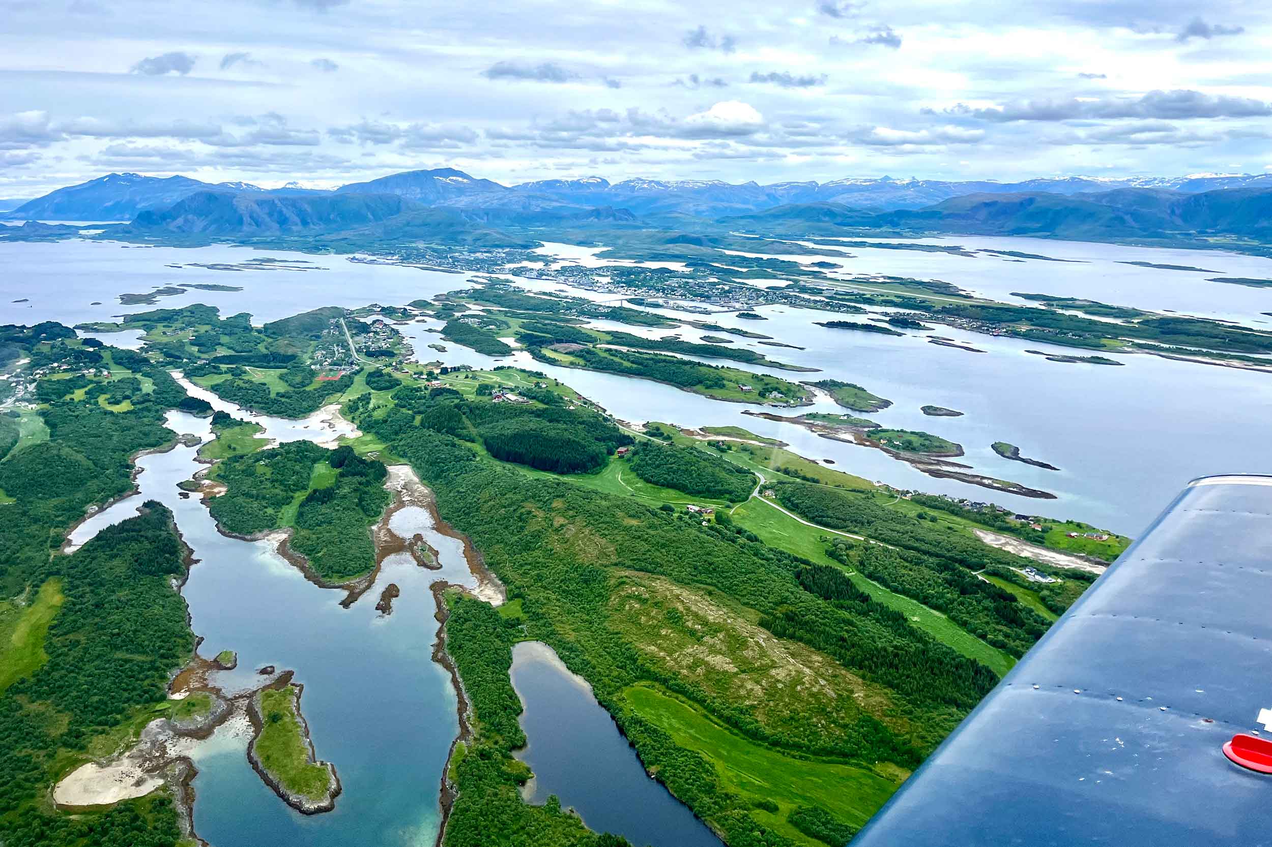
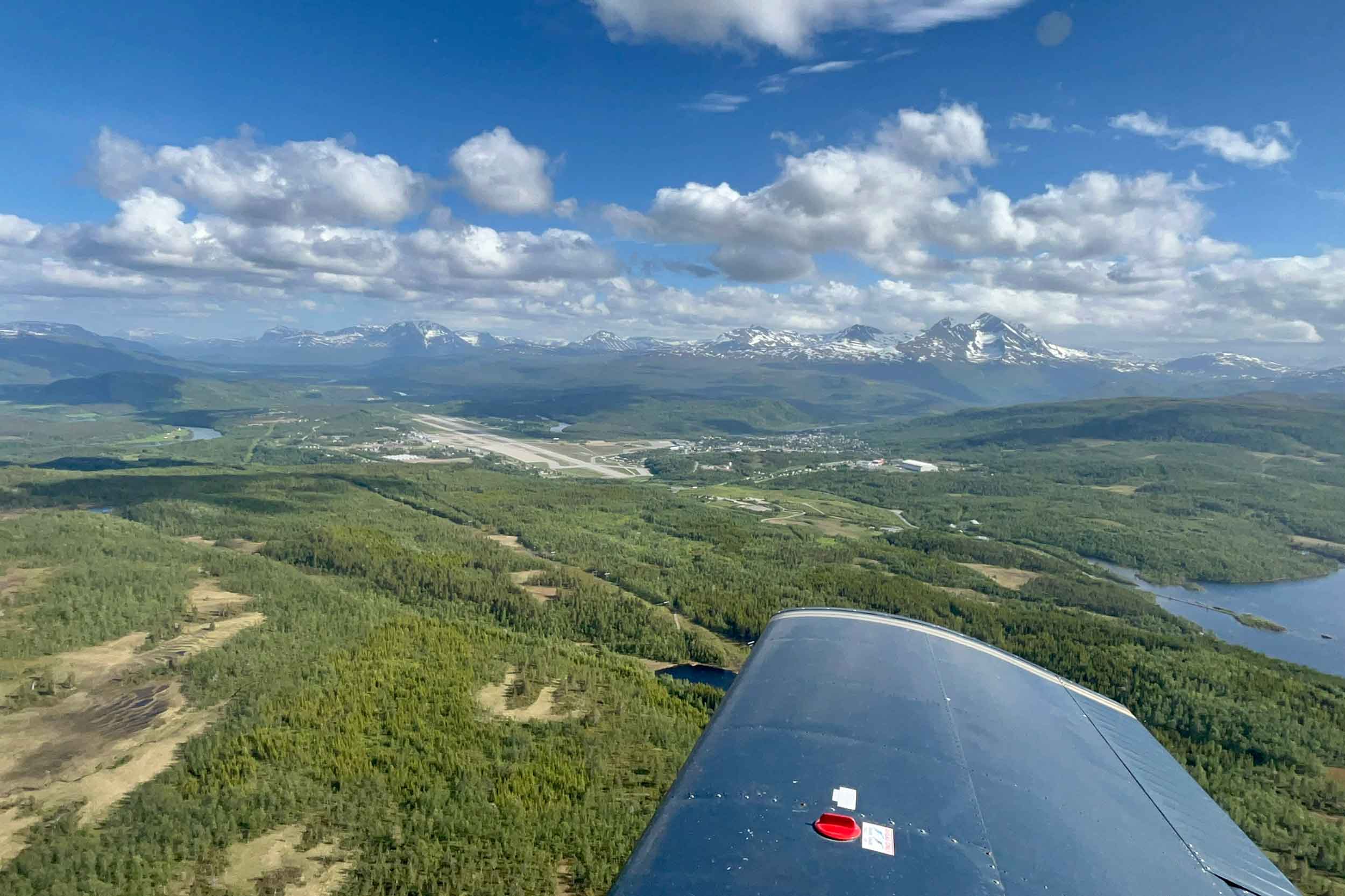
Bardufoss – Alta. Distance: 165nm High winds were forecast at altitude, which presented a real problem as we were surrounded by mountains. Consider a 20kt wind at altitude, deflected downwards at an angle of 20° – this implies a vertical speed of around 700ft/min which is close to the maximum rate of climb for our fully laden Cherokee! Turbulence, updraughts and downdraughts can have a significant impact on a light aircraft like ours, not to mention that I was inexperienced in mountain flying…

Simply waiting until the weather was suitable to stick to our plan was out of the question. The weather would clear by the weekend, but by then Hammerfest would only be open between 1245 and 1500L – clearly not suitable for a midnight flight.

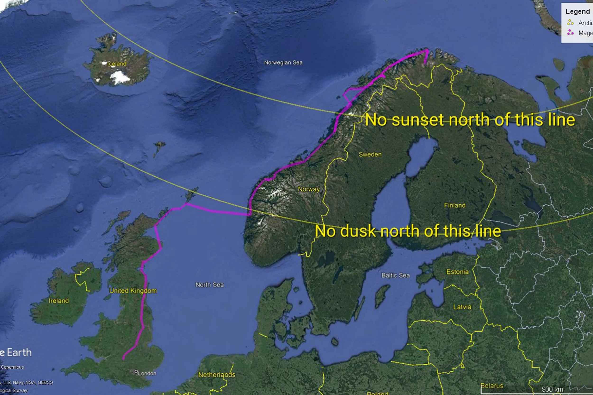
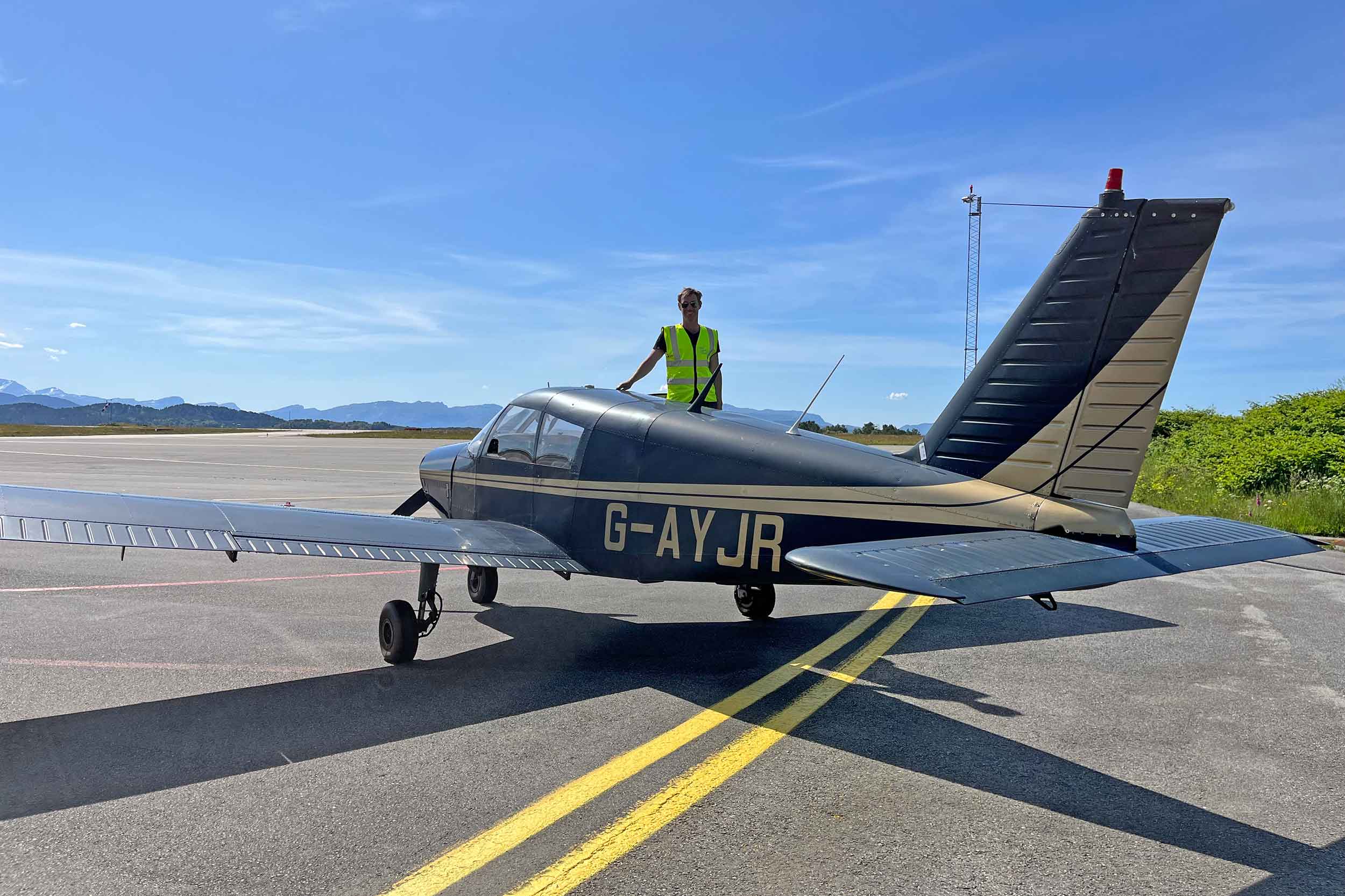
Our objectives were to fly at local midnight and to fly round the North Cape. The constraints were limited fuel availability, limited opening hours, and of course the weather. We spent hours plotting possible routes through the mountains on paper charts, always wary of the wind. We also needed options if there was an engine failure – there aren’t many fields in that part of the world, so ditching was always preferable to a forced landing on jagged rocks. There was only one solution, a late flight to Alta to refuel, then an even later flight around the North Cape all timed so that we could land at Hammerfest after midnight.

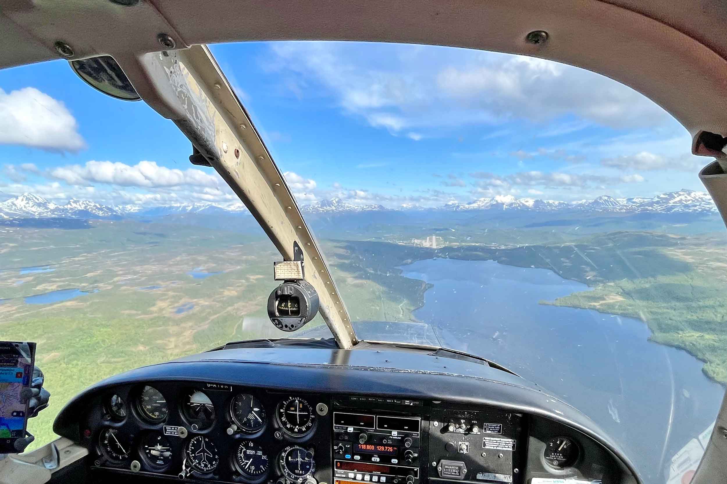
The flight out of Bardufoss and past Tromsø was, to quote Martina, ‘bumpy as hell’. But we did everything right to avoid downdraughts and to fly when the wind had abated. This was helped by there being windshear forecasts for many airfields, as well as wind speed data from anemometers on mountain tops near the airfields.

The timing of the next flight was critical…

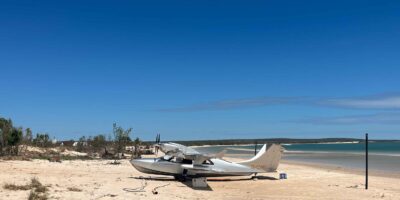
Alta – Hammerfest (via the North Cape). Distance: 209nm

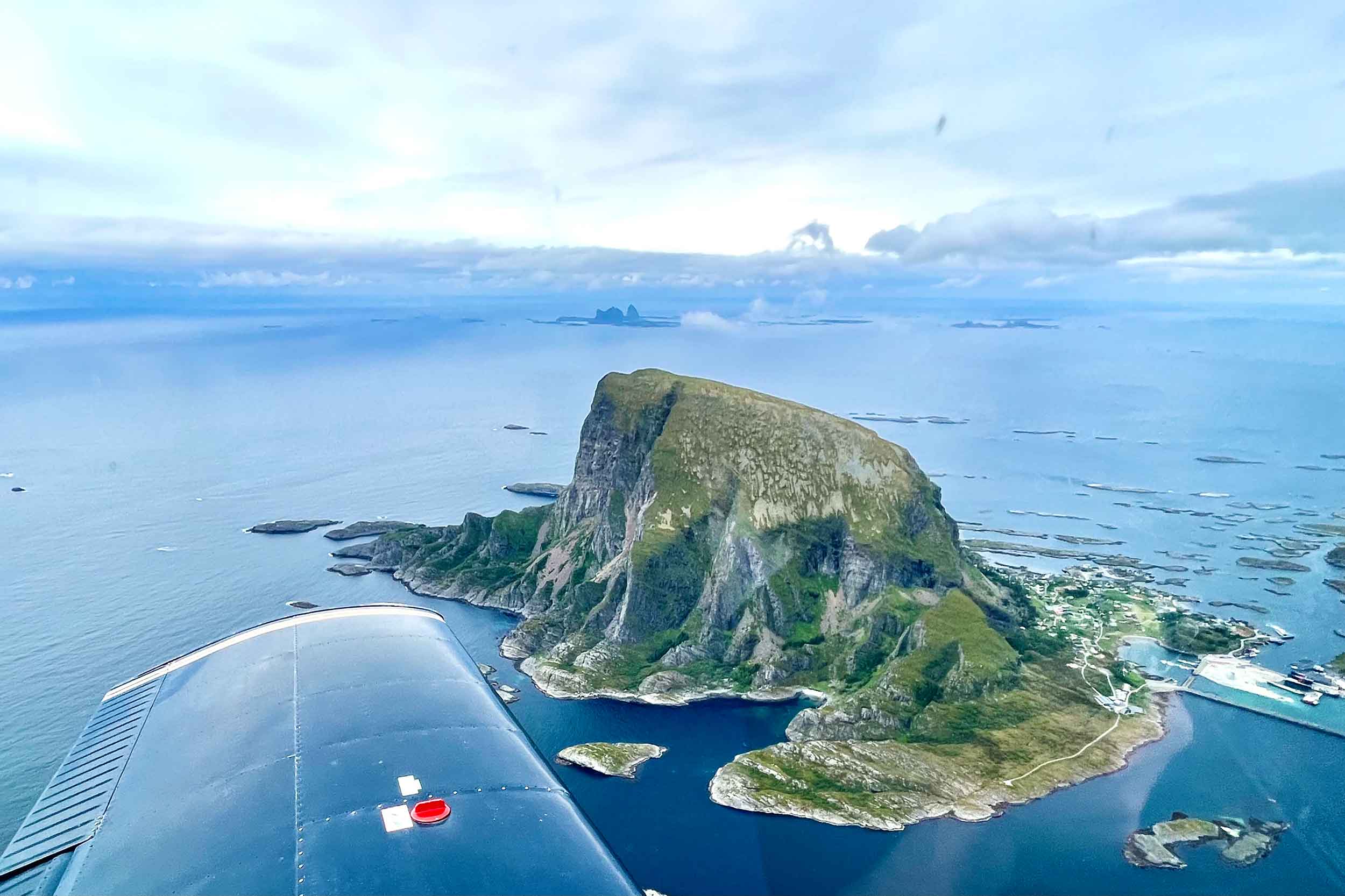
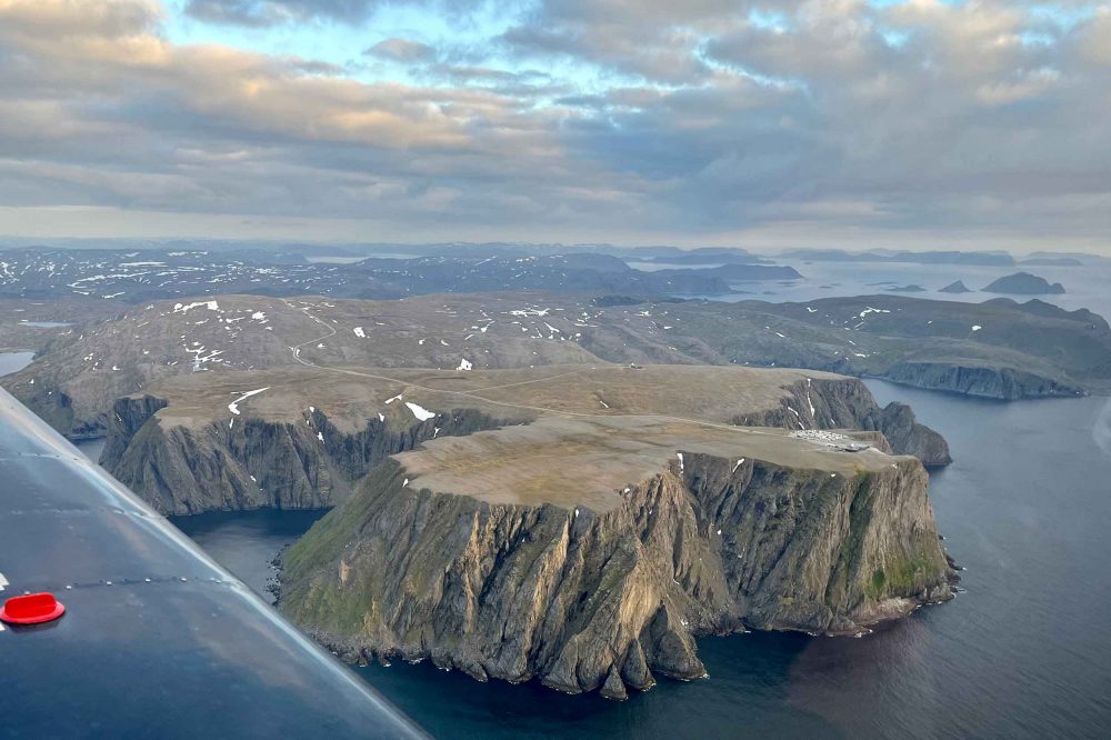
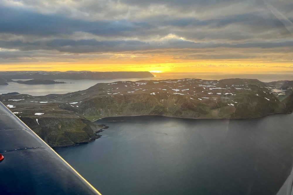
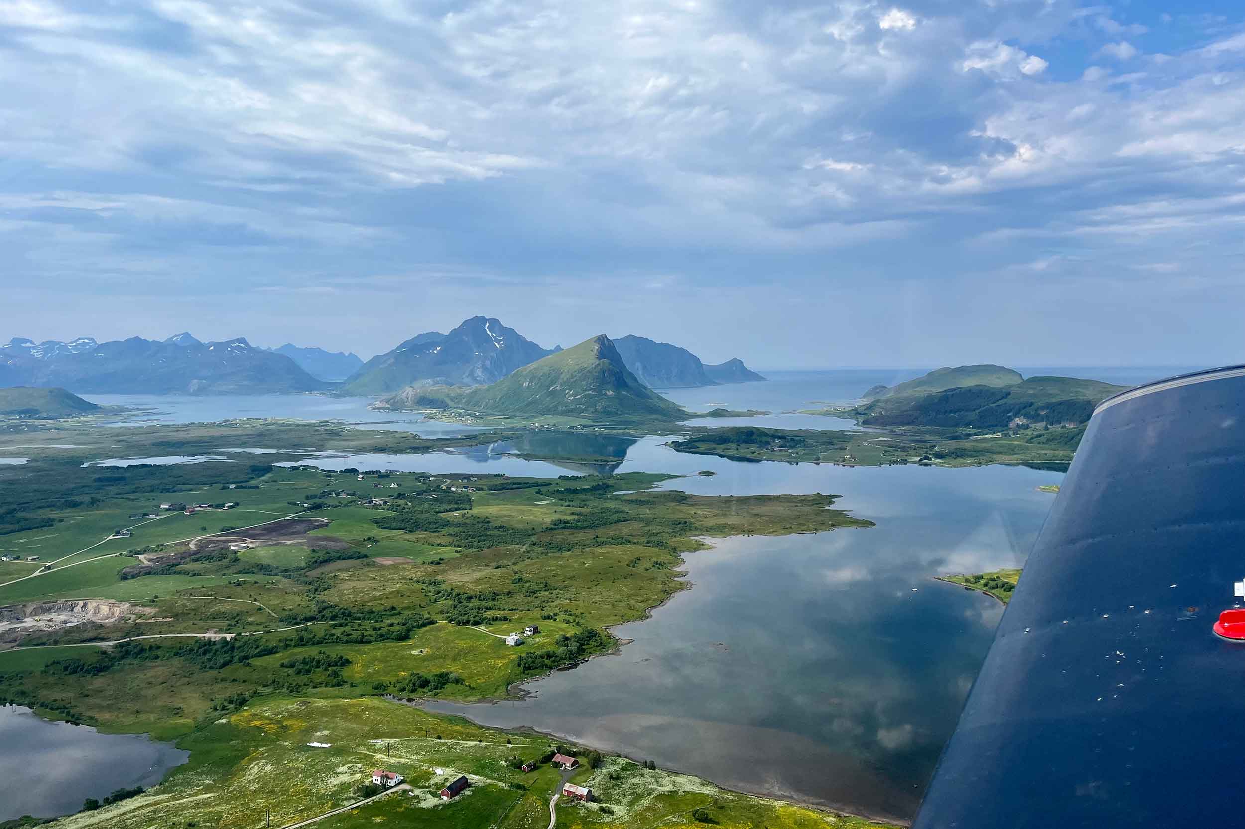
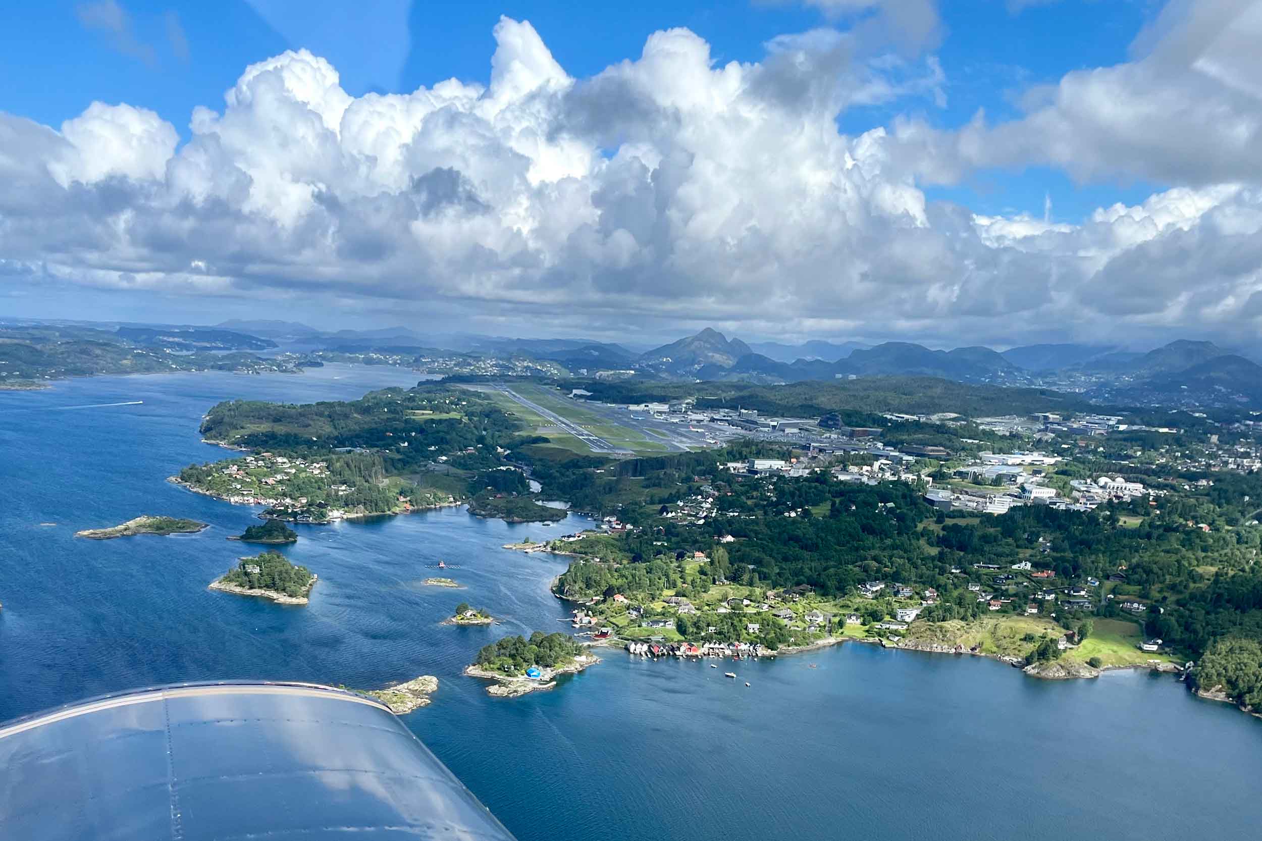
We took off at 2204 local time into bright sunshine. Flying along Porsangerfjorden towards the North Cape felt remote; big cliffs, lots of sea, late at ‘night’, with dramatic lighting thanks to the low sun peeking through gaps in the dark clouds. Once we got to the North Cape I was surprised to see lots of tourists and camper vans near the globe monument atop the 1,000ft cliff. Everyone had gathered to see the midnight sun. Hopefully they were equally surprised to see a little Cherokee bumbling past!

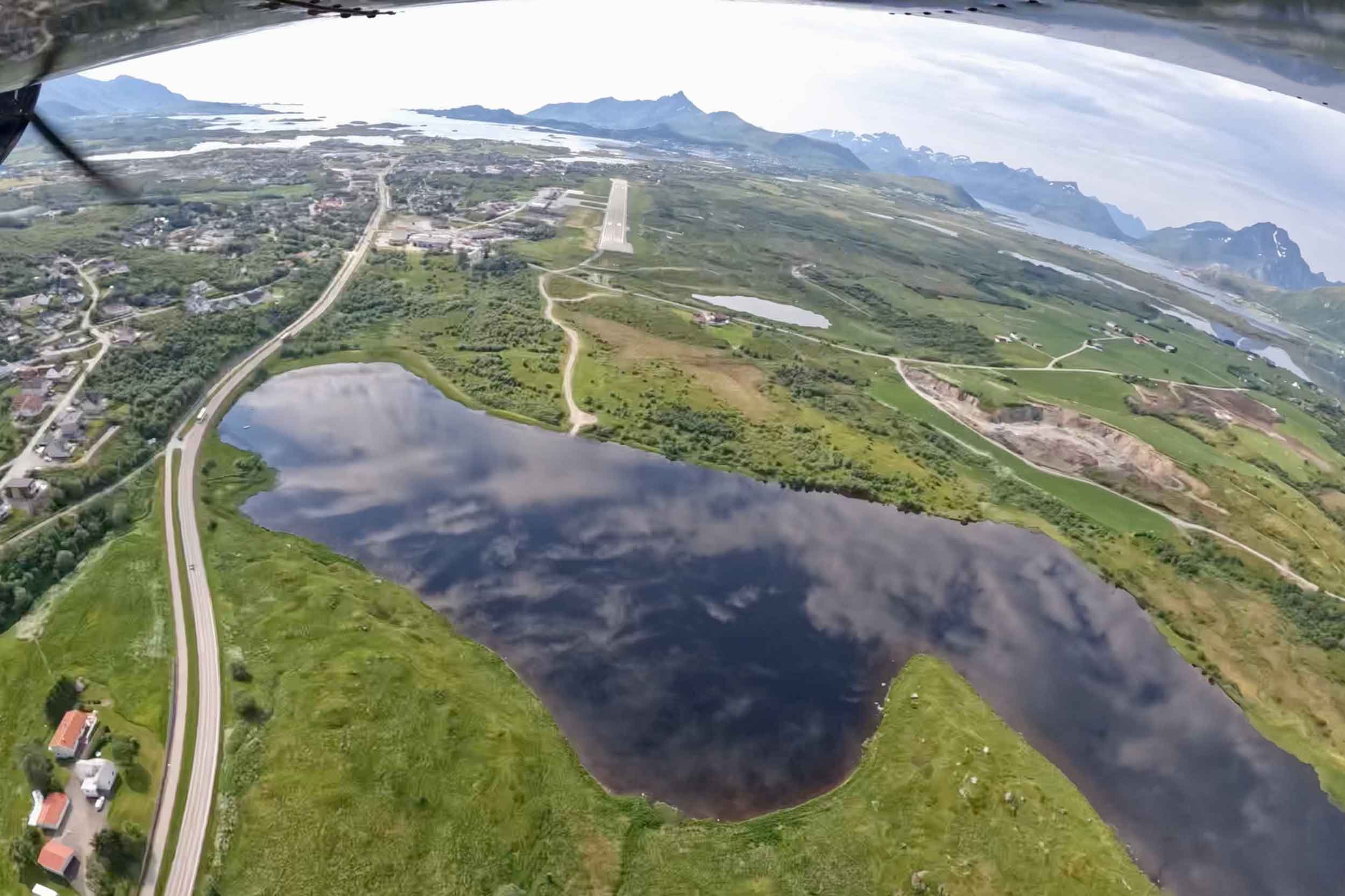
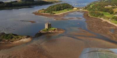
Our flight was made more spectacular when we spotted several pods of humpback whales lunge feeding in the calm waters below. To this point, the flight had gone to plan, and we were scheduled to arrive at Hammerfest at about 0025L. With Runway 22 in use and our approach being from the north-east, the AFIS anticipated me making a straight in approach. At the time, I was not visual with the field, and I felt that I wouldn’t be until quite late, given the surrounding rocky hills. I opted to fly anti-clockwise around the 1,250ft headland and join downwind left-hand instead to give me a chance to get acquainted with the aerodrome. 

Unfortunately, the high ground at the end of the downwind leg made me fly higher (it’s surprisingly unnerving being close to rocks at that point of the circuit when you aren’t used to it). On final, try as I might – full flaps, idle power, full side slip – I couldn’t get anywhere near the runway. The last of the commercial traffic departed. The airport was scheduled to close in a few minutes. Attempt two wasn’t much better – I had no desire to fly closer to the rocks, so I extended downwind. I did not commit to extending far enough, and the situation repeated itself. Another go-around. This time the AFIS queried my intentions. There were no other airfields open for hundreds of miles – and I noted the less than subtle hint that it was his home time. Next time round I extended downwind much further, and we landed safely in broad daylight at 0027L. Mission accomplished.

Next day, by pure chance, we realised one of our unofficial objectives. A close encounter of the wild reindeer kind! They were sitting in the sun munching on grass in a secluded part of the town centre. Better still, just before midnight we saw them again from the hotel window, this time causing havoc: stopping traffic, drinking out of the fountain, destroying the flower beds.  

North Cape
North Cape enroute to Hammerfest
Hammerfest
Midnight sun on the route from Alta to Hammerfest

Hammerfest – Bardufoss, Bardufoss – Svolvær. Distances: 183nm, 118nm Back to Bardufoss. I spotted a Notam which had only just been issued, our next destination had closed early for the day as it was taking advantage of strikes that were affecting the commercial operators. We quickly replanned for Svolvær in the Lofoten archipelago. Lofoten has distinctive scenery with dramatic mountains and peaks, open sea and sheltered bays.

Svolvær – Leknes. Distance: 37nm Shortest flight of the trip! The main challenge was actually getting from the campsite to the airport to start the flight. We ordered a taxi, but as all of the scheduled flights were cancelled due to strikes, they thought it was a hoax call and the taxi never arrived.

We camped again, this time on the sand by the sea. We headed out for a SUP in the Arctic Circle on the Norwegian Sea. Watching dolphins from the tent in the sun, at midnight, was a perfect way to end the day.

Leknes – Brønnøysund. Distance: 180nm The weather: hot. Despite there being a long stretch over water, we opted to keep the immersion suits stowed and just wear lifejackets rather than risk passing out. We took the shortest route across the water, then south along the coast and out of the Arctic Circle. Getting accommodation was tricky, the offshore oil rig workers were grounded due to bad weather and had taken every available room in town. After much negotiation we managed to get a condemned room!

Brønnøysund – Ørsta. Distance: 281nm Satellite images showed the weather just offshore was lovely, but there was a low cloud base above the field. Once it lifted enough, we departed. We encountered carb icing at about 800ft on climb out. In hindsight I should have anticipated this, given the high humidity.

The approach for landing was ‘interesting’. The wind was reported as four knots variable at ground level, and there were light winds at altitude. What wind there was funnelled around the mountain creating intense vortices that caused the little Cherokee to move around a lot. Keeping a stable approach was very tricky.

Ørsta – Florø. Distance: 78nm The plan was to fly to Bergen as required by customs, and then on to Sumburgh. Both flights needed to be completed on the same day so that we could avoid dusk until we were back in the UK. The North Sea weather was not suitable. Unusual opening hours at Ørsta compounded our problems. We flew south to Florø instead. This kept us just far enough north to avoid dusk while we waited for better weather. Florø lacked fuel but it was open all day. As soon as suitable weather arrived, we could go.

Florø – Bergen. Distance: 89nm Every time we looked at the weather forecast, some point on our route (usually Sumburgh) was not suitable. As one day in Florø turned into several, we considered all our alternatives: routing via Stavanger (an international exit point), to Wick, to Aberdeen, to Newcastle, or even as far south as Teesside. However, none of these options worked, either due to weather, excessive handling charges, or both. In any case very long stretches over the water were undesirable. We waited. Dusk was getting closer every day.

It was 5 July. Checks done, we sat in the aircraft for hours, waiting out showers and keenly checking updated forecasts. Satellite images seemed to show a window of flyable weather, lasting perhaps more than one hour, approaching from the west that we could exploit to get to Bergen.

After take-off we dodged showers and made it to Bergen as the weather there cleared. We got fuel, and had a visit from the police who stamped our passports. Then we got suited up to return to the UK…


Bergen – Sumburgh. Distance: 208nm The weather at Bergen appeared to be lovely as we rolled for take-off, but on climb-out it became obvious that there was a heavy shower blocking our cleared route. Pre-flight planning came into its own and I quickly requested an alternative route to remain VMC which was immediately approved. This took us round the showers and out over the North Sea at a little more than 800ft. Our low altitude made radio communication difficult at times. We climbed progressively as the height of the cloud base increased. We were given radio frequencies to change to at the median line in case we lost contact with Polaris control. The situation improved as we climbed, and we made it safely to an unusually sunny Sumburgh a few hours later.

Sumburgh – Aberdeen. Distance: 195nm The weather forecast in the north of Scotland for the next few days was not ‘aviation friendly’. If we were to get home any time soon, we had to leave there and then. There were still a few hours until dusk, so we headed south to Aberdeen where we encountered our first dusk since we left the UK 16 days earlier. This bonus flight brought our total distance covered between dawn and dusk to 2,679nm – not bad for a Cherokee with a cruise speed of 95kt.

 Lessons learned

  1. Even in summer, the weather in northern Scotland, the North Sea, and Norway is not always blue sky and sunshine. Who’d have thought?!
  2. To do a trip like this on any kind of schedule requires an instrument rating. That said, once you have an instrument rating, an adventure like ours is just not possible. Flying this trip VFR was a significant challenge and I wouldn’t have done it any other way.
  3. In some circumstances a straight in approach at an unfamiliar airfield might be the best option – you can always go-around.
  4. In controlled airspace where you are at risk of losing radio signal, it is worth getting cleared to higher altitudes than you can currently maintain to give you options.
  5. Reindeer are naughty.

 PS We won the Coventry Trophy for second place in the 2022 Pooleys Dawn to Dusk Challenge. Read more about the awards here.

Oxford airport
We made it! Back at Oxford
Share

Leave a Reply

Share
Topics
  • 2
  • 3
Enjoy 3 Free articles OR Join today to enjoy unlimited access to all content
Join today

We use cookies to give you the best online experience. Please let us know if you agree to all of these cookies.