Flying Adventure

Chain Reaction

Winner of the 2021 Pooleys Dawn To Dusk Challenge, Kai Barnett, decided to pay homage to gyro pilots from 529 (Rota) Squadron who flew Avro 671 Rotas to calibrate the WWII Chain Home radar network…

As a gyroplane pilot, I aimed to create a flight which would be relevant to gyros, of personal interest to myself and perhaps obscure enough to pique interest in others. Being based at the now closed Chiltern Park, there was one obvious choice. During WWII the UK’s air defence system used the Chain Home radar network for aircraft detection. The accuracy and calibration relied upon the use of a squadron of autogyros, 529 (Rota) Squadron, to fly slow and accurate patterns so that transmitting and receiving stations could calibrate and harmonise their equipment.

The Avro Rota autogyros arrived at RAF Henley-on-Thames, from RAF Halton, during August 1944 and flew from there to various outlying airfields for the calibration flights.

Much of this history is documented in Spitfires and Autogyros by Darren J Piltcher. Inspired by the book and with historic locations and airfields disappearing with land usage, I began to see which sites previously used – or visited – by 529 (Rota) would be in range to be photographed from my aircraft within the required dawn to dusk period.

From the map in Mr Piltcher’s book and a 1:500 South England chart, I created a triangular route which appeared feasible. But when to go? Weather forecasts suggested Monday 14 June looked like being the day. Sunday saw the aircraft fuelled, plus an additional 40 litres in a backseat ferry tank, books, charts and kit sorted – and stowed and moved into the little hangar ready for a smooth get away the following morning.

Rota Leg 1: 0416 local, engine start

Sunrise is at :46, so the gyro and I were good to go. A gentle taxi to the 04 threshold, but no rush as warm up is nine minutes. Run up is normal, followed by a slightly longer than usual composure check before entering the runway.

The rotors spin up and we’re moving. We lifted out of the grass at 0427. Turn right to RAF Henley-on-Thames, Upper Culham Farm, former home of 529 (Rota).

Next waypoint is RAF Halton, the initial home of the Avro Rotas. We’re going to pass Booker, so I make a call, not expecting a reply, but looking and listening all the same. After all, I’m daft enough to be here, therefore, logic suggests that somewhere else there is someone else equally as daft…

Change radio frequency to Halton and Luton radar and set 0013. Nothing heard from either, but ‘we’ (gyro and me) proceeded with caution, getting what I hope will be a nice photo of the runways and hangar at Halton.

Radar calibration work was controlled by Fighter Command, 60 (Signals) Group from Oxendon House in Plantation Road, Leighton Buzzard. There’s nothing there now except a plaque, but it’s en route so it is included in our pilgrimage.

“I talk myself through my plan if the motor stops. Look for a ship, spot one, and deviate course slightly”

We settle into the cruise, and our next photo task is the former site of Stenigot Radar, at the northern tip of our triangle. This is no straight line cruise because first we have to pass around Cranfield, which I call, but there is no activity, and then call again as we pass close to the ILS. Still no reply. The next call is RAF Wittering for a MATZ crossing, heading north across the stub which enables a good view down the runway. All is quiet with just a few lights.

Next on the PLOG is RAF Coningsby but this time we’ll be in the MATZ proper and passing close to the ATZ as I’ve got Woodhall Spa as a way point. A call for a service goes unanswered and I continue on track making a position call as we enter the MATZ and again as we approach the extended centreline of the runway. There are lights but no aircraft moving. Call from Woodhall Spa and reflect on the crews of 617 squadron, then a final call leaving the MATZ remaining on frequency as their LARS covers the next section of the flight and down into the Wash.

Twelve miles away and my ‘top-of-triangle’ target is in sight, we are on track ahead of time so I relax a little. Activating the ‘autopilot’ (a piece of foam wrapped around the stick and held by my knees), it’s time for a coffee break.

Stenigot is easy to see as there is a modern mast and a taller one just to its north-west. My intention is to try and take the photos at 1,000ft above the ground to try and keep the perspective the same for all sites. I remove the camera. It sits neatly on my front, secured by a neck strap with the lens tucked into my lifejacket, and I check the settings. Good job too as they’ve been bumped, so previous pictures might not be up to the quality I want.

I’m really pleased there’s a mast (albeit new) and an original Rx or Tx block, the fields around are beautifully flat and productive. However, I did know that this site was chosen for its elevation, view to seaward (it must be about 12nm inland) and it’s flat land behind. About seven minutes to the east is RAF Manby that was. I line up the shot of the airfield, classic grass and peri-track with serrated roofed hangars behind. The camera timer says 0502(z). Time to target was 2hr 6min. We were there in 1:37 and mental maths tells me we’re better than 85kt average. So far so good.

Turning south-south-east we have the sun off the left shoulder and everything looks distinctly grey and uninviting. We pass west of Skegness within a gyro’s glide of the runway at Croft, as I climb and go through the ‘feet wet’ checks. Engine health Ts and Ps, pull the helmet aside for an unhindered listen to the little Rotax at 5,000rpm. All good. Radio set for D&D and transponder Mode S 7000, Coningsby on the dual watch. Radio helmet connector clear and belts clear for ditching and talk myself through my plan if the motor stops. Look for a ship, spot one, and deviate course slightly.

From Gibraltar Point to Hunstanton Lighthouse it’s 11 miles, from 2,500ft a gyro will glide for maybe 1.5 miles, a 747 would do 10. Halfway across all is going well and put in an orbit. WhatsApp flashes up a message: “Why the orbit?”

I reply, “Calibrating”, which then descends into whether or not I’m having a pee and that my ‘equipment’ is obviously ‘insufficient’… I’m not alone. The reprobates from the hangar are up despite it not being 0630 yet and FlightRadar is working.

Norfolk and the evidence of old airfields is all around, but I try not to get distracted. My next radar station is West Beckham about 25 minutes away – and my fuel tank reminder comes on. It’s not an issue but a prompt just to keep me aware. I cancel it and make note that next time it will be important.

Again, this old radar station is not hard to find as there is a modern TV mast on the site. There is also more evidence on the ground of its wartime role with pillboxes and what could be Chain Home Low locations. There’s an excavator near the Rx block (hidden in the trees) and a new road going in which doesn’t bode well. The Tx block is still there too, but I can’t quite tell if the mast bases are present.

A Notam came up stating that the Norwich CTA would come live before we got there and the airspace would become Class D requiring Air Traffic Control to authorise entry and crossing. Squawking 7350 and giving the approach controller a call at five miles out, and requesting a crossing from Coltishall to Stoke Holy Cross via Thorpe, I was met with a friendly voice giving me the QNH and advising me to remain three miles clear as two helicopters would take off and climb behind me.

Sure enough my ADS-B traffic picked up the aircraft as they lifted off. Stoke Holy Cross was an absolute delight, a former Chain Home radar site with two newish masts to enable easy location but with the remains of some of the original mast feet still visible and Tx and RX blocks. Less than 20 minutes away is High Street Radar, Darsham, which was one of the first receiving stations to be built. I wasn’t aware at the time (until after my flight) that the site had also been upgraded to a full transmitter site and I knew the evidence of the Rx site would be difficult to spot being hidden in trees. The upside was that the proximity of the railway and road junction gave me confidence on the navigational side. Result. The Rx block was visible among the trees as well as other concrete structures. The Tx site has been completely reclaimed by agriculture.

Fuel transfer and time to evaluate my contingencies, should the fuel fail to flow. Running parallel but about five miles inland from the coast, I can see that the fuel is flowing and I won’t need to head for Bentwaters or Great Oakley.

Orford Ness is over to the left and was the site of much experimentation and innovation, but I didn’t have any knowledge of the Rota boys being directly involved at the time. So, on to my next objective, Bawdsey Manor – the home of radar and its initial development, as well as some of its continuing

development. Now a residential activities centre I thought it wise not to fly too low taking photographs… Apparently in 1943-44 the boffins here were working on a project referred to as 1090 (the ADS-B frequency) for the RAF. I wonder what happened to it?

“We transit past Lydd listening to two aircraft leaving the hold and joining the ILS”

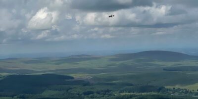
Over Felixstowe and Harwich looking for the next mast, there’s a new one on an old site, Great Bromley. There are lots of structures on the ground and I struggle to see anything to positively identify the location as a former Chain Home site, until I spot the flat top of the Rx block.

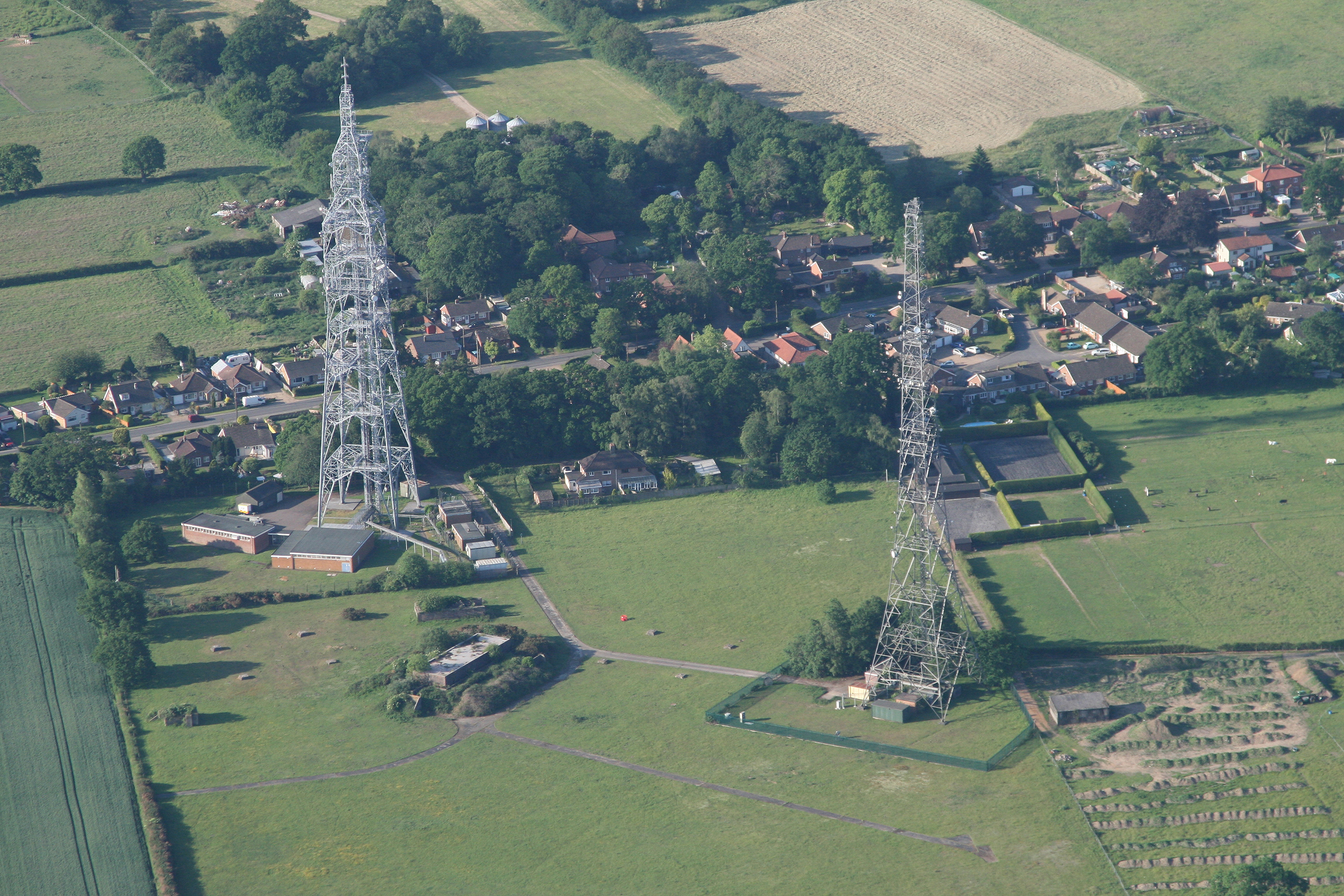
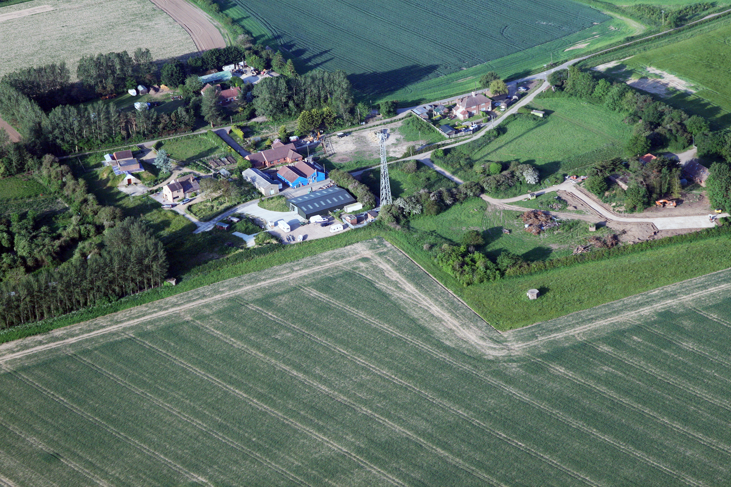
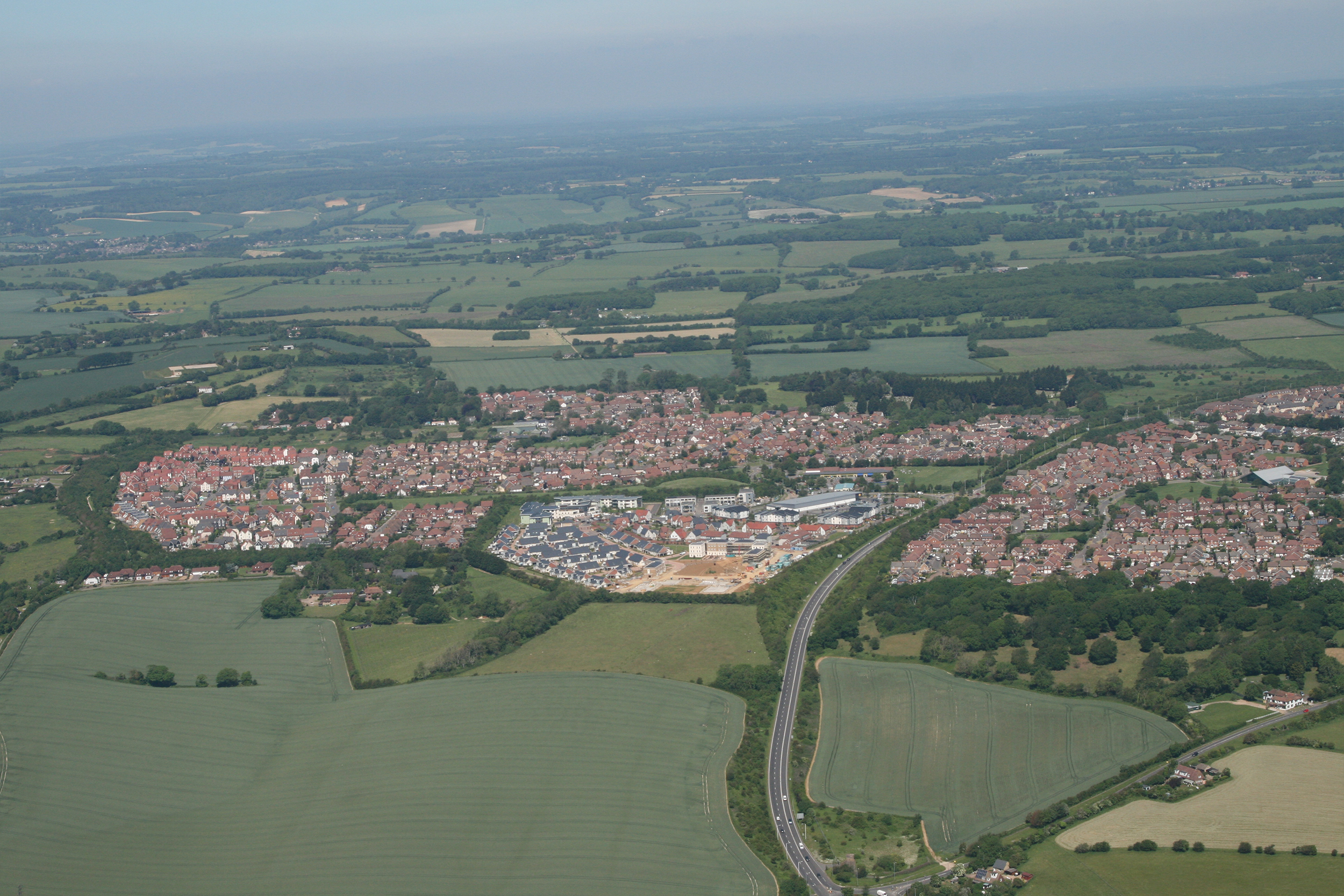
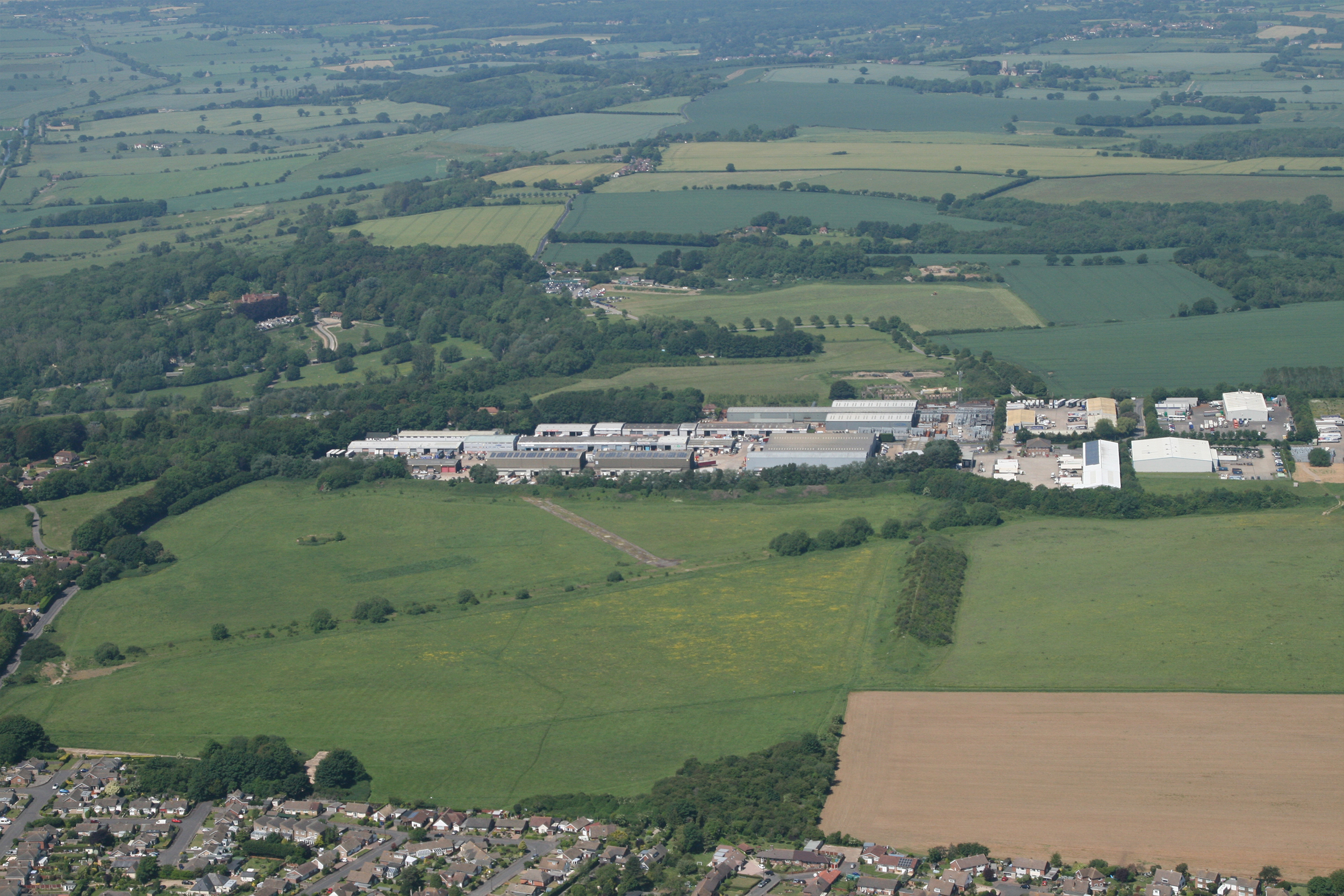
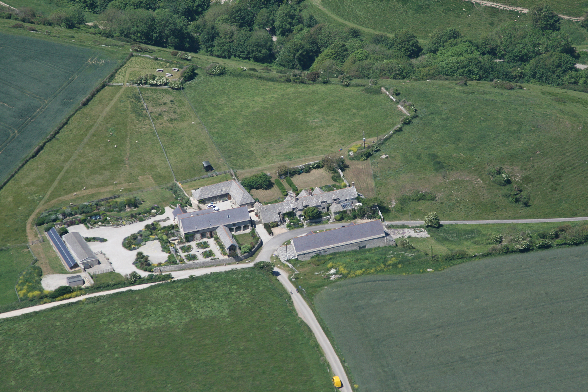
Passing to the south of Colchester, I called Southend Approach to reset the squawk and make my request for the photo tasking. Yes, it all looks possible… I’m to call for clearance after getting my photos of the Great Baddow complex and make my turn in. Great Baddow has one of the last original transmitter masts and the site next to it has been used for radio and radar development ever since.

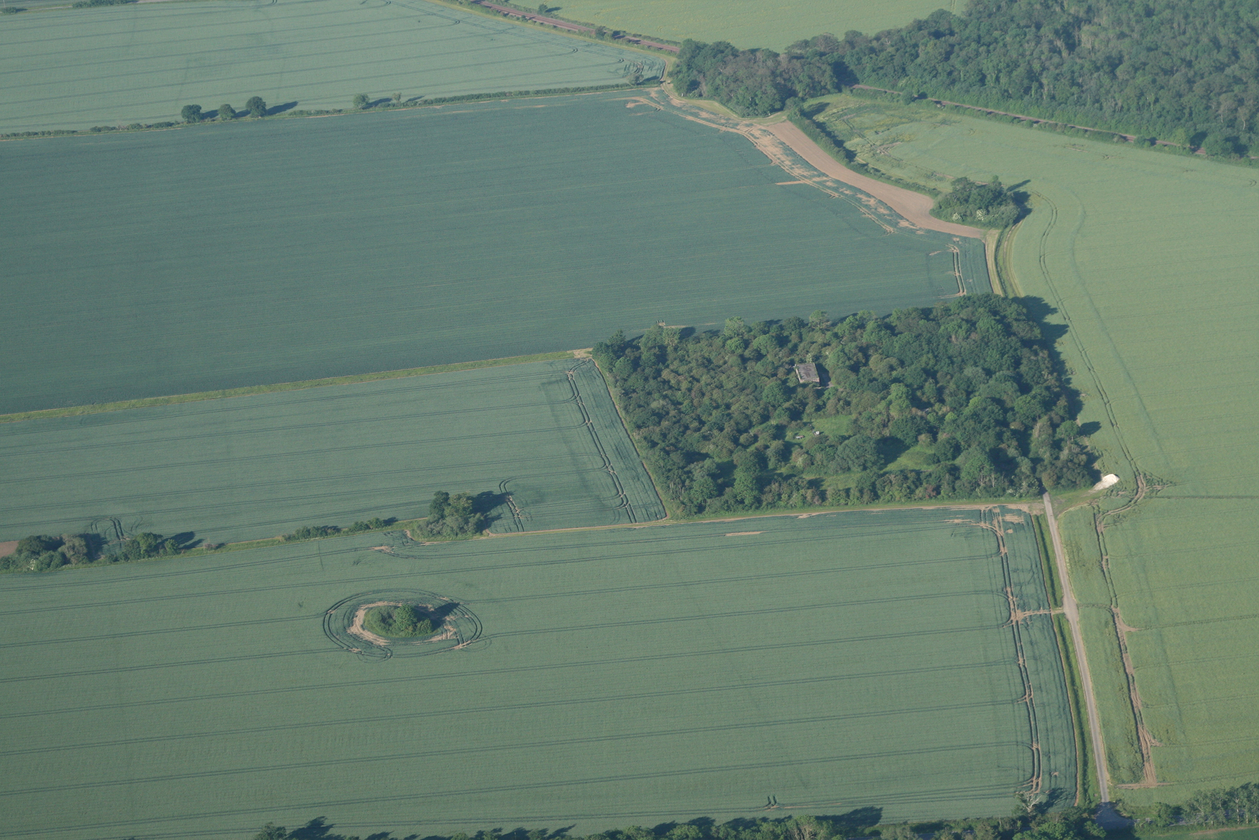
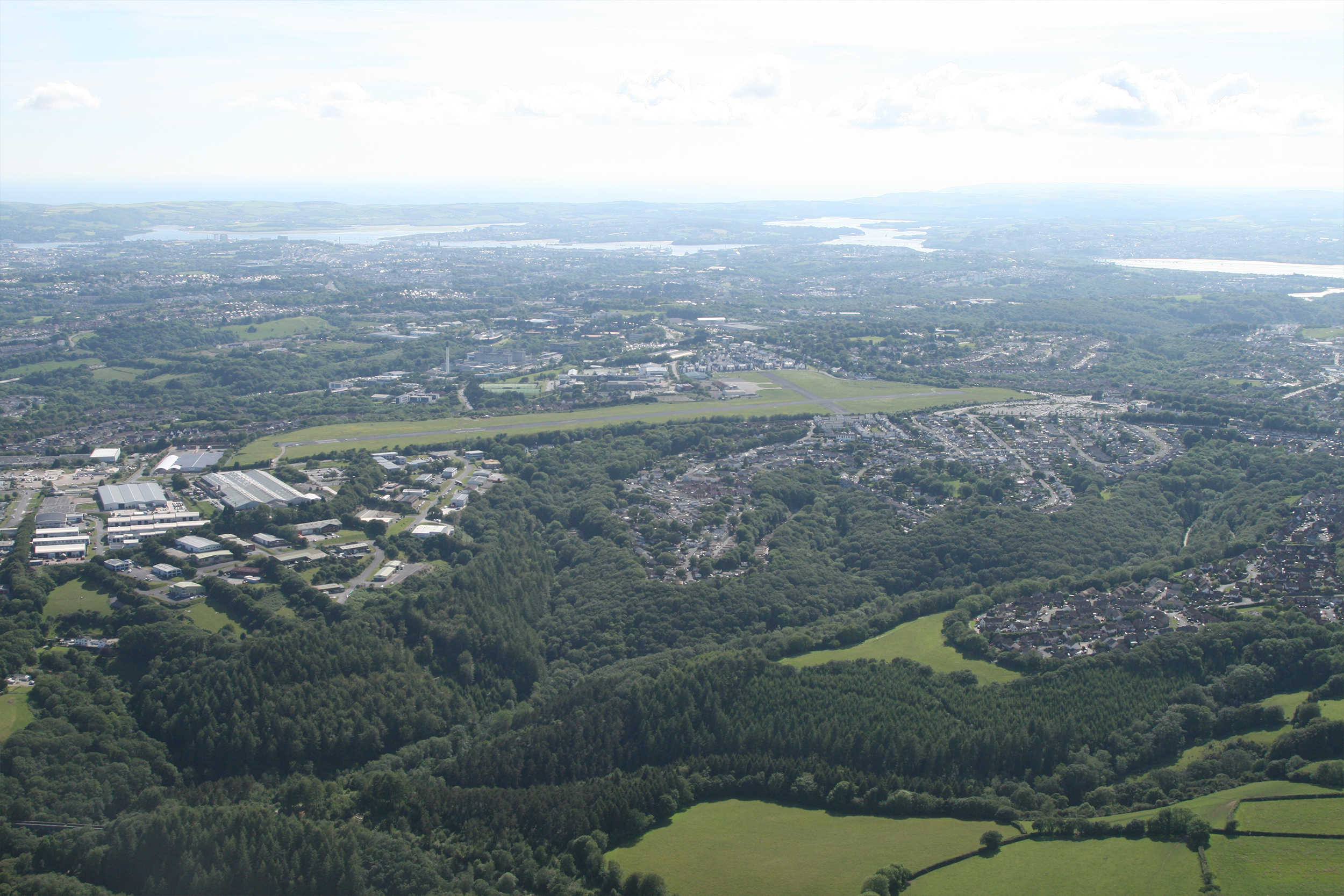
I’m given clearance to the village of Canewdon via the overhead of Stow Maries, a former WWI airfield, and now a museum. I slow and reduce height for the pictures of Canewden, and for a change the Tx site is the more obvious. I’m directed out of the zone via Southend Pier and Stoke on Medway Airfield. I know this part of the world as I learned to fly gyroplanes here.

Southend passes my next radio frequency and I read back correctly, then squawk Conspicuity. I called Rochester, no reply, it’s early, I’m ahead of time, so I’m not concerned. I called again, no reply. I make a long final call, lights on and with all checks complete, call short final two zero. I land and I am greeted by the ground team with, “What’s wrong with your radio?” I replied, “Nothing.” Closer inspection shows I’ve dialled up 122.225 instead of 122.255. The engine shut down at 0900 after 4hr 46 min running and 4hr 29min flying (35 minutes ahead of schedule averaging about 85kt). I put 80 litres of fuel in which gave a fuel burn of 16.8 l/hr (or 17.8 if you don’t include warm up and taxi).

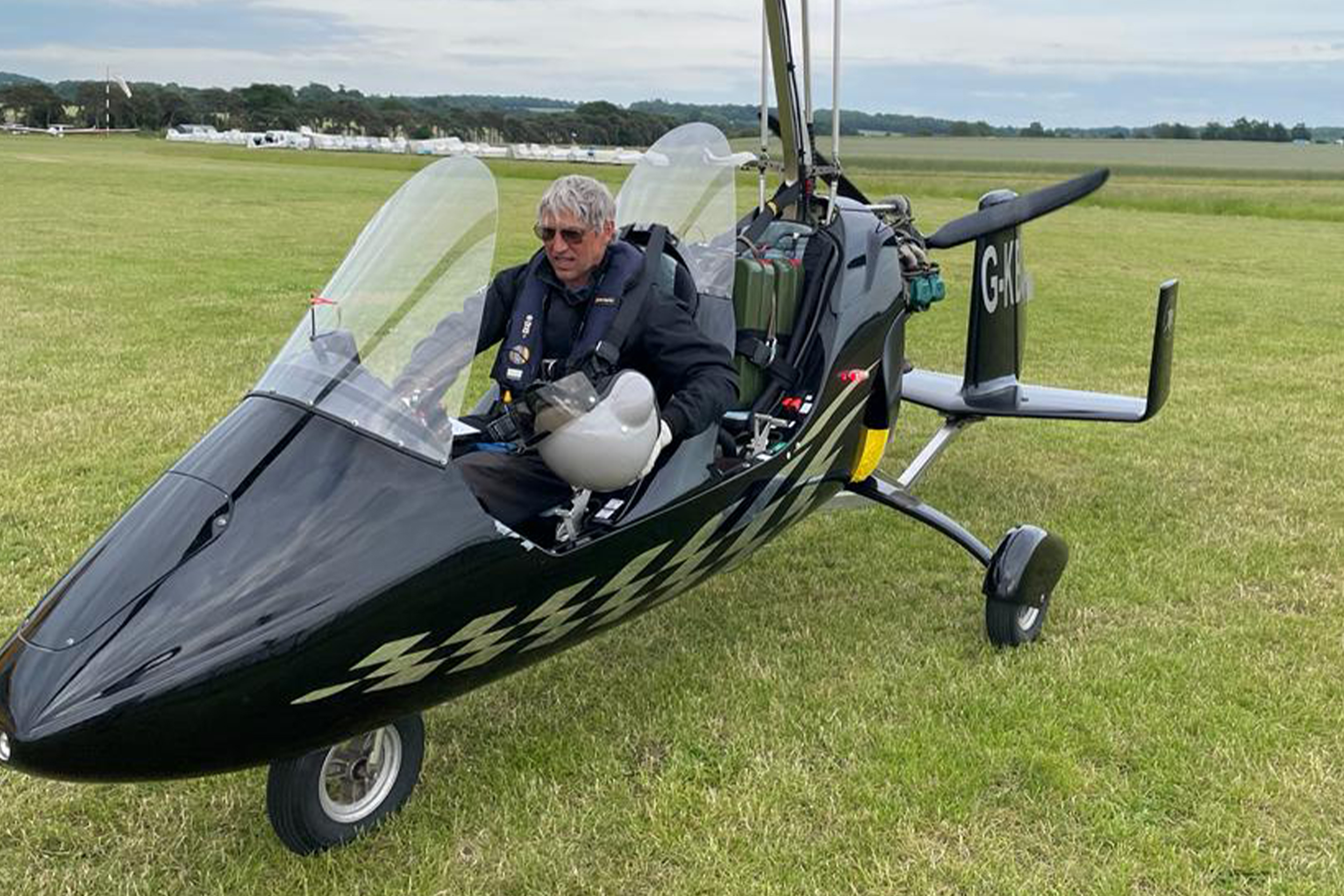
Rota Leg 2: Rochester to Exeter

Although this leg is shorter than the first, at 240nm and 3hr 50min, it is more complicated with radio work and I’m expecting more traffic. The prop turns at 0959 and the wheels are out of the grass 10 minutes later. A radio call advises me there are paragliders in the vicinity of Detling but can’t be more specific.

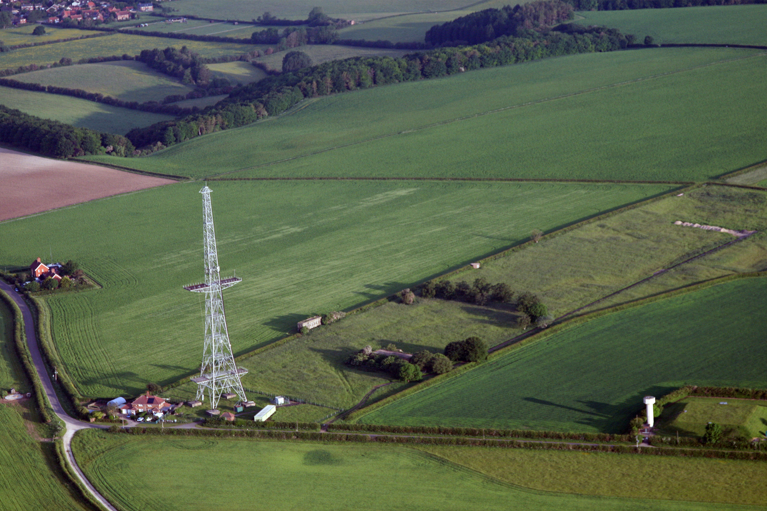
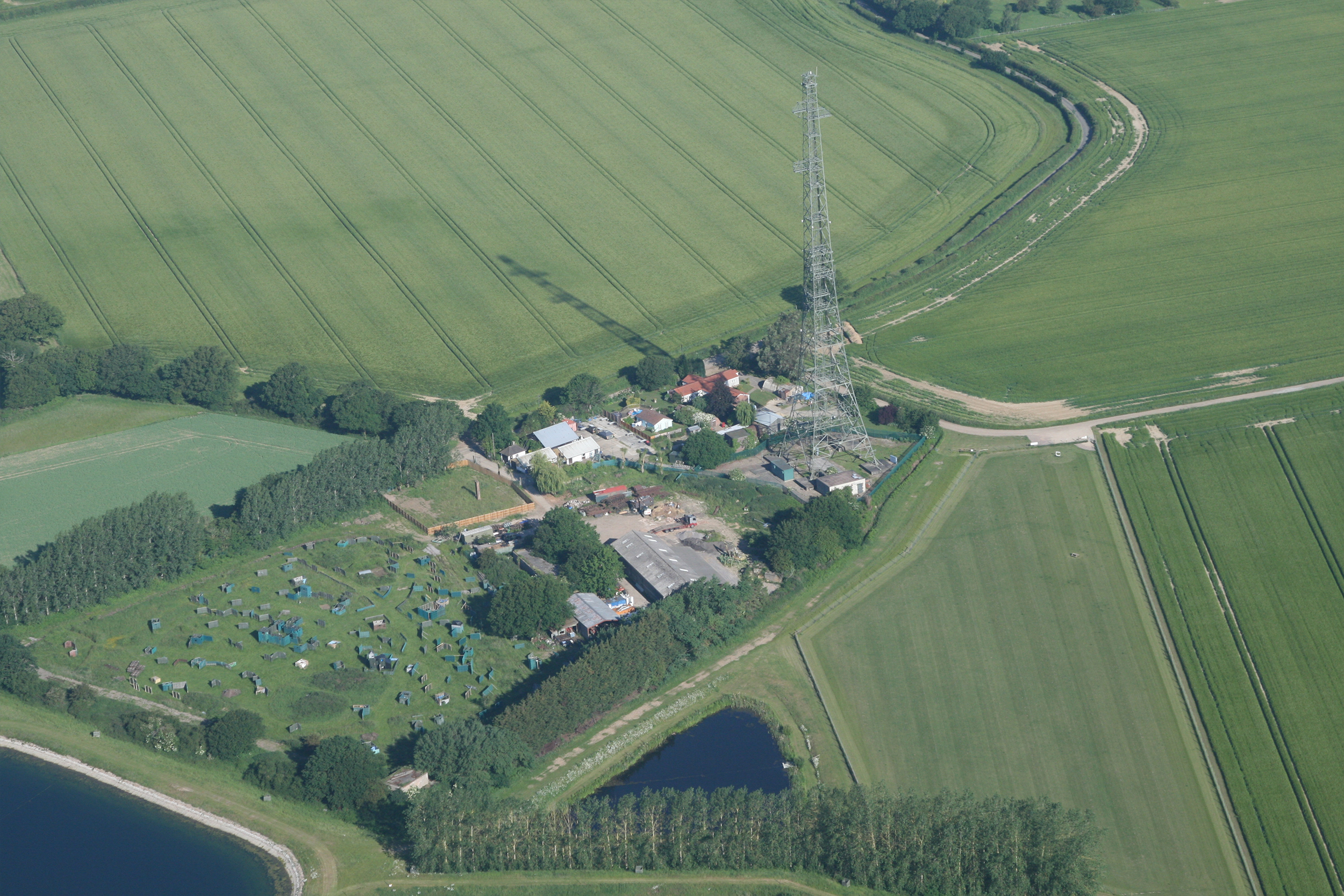
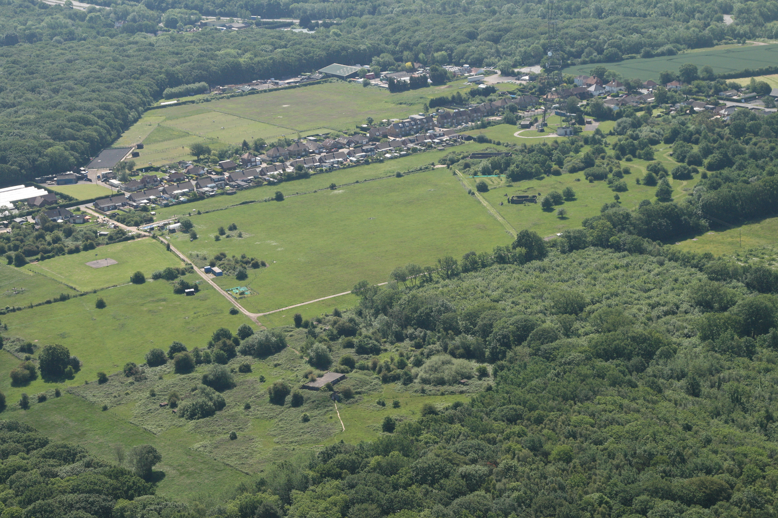
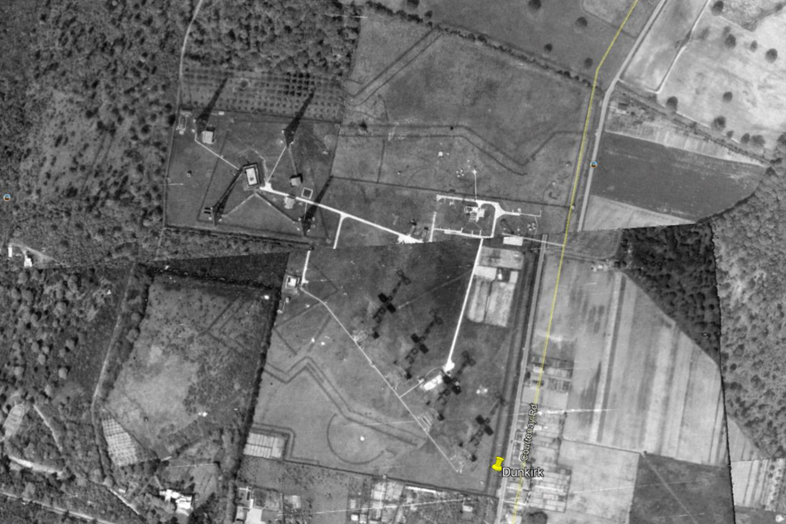
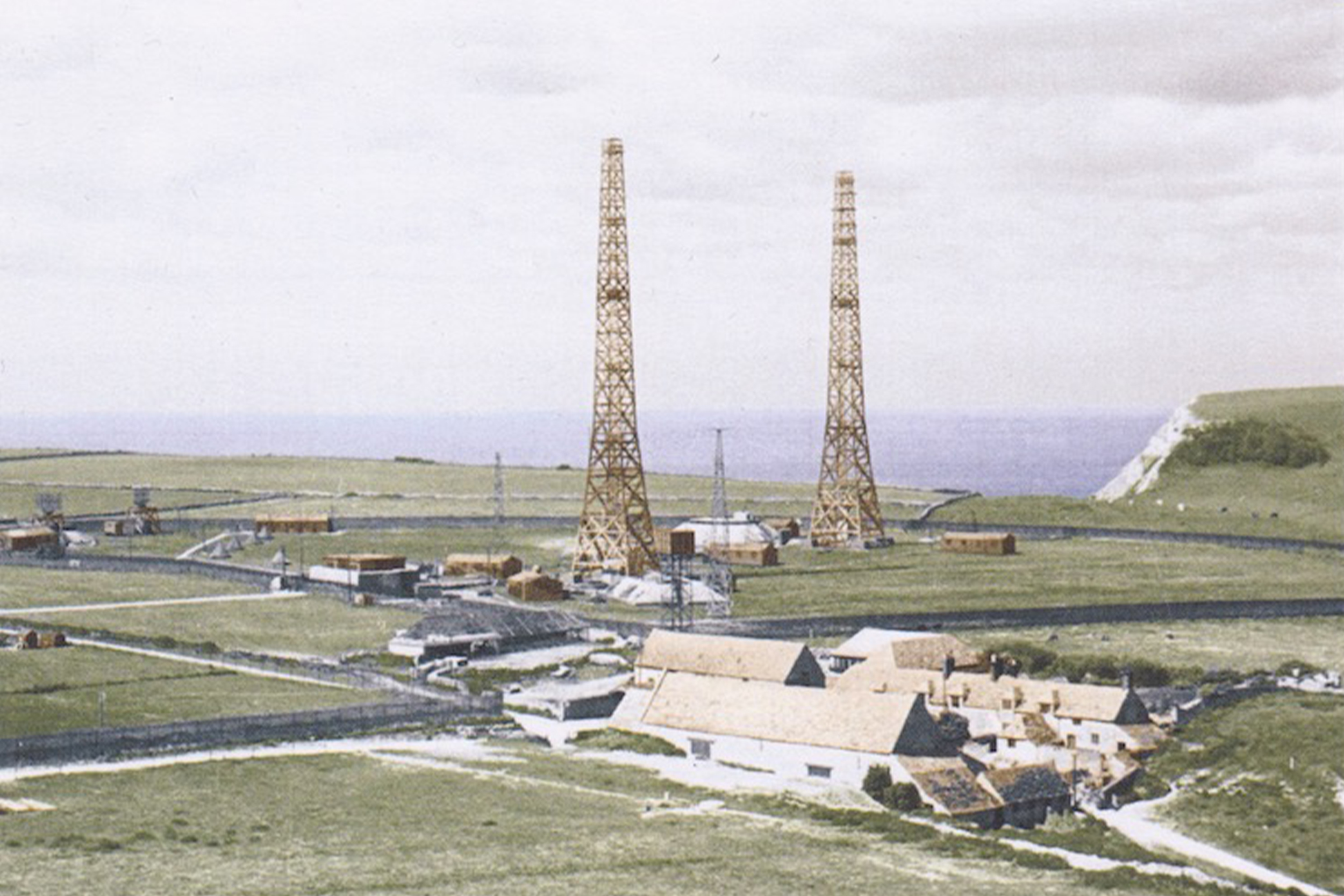
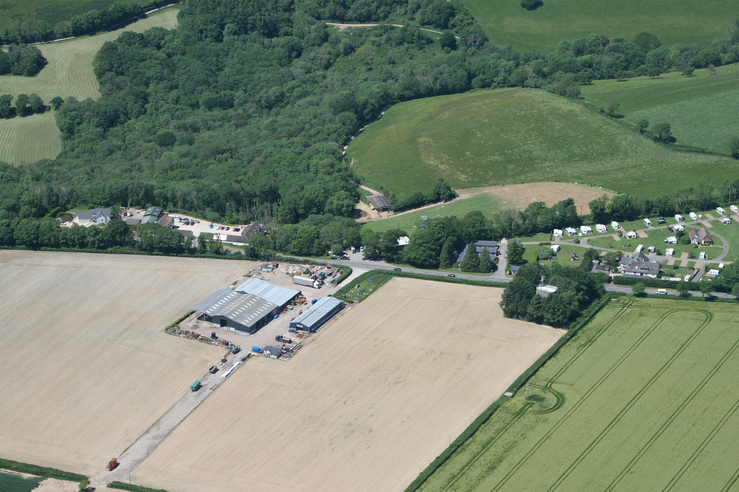
The airfield at Detling has become the Kent showground and due to the time of day I consider the possibility that the paragliders may well be paramotors, having taken off from the showground, and give it a slightly wider berth. I take my photo and then spot two paragliders scratching for lift on the south-westerly facing ridge before turning to seek out the mast at Dunkirk, near Canterbury. There’s a modern mast at Dunkirk aiding location. The four Tx masts stood in row near the current mast with the four Rx masts in a square with the Rx block in the centre in the foreground of the photo.

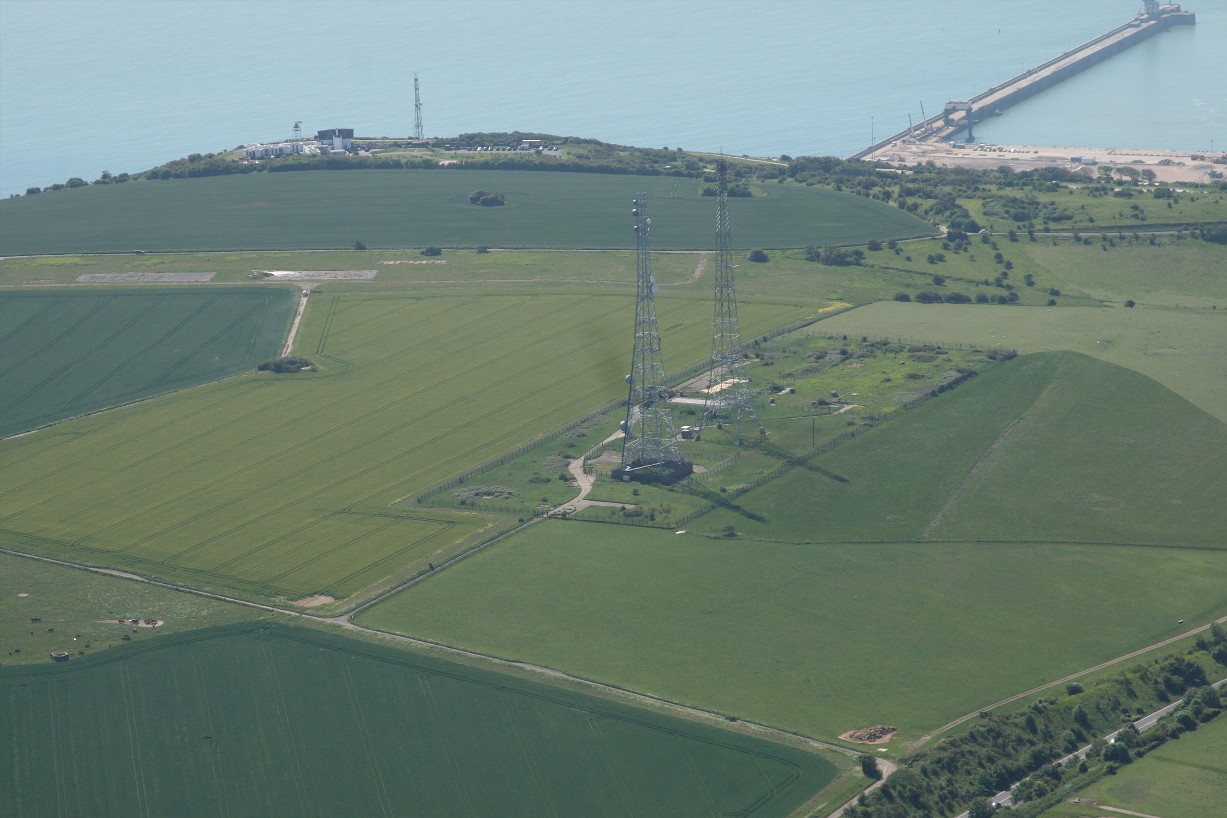
Passing Canterbury on the way to Dover the current Swingate masts are visible, but due to the Notams in force I don’t want to get too close or too low. Passing west of Dover I notice a huge anti-aircraft gun emplacement and photograph it as 529 Squadron were also used to calibrate the radar for anti-aircraft gunnery.

Looking for the airfield of Hawkinge, that famous stalwart of the Battle of Britain, I can only see houses and building sites. I just hope that the new names of the roads reflect what had occurred on the site 80 years previously. Lympne is six minutes away although an industrial site now still has the vestiges of an airfield and runway.

Coming up quickly now is Dymchurch Radar but I’m not sure if I’ve identified the location correctly. We transit past Lydd listening to two aircraft leaving the hold and joining the ILS. I have them visually and on the traffic screen.

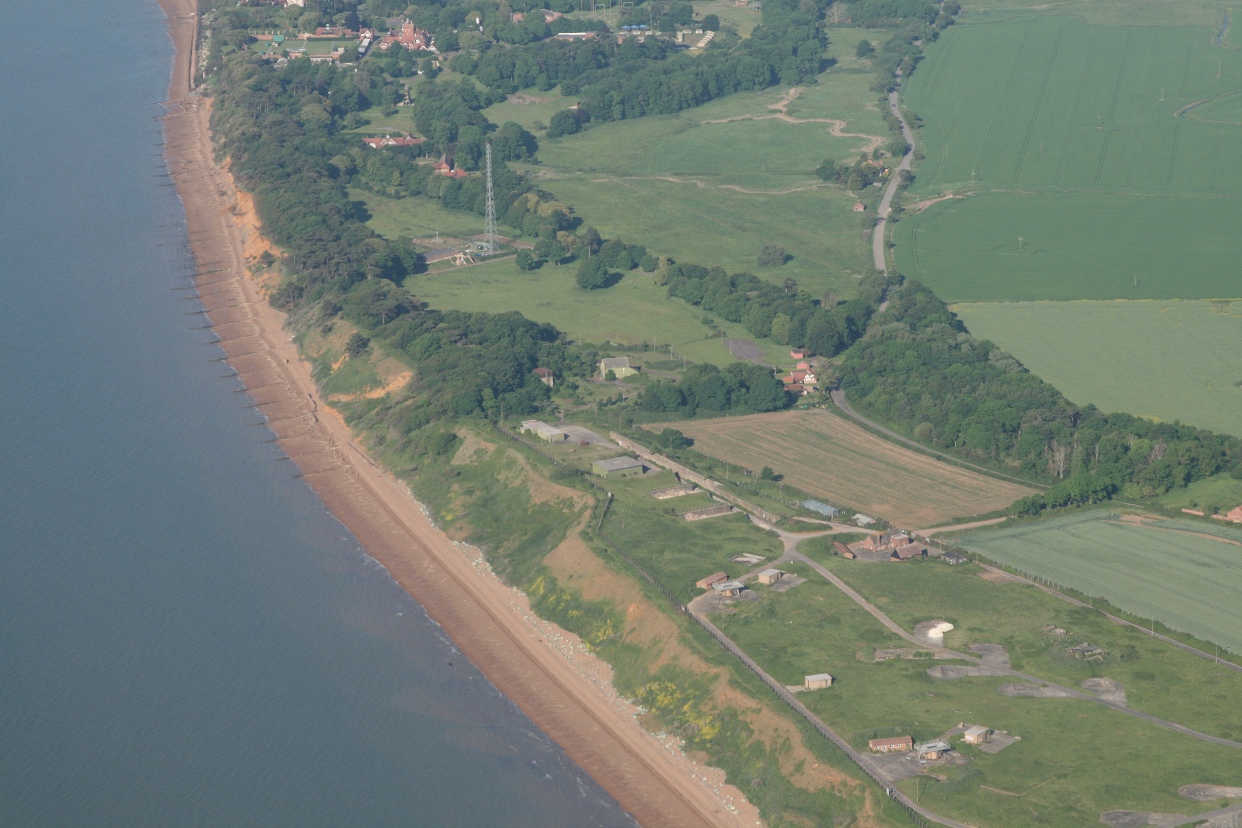
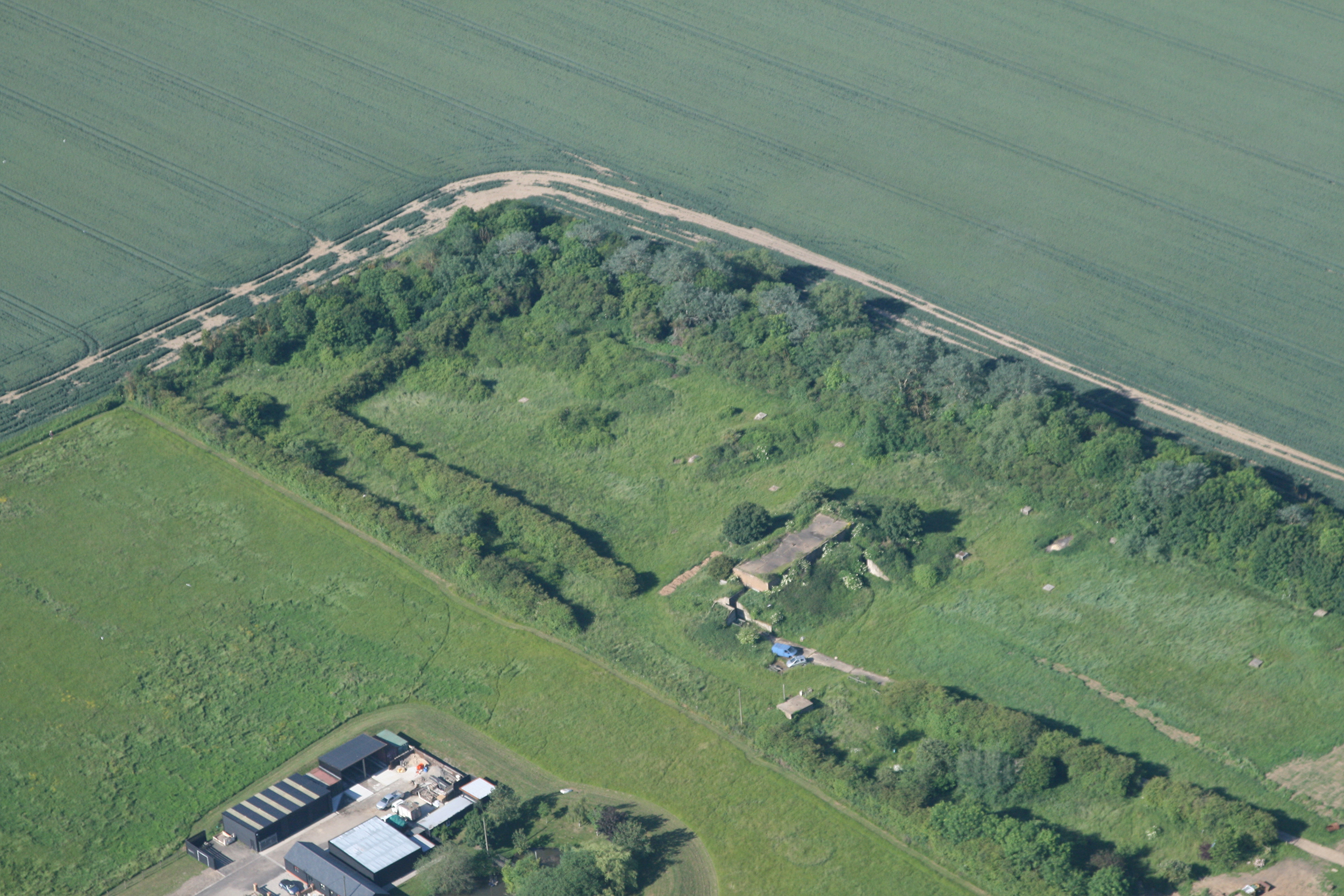
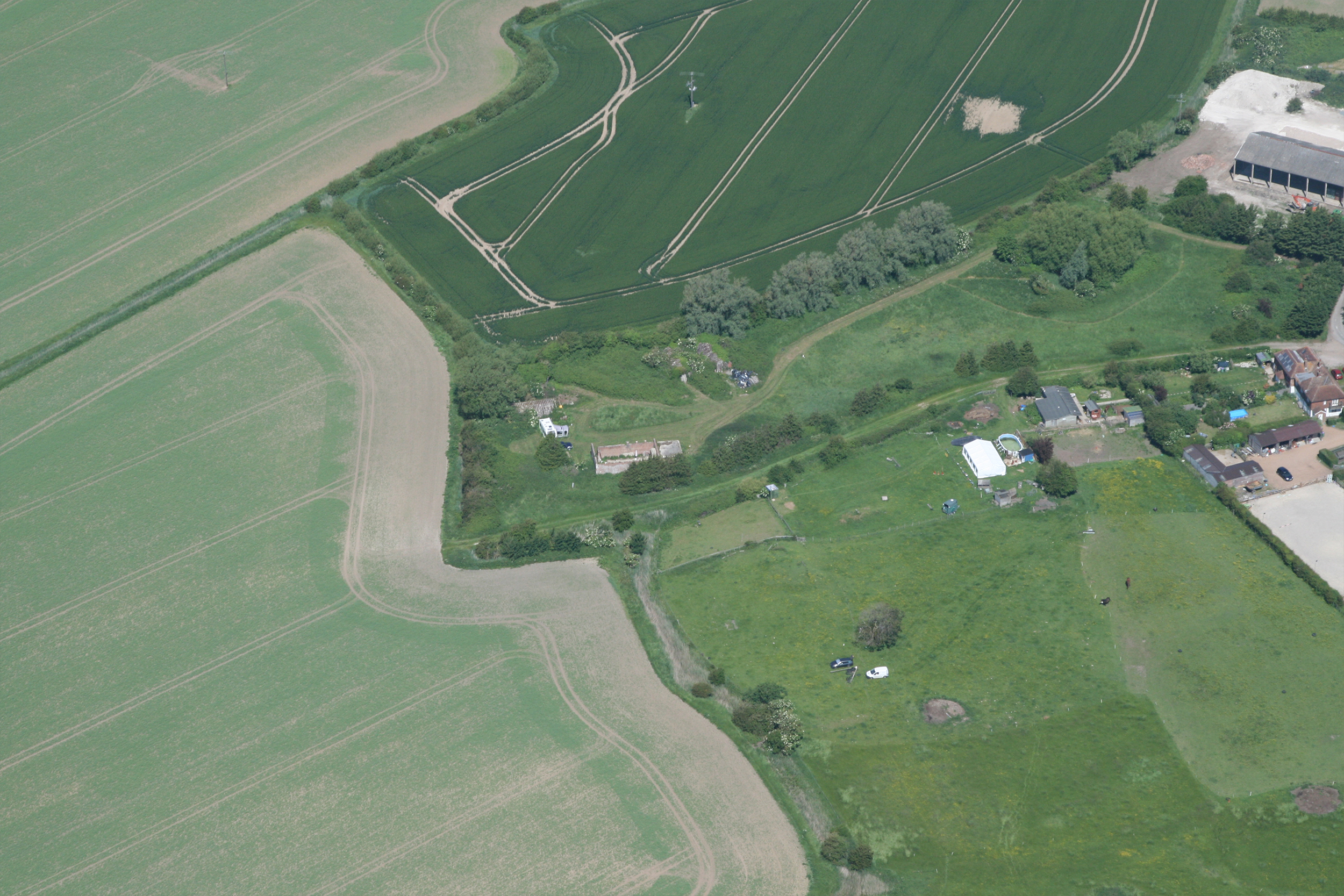
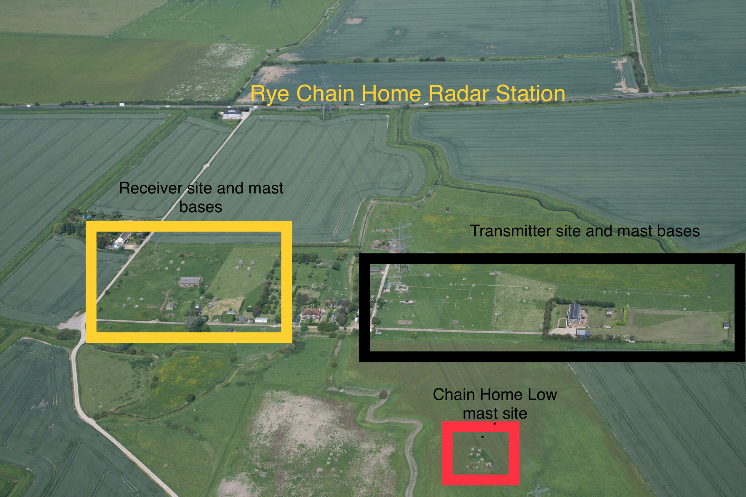
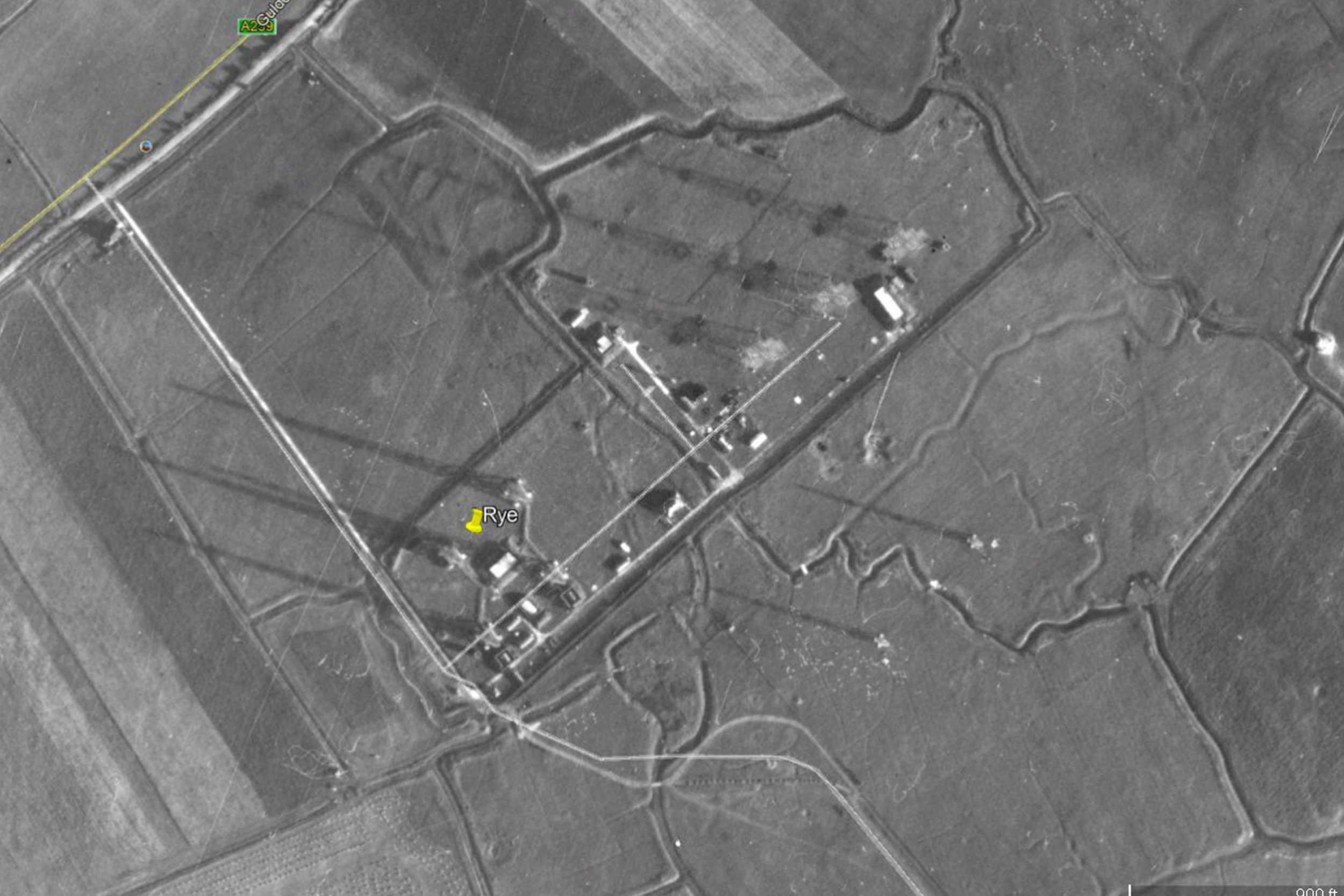
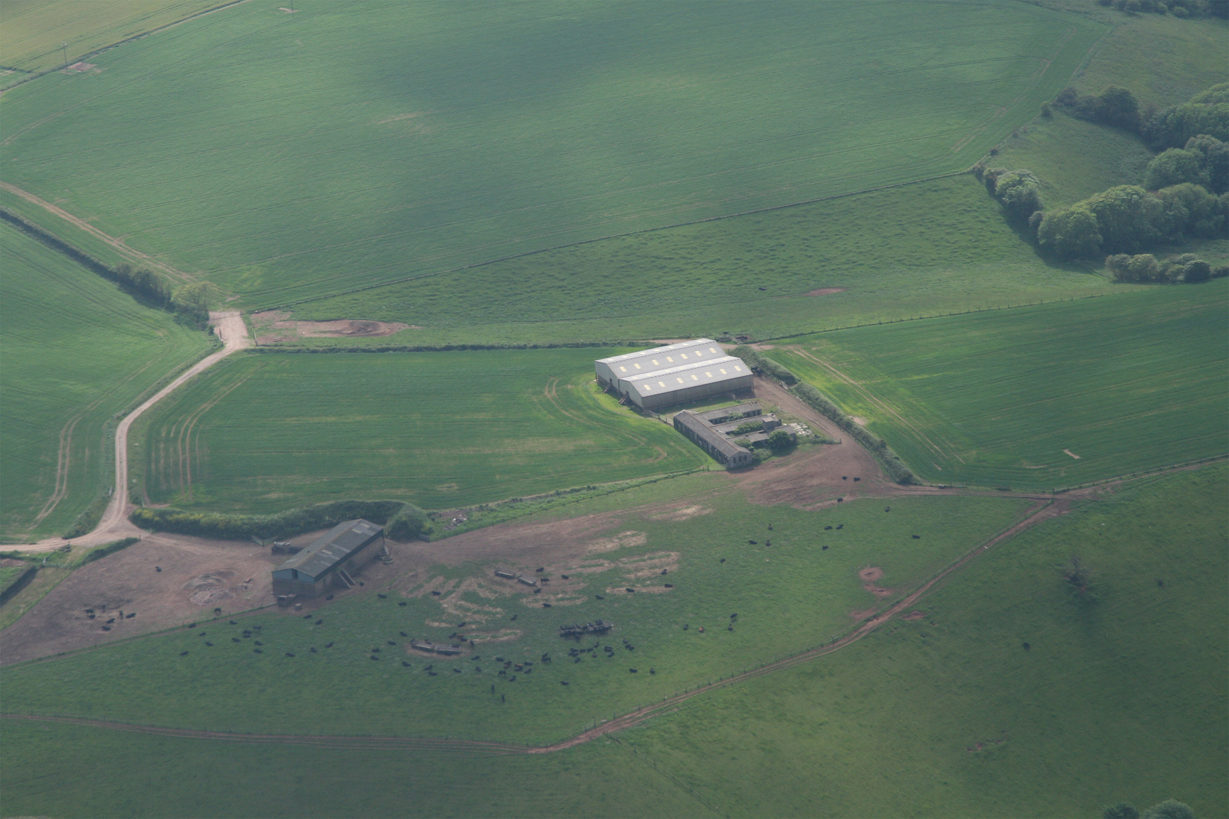
My notes have the radar station at Rye north-west of the wind turbine, under the power lines south of the road. Sure enough there it is and, incredibly, I can see how the sites were laid out. The site is linear. Looking inland, to the right is the Transmitter (Tx) site with four tower bases and their four corners visible which would have supported steel masts approximately 350ft tall. The Tx block looks like it has been converted to a house. In the middle of the site there’s a pair of semi-detached houses and an orchard, and to the left the Receiver site with tower bases forming a square and Rx block in the middle. These masts were wooden and 240ft tall. In front of the site are the bases for two smaller towers which would have stood 80ft tall and provided Chain Home Low coverage.

Eighteen miles to the south-west passing Hastings is the site of Pevensey Radar. A lull in the traffic enables slightly different photographic angles and once again it looks like the Tx block has become a house. Ford Airfield was next on the list and yes, it is still discernible as an airfield, and as we routed to the north of Bognor Regis, Tangmere aerodrome with Goodwood House behind were visible. Next target is Ventnor on the Isle of Wight.

My kneeboard has a large exclamation mark and ‘TRAFFIC’ written on it, and I’m looking for activity from Bognor gliding as well as for traffic for Goodwood and Bembridge. Sure enough there is traffic descending over the sea inbound to Goodwood. I can’t see it on my traffic display so halt my climb. I spot him, he’s above and fast, sure enough he passes safely overhead.

Everywhere is busy – the sky and the sea – and I tell myself that should I have to ‘take a swim’ that at least I’ll be picked up relatively quickly… Directly east abeam Sandown with Ventnor spotted there’s a problem. There’s been an incident on the runway at Sandown and all inbound traffic is being advised to route to Lee-on-Solent. We give them a little more space and stay out over the water.

Ventnor Radar is easily identifiable as it sits about 800ft up and must be the highest point on the island. However, I couldn’t see anything that clearly identified the site as Chain Home like Ryde or Pevensey. Moving across the island I contacted Bournemouth Approach for a service remaining outside its CTR for a routing to Worth Matravers and St Aldhelms Head via Hurst Castle, Hengistbury Head and Sandbanks.

Just before Hengistbury Head I photographed the former location of Christchurch Airfield where 529 would often base themselves for their south coast taskings.

Sandbanks and Poole Harbour are suitably spectacular, but this is a busy corner so don’t take pictures. I turn to the south-west and slow a little as we’re flying into a cul-de-sac created by danger areas and looking for the village of Worth Matravers which was home to the Technical Research Establishment (TRE). This was a huge site occupying the whole headland of many square miles and ‘most secret’. So secret in fact that nobody noticed it was covered in masts and wires. I’d found an early coloured image of the site when the receiver masts were just being put up and in it is a distinctive looking house. I made locating the house with its unique roof windows my objective.

While trying to obtain the angle for the photo, Bournemouth ATC advised me that the danger area was very much ‘LIVE’ and could I make my turn to Wareham in good time? The building is identified, picture taken, and we make our turn. I had hoped to ask to cross to the Danger Area to obtain a photo of the installation at Tyneham and the church at Steeple, but instead fly parallel to the danger area in the direction of Weymouth trying to pick out Ringstead Bay. The positions of the antenna bases are all overgrown and I can’t recognise any buildings.

I started listening to Exeter Approach. I’ve been in the air about 3hr 10min now and I’m on schedule. We make our way along the coast looking for hang-gliders and paragliders and other aircraft enjoying the scenery. The coastguard and Navy are out as we pass Bridport. Passing Seaton we call Exeter. I’d telephoned from Rochester so they are expecting us to join from Sidmouth. Looking hard for traffic I try to get into a position for a photograph of something that can distinguish the Branscombe Cross Radar site.

As it turns out the picture isn’t too bad. Camera away, fuel transfer on, Exeter Pooleys plates swapped for the chart, radio frequencies queued up and I go through a mental rehearsal as Exeter is busy.

We position to join left base Runway 26, go to Exeter Tower and are requested to orbit left to deconflict with large inbound jet traffic. Tower informed the airliner of a ‘little autogyro orbiting left base’, to which the Captain replies, “I’ve got him on TCAS…” Good to know my transponder works! As my orbit comes around I am instructed to follow behind, happy in the knowledge that with our speed differential and crosswind there won’t be a wake turbulence issue. Informing the tower I’d like to refuel before parking as I overfly the threshold, I’m given clearance to vacate at Charlie. I land at Charlie and immediately vacate heading for fuel. Engine running time 3:53 with 3:41 airborne – eight minutes ahead of schedule.

While waiting for fuel I chatted with the crew of another waiting aircraft which had been trying to reach Bodmin in Cornwall. Due to low cloud Bodmin was closed and they had to divert. The cloud was now lifting and if they could get fuel they could carry on to Bodmin. Due to the G7 Summit in Cornwall the previous week, the US Marines now wanted to go home, meaning that their four Ospreys and three Hercules transports were consuming Exeter’s resources and staff.

Rota Leg 3: Exeter to Chiltern Park

After an extended delay on the ground due to the departing Americans, the call for start up occurs at 1540. We taxi via Charlie to hold at Delta 1, run up and, checks completed, call ready for departure. No reply from the tower. I wait and repeat the call, still no answer from the tower, but I am receiving all other radio traffic from the aircraft on and around the airport. Unable to move from the stop line without permission I call for the support of the ground vehicle which promptly arrives. After a short discussion, I request an ‘old school departure – lights or flares, please’. No, they can’t do that but how about lights on the tower? Perfect.

All systems on, transponder set. I call ready for departure and look to the tower not sure whether to see a person with a handheld light or something else. A bright green light illuminates above the tower windows and I throttle up KBOJ to line up on Runway 26. The light remains steady and green and I call that I’m pre-rotating with the intention to take off. As the wheels lift off the tarmac two-way communication is restored with the tower… 1607 local and we’re on the home leg.

Thirty minutes away on a heading of 200 is Prawle Point, a couple of miles west of Start Point. A few clouds indicate that Cornwall has had different weather today and the air is a bit more turbulent. The radar station at West Prawle, to all but the well trained eye, is a farm site and the buildings are just farm buildings, old and grey. The giveaway that this was a west coast Chain Home radar site is the ‘E’ shaped building next to the new barns.


There are other radar sites along the Devon coast but, as they are related to gunnery and radio direction finding, I’m trying not to be distracted by them and fly the task, the primary Chain Home stations of which we have two more. The first being Wotter on the south-west corner of Dartmoor above Plymouth.

Wotter and Downderry, our final radar stations, were serviced by 529 (Rota) from Roborough Airfield to the north of Plymouth and would later become Plymouth Airport. Flying past, rather than overhead to avoid the built up area and Naval Dockyard, the airfield looks in good shape and is crying out to be used.

Crossing the Tamar, you can’t see Downderry because it’s at the foot of the cliff and comes up quickly. I’m not expecting to find anything on the radar site as I know it was cleared in about 1969 and the land used for beach front houses.

Time to stay focused and alert as it’s the best part of 160nm home and will take over two hours. Climbing up over the moor to route Princetown – Cullompton, we can see Wales clearly but the Bristol Channel looks like a glacier with the top of Lundy Island looking like a flat slab on the surface of the ice. I look at the Dunkeswell plate and tune in, just in case. Passing Yeovilton the weather is looking grey and colder and Wiltshire has a lowering cloud base to about 2,500ft. I don’t think it will be an issue but see if my phone will connect to give me a forecast at home. Home is better, the cloud may be as low as 2,000ft around Marlborough but I’ve contingencies with Lydeway Field or Clench. If I’d been running late I thought I’d need a plan if I couldn’t make it home. We passed Lydeway at 1839 and Hungerford at 1852.

Nearly home, I called Benson for a MATZ crossing to the final waypoint at Crazies Hill, line up an approach and fly through at 1915, some 14hr 43 minutes since I departed.  A few minutes later I’m on final 04 into Chiltern Park. Total time in the air 11hr 30min, total distance flown 783.7nm. Taxying in I’m met by Paul Adams and a cold alcohol-free beer…

Share

Leave a Reply

Share
  • 2
  • 3
Enjoy 3 Free articles OR Join today to enjoy unlimited access to all content
Join today

We use cookies to give you the best online experience. Please let us know if you agree to all of these cookies.