Flying Adventure

Islands in the sea…

As Paul Bass reports, the perfect post-pandemic pick-me-up consisted of him, together with his mate Darren Maybury, heading over the sea to the Outer Hebrides and the Shetlands…

We set off from Sherburn in Elmet on 28 August 2021. Darren in his Skyranger Nynja and me in my EV97 Eurostar, loaded with lightweight camping gear and folding bikes.

The start of our journey took us, fairly rapidly, to the Lake District. However, it almost ended badly for Darren before it really got under way. We’d left Sherburn under a bright blue sky and hadn’t been airborne for long at 6,000ft, when some deep, towering clouds stood ahead. I climbed up and over the biggest of them, but couldn’t see Darren.

“What’s your position?” I ask, to an empty silence.

All the while I had been merrily snapping pictures of the cloud formations Darren had had a scary experience. I heard the full story later that evening.

He said: “I made a huge mistake. I pushed full power to climb over the cloud but left it too late, thinking that my Skyranger would out-climb the distance between me and the cloud. I was in a total white-out before I could do anything about it, forgetting the difference the extra weight of the camping gear makes.

“The airspeed indicator spun around like a rev counter, and the vertical speed indicator maxed out. The artificial horizon was at a radical angle. Yet, for some reason, I was completely relaxed and didn’t
panic at all.

“I levelled the wings and got the airspeed under control, but it felt like an age between backing off the throttle and getting into a level descent. I expected violent thermals, but it was calm. It felt like minutes before I came out of the bottom of the cloud, travelling 2,000ft vertically to reach the bottom. I didn’t feel like a hero, and only once everything was under control, only then I felt fear and a ‘code brown’ alert.”

Isle of Harris in the Outer Hebrides with the oldest rocks in Britain

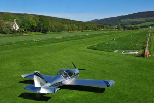
Later that night, after topping up with fuel at Strathaven, from the generous Colin MacKinnon’s jerrycan supply, we biked into town for a celebratory ‘survival’ curry.

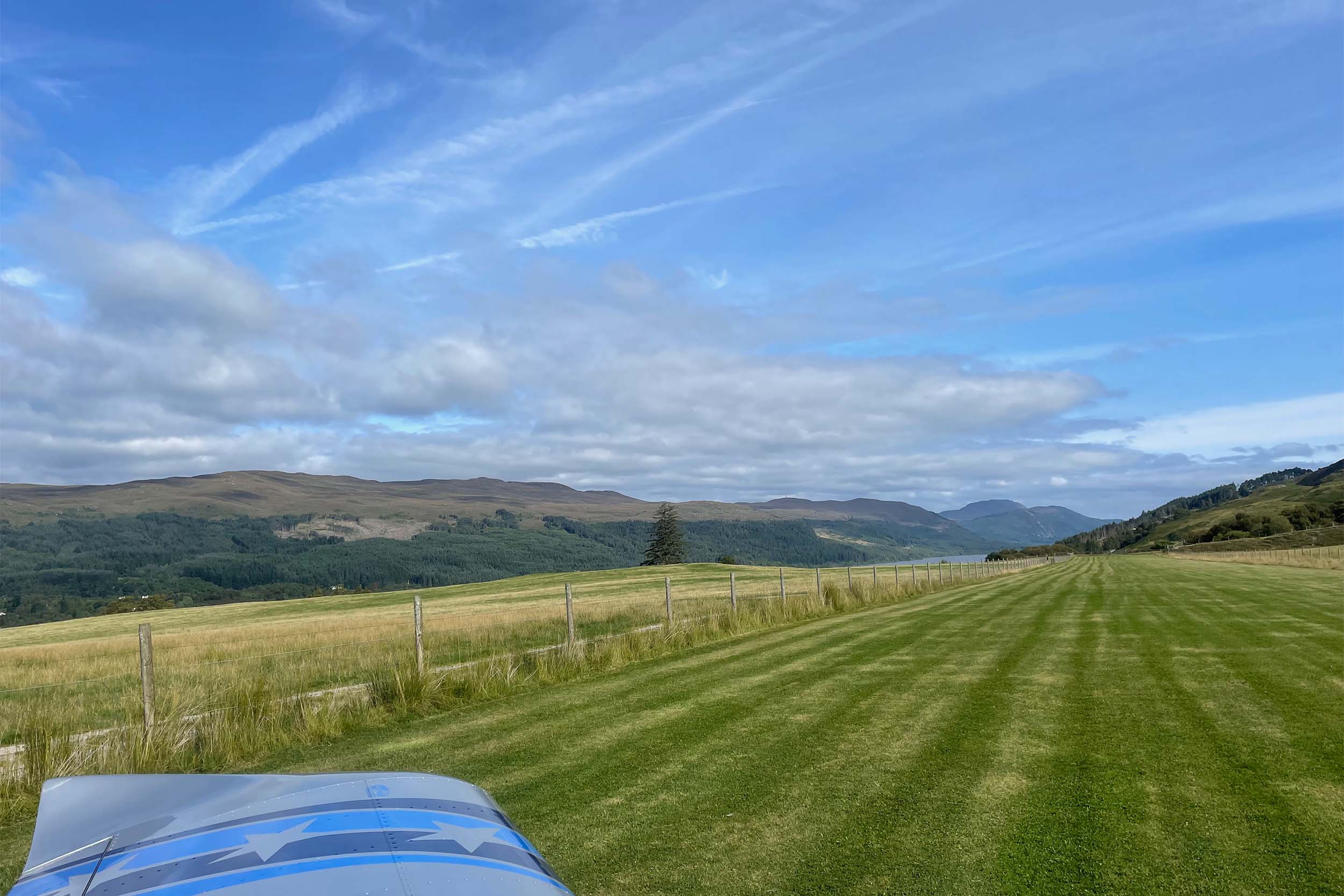
The following morning it was foggy, so we took our time packing. Then the weather radar showed it was improving slowly out to the west coast, so we climbed into the low, breaking mist, hopeful that we could make progress… but we were soon on the ground again, 37 miles and 25 minutes further on at Bute Airfield.

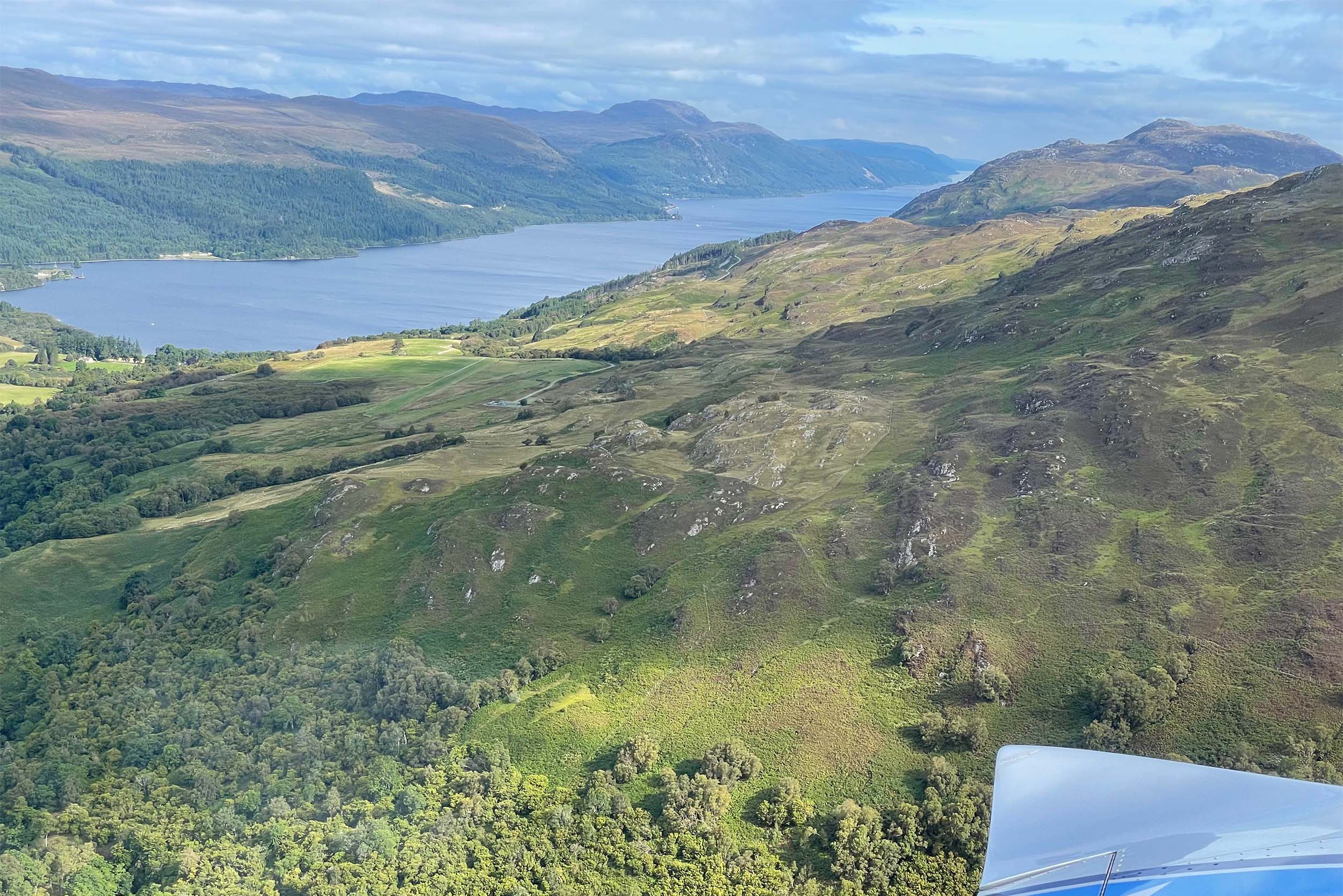
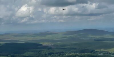
“What do you think?” I asked Darren. I could see the island mountains ahead, which were still tipped with clouds. The choice was in front of us – over the sea or over land. As we couldn’t see far enough ahead through the mountains from the ground, we decided to have a plan B, which was to hop along the coastlines of the islands on the way, just in case. Plus, we knew we were flying towards better weather.

A few miles from Oban, the terrain climbed up, and the cumulus clouds seemed to sink lower as we broke into a bright blue Oban sky.

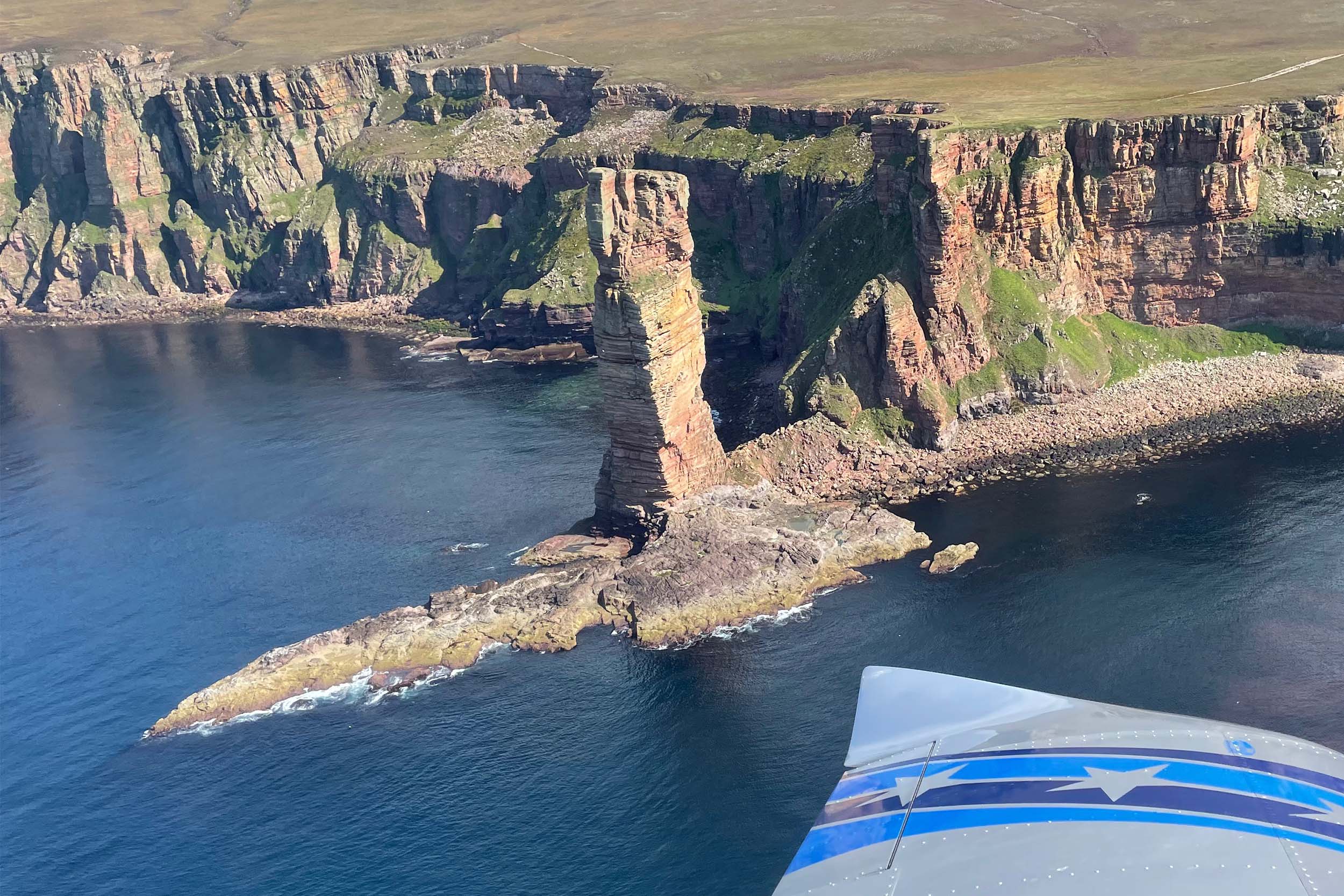
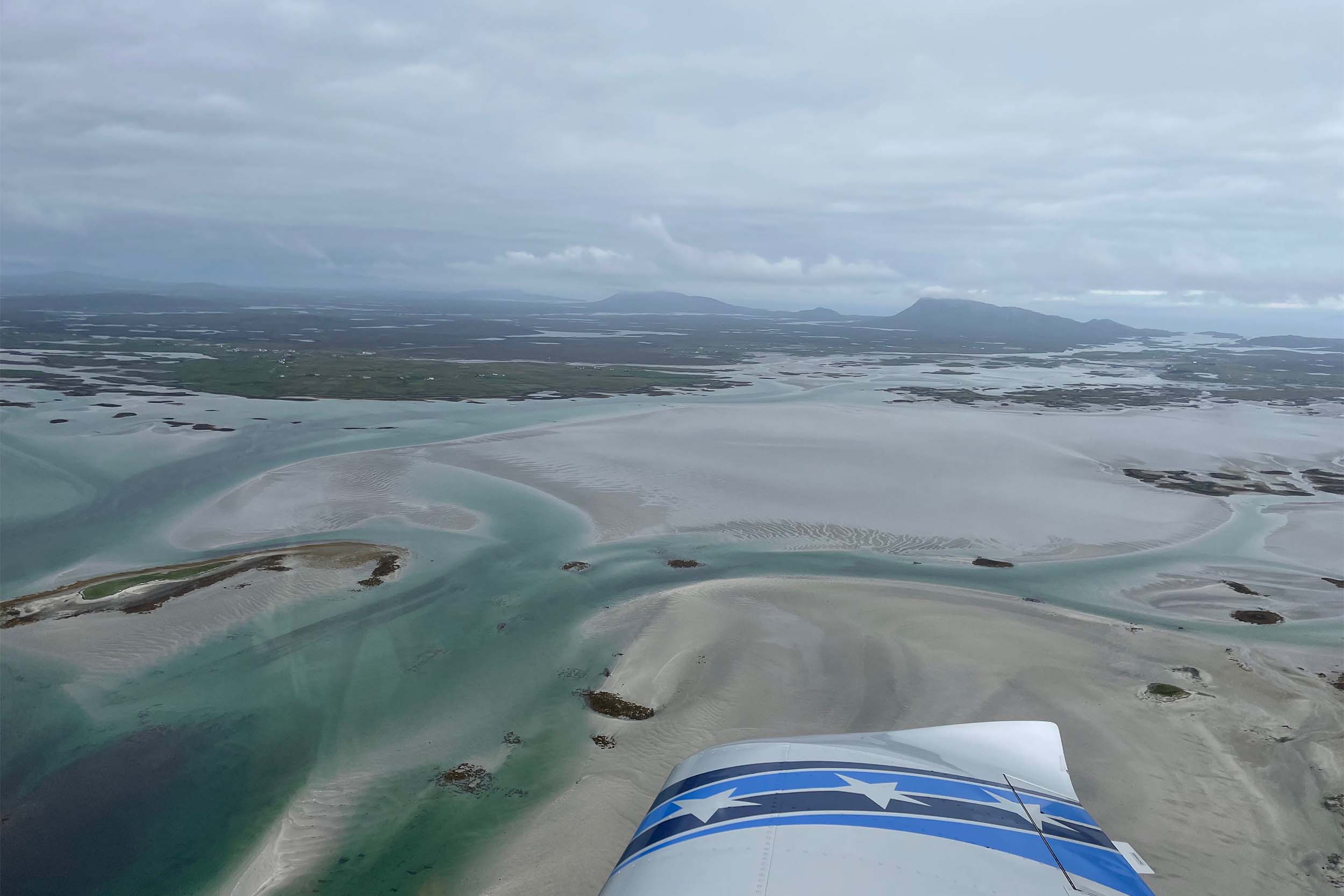
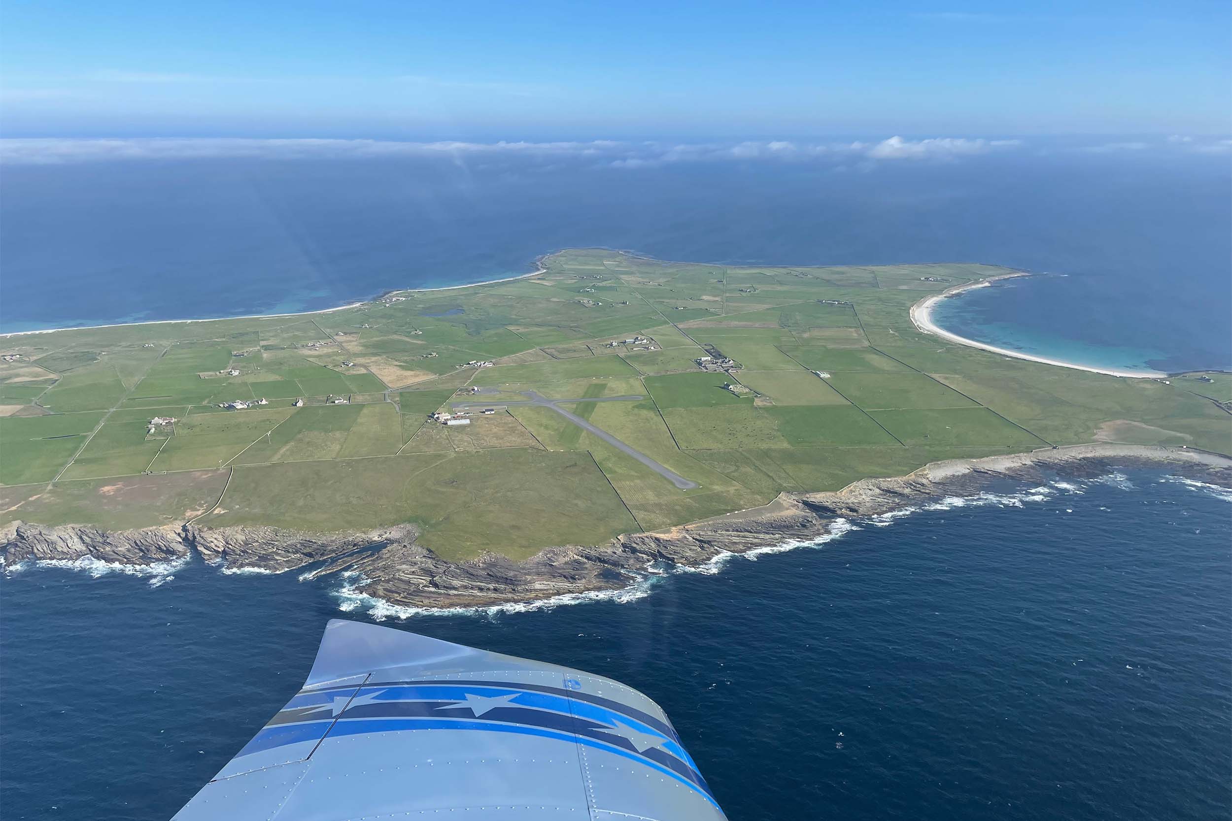
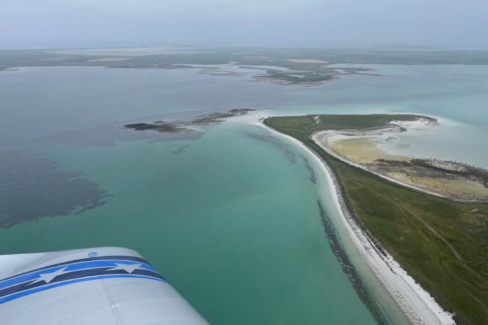
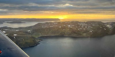
As we flew out over the sea around the Hebrides for the 102-mile flight to Benbecula, on the Outer Hebrides, reality started to bite. In the distance, a line of ragged cloud edged South Harris.

“Why don’t we just straight line it?” Darren said, his direct routing approach over the sea overcoming his initial yearning to hug every spit of land.

“OK,” I replied.

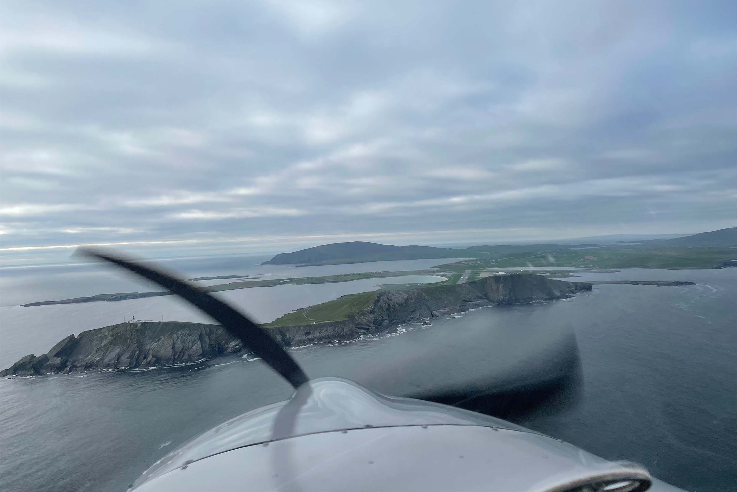
We arrived at Benbecula, the broken cloud line now down to 1,500ft. And, everything appeared to be locked up and closed.

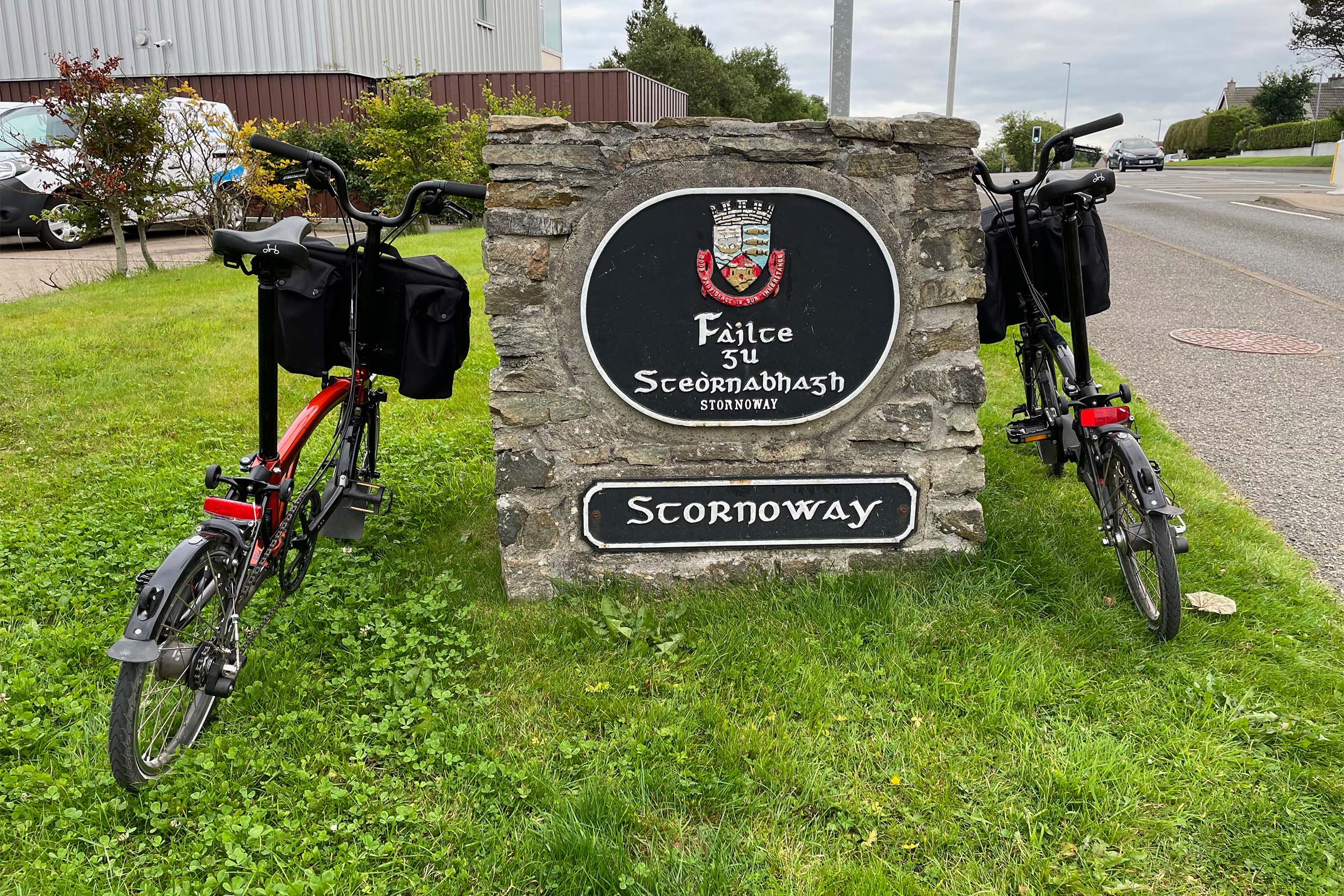
“Shall we try Stornoway?” I asked. And proceeded to ring the tower.

“What time are you open until, please?” I asked, hopefully.

“Five. So if you can make it by then, we’ll see you.”

In short, as it was 63 miles and 45 minutes away, it left us a margin of only a few minutes.

Recognise Strathaven from Grand Designs?

We zoomed off, crossing – what now feels like – real adventure terrain. Light-grey Lewisian gneiss (a high grade metamorphic rock) peppers the landscape, taking its name from the largest island area in the archipelago. We were flying over the oldest rock formations in Britain, at nearly three billion years old, and some of the oldest worldwide.

A single road weaved through this apocalyptic-looking landscape. Only a few bright, white houses dot the route. It crossed my mind how I’d love to ride my bike through this beautifully desolate place…

A flock of birds flew across me from right to left as I came into land at Stornoway, landing in the northerly crosswind, making me jump, but they gave way.

I just couldn’t imagine what it’s like here in the more ‘usual’ wild weather, so I asked the ground crew.

“Well, 40mph is a good drying day. People don’t bat an eyelid if it’s 50mph… 60mph+ is when people start to get concerned,” came the reply, with laughter.

They added that ‘houses are constructed on a completely different level. Every tile and fixture is nailed down’. In short, they’re just used to wild weather.

Man-eating midges were ‘happy’ as we put up our tents at the nearby Laxdale Holiday Park campsite and unfolded the bikes so we could go and explore. There was even one woman sitting on a bench with a full netting regalia on her head, reading a book – and it wasn’t yet peak midge season.

The Hebrides is a deeply religious place, and as it was Sunday, everyone seemed to be going to church. Women in their best dresses, while men wore dark, smart suits. We struggled to find anywhere open for food and ended up having a pizza after waiting for an hour outside a pub.

On approach to Oban Airport

The next day, we were on the way back to Wick near John o’ Groats on the mainland. We followed the wild west coast of Scotland, with the sun beaming through occasional holes in the cloud, lighting up the speckled sea. White beaches and picturesque blue-green, sea-lapped coves are everywhere.

Equally as remote as the Outer Hebrides, the west coast of Scotland looked different again. The mountains are enormous, and cloud sits menacingly on the tops. There are very few roads, and the terrain would be the last place I’d want to make an emergency landing. We talked about taking the softer option of landing in the sea, near a bay.

North Atlantic

We refuelled at Wick, where the staff couldn’t be more helpful. I’d just finished reading Ferry Pilot by Kerry McCauley. I learned that in an average year, three pilots die ferrying small aircraft over the North Atlantic. So, I enquired as to how many have had problems recently.

Wick seemed more hopeful, saying that it hasn’t happened for a while… only a twin that made it on one engine 50 miles away from land a few months ago.

We slid into our neck- and wrist-crushing dry suits, and I dolloped a powder of talc on Darren’s head.

“You’ve got to talc up, or the seals break – and they aren’t cheap to replace!” I told him.

We sipped a drink and paid our fees, and the chaps in the handling office seemed to smirk as we tell them our next stop is Shetland.

Darren’s face started to look just very slightly uncomfortable, to which the guys commented that Darren ‘doesn’t look convinced’.

“He’s his own man!” I protested, adding with a smile “We wouldn’t do it if he felt uncomfortable!”

“We’ve got to do it, haven’t we…?” Darren ventured. And 15 minutes later, we headed out over 117 miles of ocean to Shetland.

The sea stretched out to what looked like infinity, and I feel suspended in time, the occasional jet vapour trail high above in the bright blue sky. The sun beat down onto the surface of the silver and grey flecked mackerel sea, where barely a ripple showed, helped by the high-pressure weather system over the UK.

Ahead, the wispy horizon didn’t give much away, and there was no land visible in any direction. The rubber neck seal of the immersion suit squeezed my neck uncomfortably, but reassuringly.

The Orkney Islands slipped out of view behind us, and we had another 50 miles to go until we got to Sumburgh Airport on the southern tip of Shetland.

“That is a lot of water!” Darren exclaimed.

Soon, Fair Isle came into view, one of the most remote communities in the UK. Getting there is a labour of love by boat alone, and dangerous north-westerly winds gusting over the large rising cliff can be treacherous for landing aircraft. We continued, and Shetland soon appeared out of the haze.

The approach into Sumburgh’s 1,426m 33 runway is nothing short of breath-taking. The spectacular high cliff on final is only equalled by the spectacular downdraughts on the lee side, as G-JG and I get battered.

“Maintain a five-mile separation,” ATC announced, as I managed to push the PTT button, while simultaneously being tossed around like a crash-test dummy on a rollercoaster. I bet the controllers haven’t been to the LAA Rally or Popham Microlight show…

“It’s a bit turbulent down here off this cliff,” I tell Darren, who is behind me, on the other frequency.

It seems he’s not taking any chances with the rotor. I spot his Skyranger speck almost in the stratosphere. Really, Sumburgh is a commercial operation, with helicopters, Loganair and rig traffic using it as a hub. I feel sure we’re a bit of a curveball for them.

On the ground, as we let out a fist-bumping ‘yeeha!’ of achievement and adrenaline at having got this far, a Loganair aircraft came into land but turned base to final inside the cliff.

We asked the ground staff if that is what we should have done.

“Well, to be honest, we don’t use Runway 33 much, as the wind is usually the other way,” came the reply, as the Loganair goes-round to land on the longer R27 instead.

Having missed the bus to Lerwick we ended up shelling out an eye-watering £50 for a hair-raising taxi ride, with the driver spending most of the time cornering on the wrong side of the road like a F1 driver.

While we sped along, we heard a story of a couple who wild-camped in a bothy (a small building where remote workers, farmers and walkers can take shelter). They had pitched up for the night on the most northern Shetland Island, Unst, during a hurricane of more than 150+ miles per hour. Unfortunately for them, the wind picked up while they were sleeping, taking the Bothy over the cliff edge with them inside, never to be found again…

As for us, we pitched up at The Grand Hotel for the night in Lerwick and I read up on the Orkney Islands’ airports. It seemed we’d have to jump through a few Orkney Council hoops.

The following day, we both decided that we’ve got such comfortable camping set-ups that we are more comfortable in our tents with the aeroplanes – and for a lot less money. There’s something magical about waking up to the fresh morning air.

We caught the far cheaper £2.90 bus back to Sumburgh Airport, laughing as Darren pushed his bulging transatlantic-looking trolley through the gate to get to our aeroplanes.

North Ronaldsway: Spectacular lighthouse

Getting it right…

By morning I had called Orkney Council’s tongue-twisting ‘development and infrastructure’ department, as I wanted to be sure we did everything right. Susan, who answered the phone, couldn’t do enough to help. We had electronic indemnity and PPR forms to complete, which we did messily, scribbling on them with our fingertips on the iPad.

At £16 per landing, though, it seemed a good deal and all part of the adventure. Since we left Wick fully fuelled up, we’d also got a good three hours of fuel left each, which was one less worry.

Darren went first, rolling onto Runway 33, with the obligatory five-minute head-start with the spacing rules. It was a bit tricky, as it meant one of us would be a few miles ahead over the sea, and Darren’s Pilot Aware had stopped working. We were flying blind to each other’s position. (We later found out his Pilot Aware licence had expired.)

I flew over the most amazingly smooth, lenticular-looking cigar-shaped cloud on take-off, and opened the throttle to 120mph to catch up with my wingman.

I scoured the vast area of sea for him, but to no avail, and my mind turned to relief that at least we were wearing our immersion suits. Finding a submerged person in this infinite ocean would be like looking for a grain of rice in the desert. Thank goodness for my PLB locator beacon, which I hoped wouldn’t get damaged if it ever got to ditching… I imagine that finding a person out here 50 miles from land in this calm sea would be difficult enough, never mind in a swell.

I followed the straight line on SkyDemon to North Ronaldsay, hoping we would find each other soon.

“Is that land in front of us?,” I asked Darren expectantly on the radio. He was still several miles ahead of me.

“No, it’s a cloud shadow,” he said. And he’s under it.

“Oh,” I say, anxiously chewing the inside of my mouth.

White sands of Sanday Island on Orkney

We’re almost on top of North Ronaldsay before it appears out of the high-pressure haze. The black shale-like surface nearly wrong-footed me as the nosewheel touched down in the stiff northerly 10kt crosswind from the right. It tried to steer me off to the left and I wonder what happened. When I climbed out, I noticed that the surface gently slopes away either side – seemingly for water drainage, as we later find out.

“We should have landed into wind,” Darren says. “That was quite a crosswind!”

“I agree!” I admit. It was my idea. With the sea psychologically at the end of the runway I didn’t want to take any chances.

David, the airfield manager, met us. He has an unusual dialect which I can only describe as a combination of Norsk, Scottish, Irish and English rolled into one. In fairness, this is the most remote of the Orkney Islands, 57 miles from the mainland, so anything is possible.

Seals laid lazily on the rocks only a few metres away from the local campsite, while flocks of semi-feral North Ronaldsay sheep wandered around, strangely outside the island boundary wall. We learn that this 5,000-year-old breed is unique to North Ronaldsay and has evolved from eating seaweed. In fact, the distinctive-tasting dulse (seaweed) is sold as far away as Hong Kong.

That evening, the Milky Way painted a dazzling collage across the pitch-black sky above us. We’re so fired up with the adventure that it seems such a waste to go to bed, so we set off on an 11pm bike ride to the other end of the island towards the alluring North Ronaldsay lighthouse, lit by Darren’s slowly dimming shared headlight. Thirteen beams from the lighthouse pierced the darkness with a brightness that would be right at home in a sci-fi movie.

Just as we started to pedal back to the campsite, a huge, bright red meteorite flamed across the black sky. It was so low it left a visible smoke trail at about 1,000ft.

The next morning, I’m onto the council again to cover our bases. We want to hop from North Ronaldsay to Sanday Island. We could see it from the ground – it’s just about visible out of the murk to the south, just two-and-a-half miles away.

Sanday Island

Our packing was now down to a fine art. We could have the tents and gear folded up and packed away in about 25 minutes flat.

The wind was calm as we powered away for the six-minute flight, getting nosewheels off the ground as soon as possible to avoid shale chips on our propellers.

Low mist hung in the air, and we were barely airborne at 400ft before we were over the Caribbean-white beaches of Sanday. Even without the sun, the bottom of the blue-green clear sea is almost luminous.

Having been given the lay of the land by the owner, we were soon pedalling to the one shop a mile away, Sinclair General Stores, before it closed, but its tills had crashed.

“Oh, don’t worry – we can sort it out tomorrow,” the woman serving told us. Now that’s old-fashioned trust, and it meant that I finally got to try my unleaded Coleman Sportster stove to make some outdoor fajitas for the first time.

I cannot imagine being stuck in the Orkney and Shetland islands in ‘typical’ autumn or winter weather, with even average wind speeds. Without hangarage, we relied on our trusty tie-downs and parked in the lee of buildings to reduce the wind.

The next day, we pedalled a mile over hard, bright white sand to the dunes to see what was happening at an archaeological Neolithic tomb dig. We were there for a good couple of hours, taking in the crystal-clear sea and tramping around the dunes and taking pictures.

We hedged our bets the next day and set off for Lamb Holm to be met by the animated owner, Tommy Sinclair. He passed us the keys to the clubhouse and we pitched our tents with a panoramic view of the sea, which was like a mill pond – something that Tommy told us only happens twice a year.

Camping at Lamb Holm

The Old Man of Hoy

The next morning, a fog bank sat menacingly off the coast to the east but was kept at bay by the westerly wind, and we just couldn’t resist a fly-by of the towering rock sea stack, The Old Man of Hoy.

Sometimes when things don’t go to plan, it gives unexpected experiences. Leaving Lamb Holm and stopping at Easter Airfield for a break, we set off for Glendoe on the bank of Loch Ness, a seductive 20-minute flight and 33 miles away.

The problem was misty, damp skies in the unmoving air. We calculated that we’d only have 40 minutes before sunset. If the Loch Ness valley mist closed in, we might get trapped in the mountains with nowhere to go… and in the dark.

We jokingly came up with a catchphrase: ‘Without a plan B, there is no plan A’. We turned back and landed again at Easter Airfield to talk through our options. We just wanted to get ahead a few more miles, safely.

We spotted Knockbain Farm on the first attempt a bit further on from Easter Airfield at the end of the Cromarty Firth. It has a three-degree upslope from one direction and a rollercoaster-like six-degree upslope from the other – and it’s perched on a 600ft hill. It sounded challenging, so we jumped at the chance.

The next morning, we sipped a cup of Coleman-stove-created coffee and admired the perfect view. The air was damp, and the forecast for low cloud wasn’t great and we finally got airborne by 11 o’clock, zooming down Loch Ness looking for Glendoe, which can be tricky to find. We tracked down the valley, following the gentle contour of the mountainside, which is only a few metres away on the problematic approach into Glendoe.

We only had time for a pit-stop to get the airfield in the logbook before flying to out-climb the 2,000ft mountains ahead, on our way to the next stop.

“Caution severe wind shear and turbulence,” Oban’s tower announced. G-JG’s nose was going up, down, left and right. It was a bit rough but I managed to film it. John from the ATC tower appeared, and the staff all seem to get along hilariously and have fun winding each other up.

“Do you fly, John?” I ask.

“Not a chance, you wouldn’t get me in anything smaller than a big jet!” he says, with a smirk.

“Have a look at what your words ‘severe wind shear and turbulence’ look like out of the front when we landed. I bet you’ve never seen the words translated to in reality,” I added. He watched the video.

“Wow! Your mate dropped about 100ft on final, too,” he said, resolving to stick to ground-based hobbies.

As we passed 35 miles north-west of Newcastle, Darren says, “Do you realise we’ve still got as far to go back to Sherburn from here as we flew over the sea 117 miles to Shetland? Crazy!”

We had flown 1,200 miles over 12 hours of flying and cycled about 30 miles on the fold-out bikes. The perfect rejuvenating post-Covid adventure.

Watch: Oban windshear and turbulence video.

Share

Leave a Reply

Share
  • 2
  • 3
Enjoy 3 Free articles OR Join today to enjoy unlimited access to all content
Join today

We use cookies to give you the best online experience. Please let us know if you agree to all of these cookies.