Spring weather tips
Special feature

Ten tips for spring weather planning

Ten top weather planning tips for pilots enjoying the return of spring…

Well what a relief! Spring is well and truly here. But after the floods and warmth of the past winter, getting your flying weather-head back into gear for the promise that the approaching seasons offer can seem a little daunting. So, here’s a guide on how to make the most of the flying that’s ahead, and how you can avoid being caught out by the weather.

1. Apps with attitude!

Think about dumping the apps. Well, not all of them, I’m being a little over zealous. However, I’m concerned by the number of pilots who are relying totally on such apps for all of their weather information.

While having always-on, instant access to weather information is no bad thing, it can lead a pilot into a false sense of security. Remember that the best weather forecaster is yourself. You’re the person who has been flying in many weather conditions, you know how it ‘feels’ to be flying inside the weather machine. Frequently, all that an app is doing is regurgitating model data that you’ve already seen.

Observational and TAF data are a different matter. They are produced by humans and are a recognised guide for pilots. They are regularly reviewed and should provide up-to-date information – just ensure that the source of the data is recognised and is stated on the app.

Of course, some weather data is better than none at all, so my call to ‘dump the app’ shouldn’t be interpreted literally, just go easy with them and build your own weather knowledge. Look out of the window and see what the weather is actually doing. If the weather doesn’t feel right, it probably isn’t!

2. Sea-breeze season

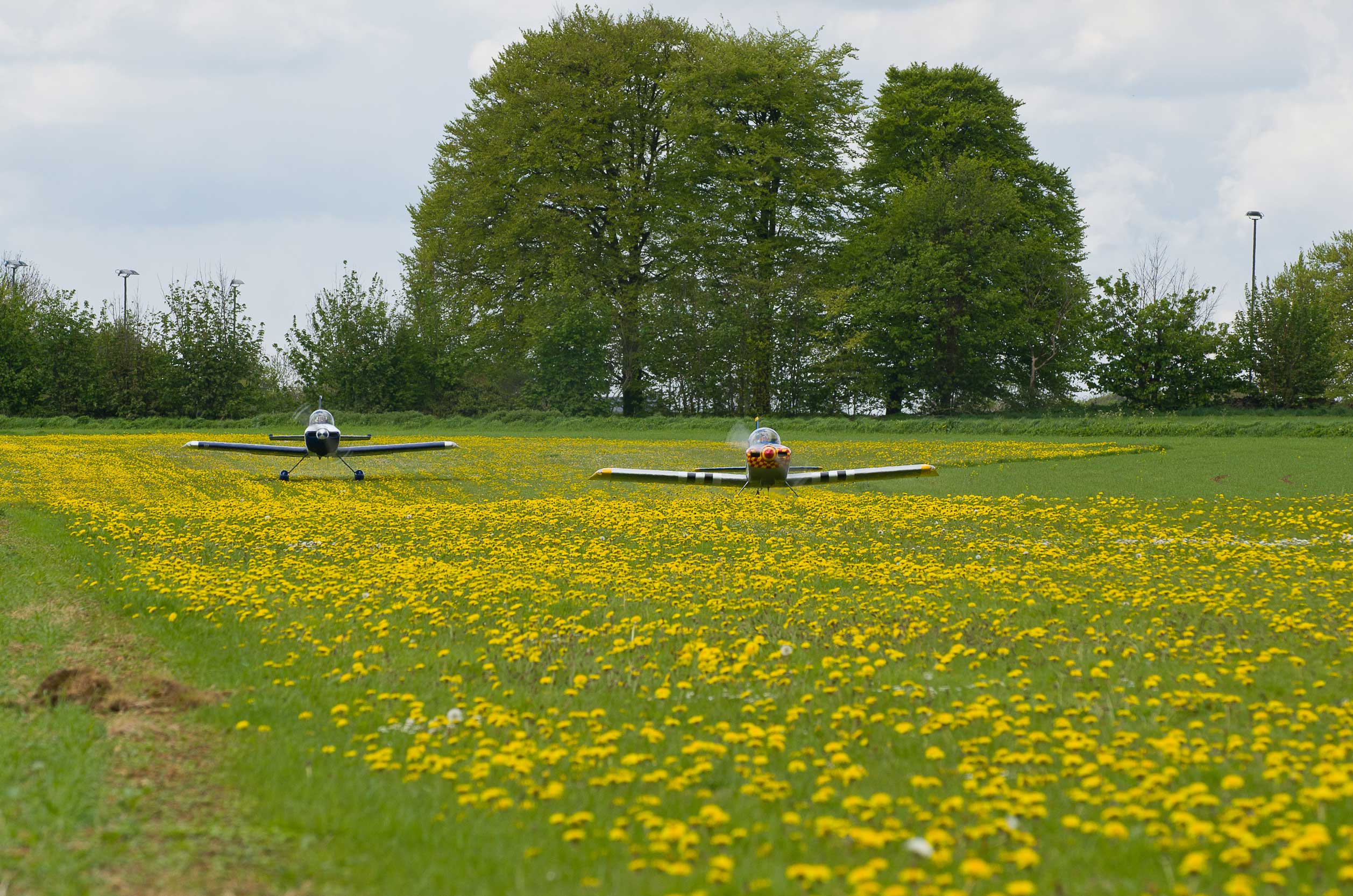
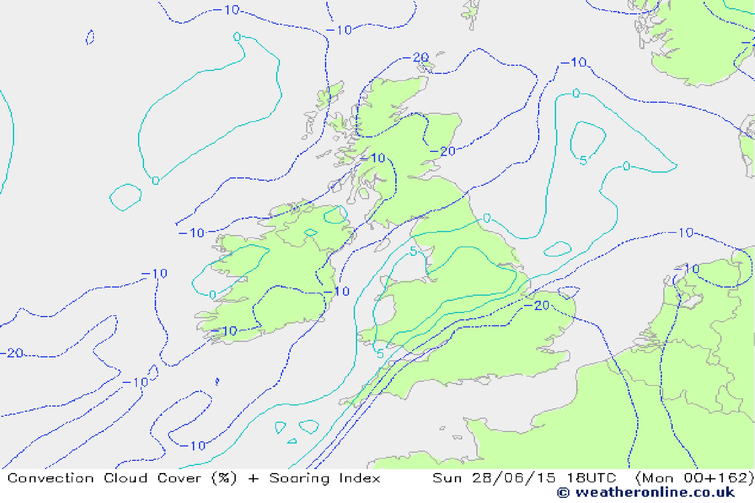
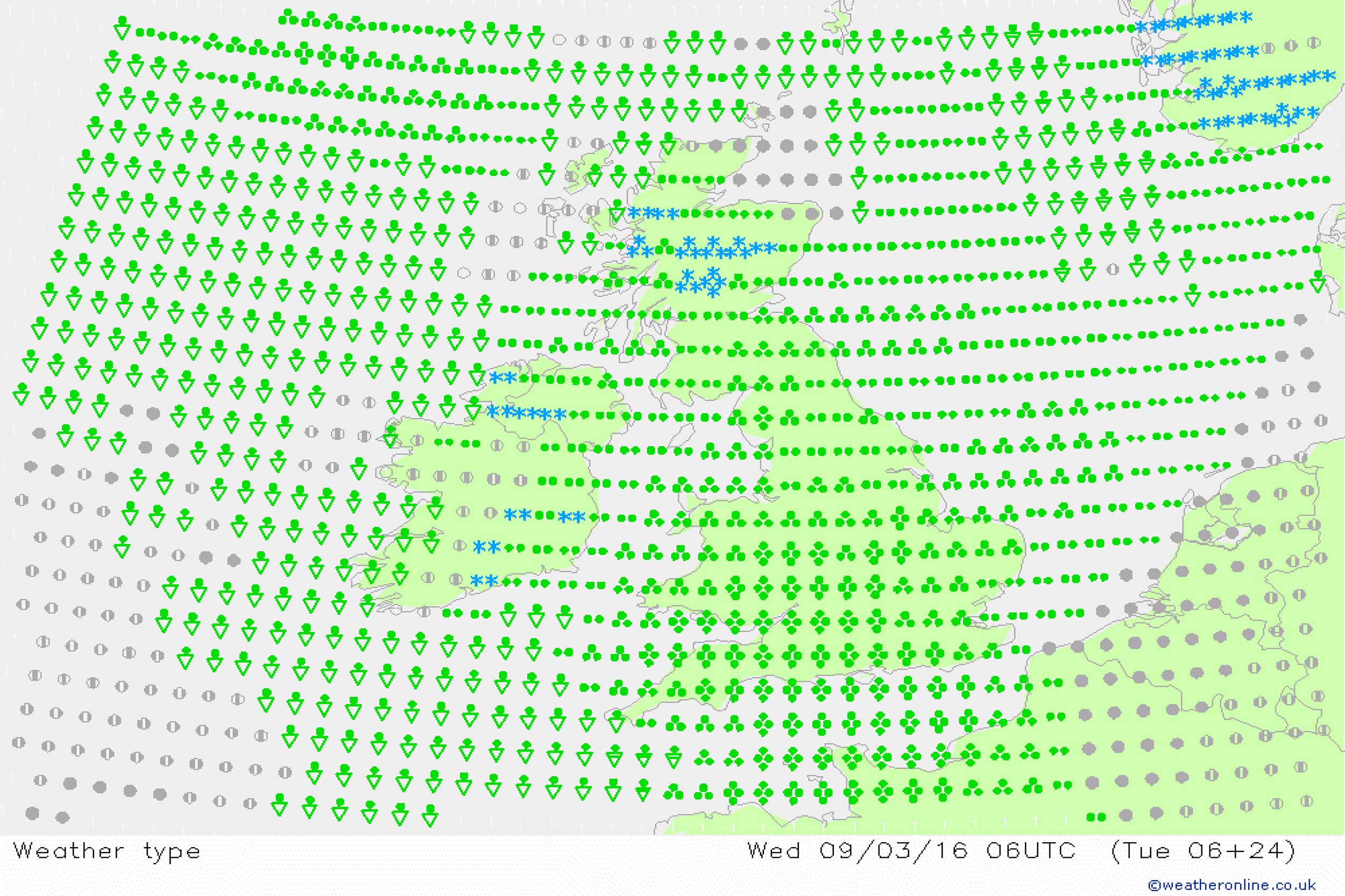
After the cooler temperatures of winter (and there were some cooler days!) it’s all too easy to forget how quickly warmth can arrive. By the end of April, inland temperatures can easily get into 20°-plus, in sharp contrast to cooler conditions around our coasts. Sea breezes can develop and these can generate some sharp showers as well as gusty winds, often catching out unwary pilots. Visibility can be reduced and particularly nasty flying conditions ensue.

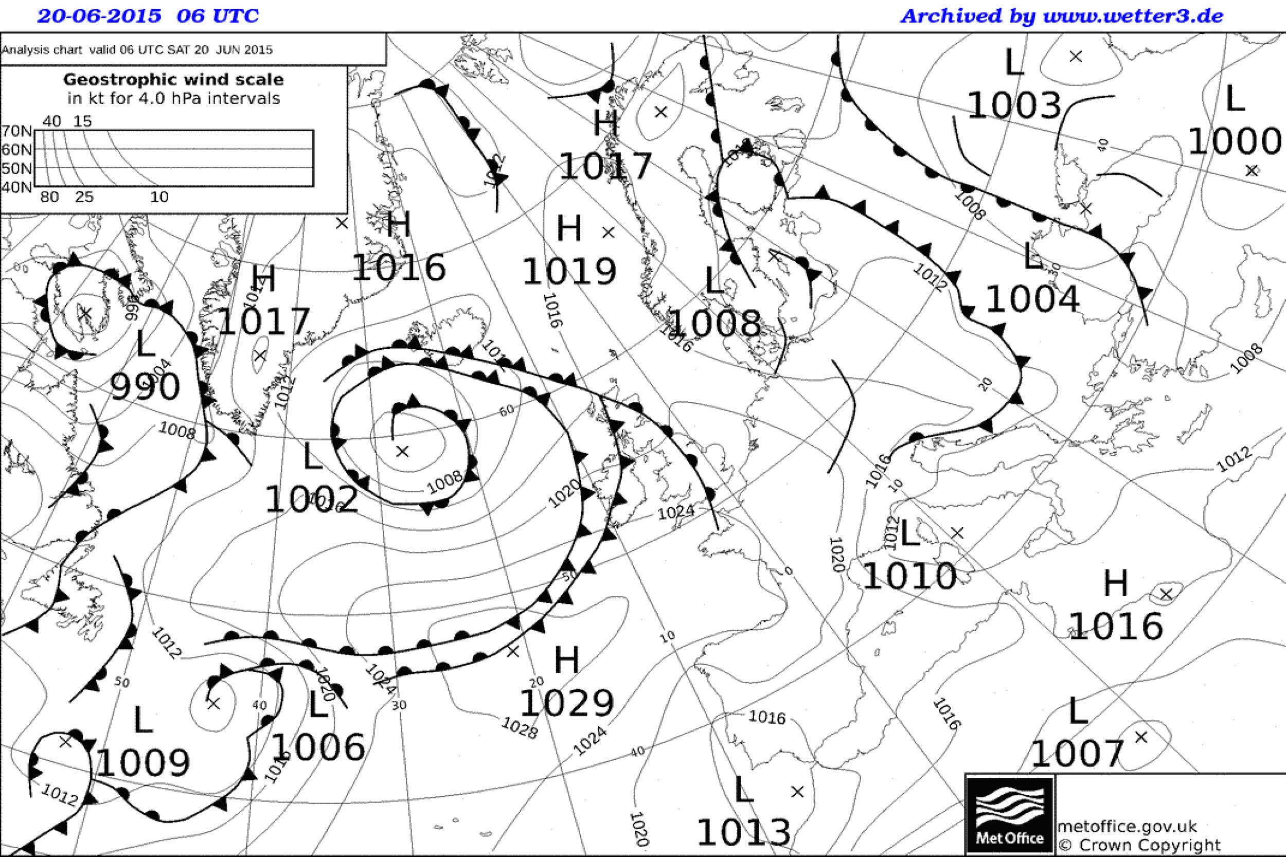
There’s even more reason to be on the watch for the sea breeze this year. That’s because sea temperatures around the UK and Irish coasts, as well as much of Europe, are above average for the time of year, and have been all winter. Air temperatures inland will therefore need to get quite high in order for sea breezes to form, but when they do they could be strong.

Be on the lookout for the sea breeze anytime from now (April) through to late September. However, the peak of sea breezes tends to be during May and June. To be honest, my experience is that strong sea breezes can occur anytime through the spring and summer months, often well into autumn, so best to be on guard throughout.

So what are the sea-breeze warning signs? Most obvious is a fine day with an increasing contrast between temperatures overland and at sea. Typically, a contrast of 4° or 5°C is required for the sea breezes to develop. However, other factors come into play too. The most important of these is the surface wind. An offshore component (flowing from the land to the sea) is the perfect ingredient for the sea breeze to form. However, the stronger the wind speed, the greater the contrasting temperatures.

Don’t forget that frequently the strongest sea-breeze days are those which start sunny and warm, often with calm winds, with the sea breeze increasing in the afternoon.

If you’re flying inland, you may think that sea breezes don’t apply to you, but they can penetrate any location within the British Isles, often bringing late afternoon / evening showers, storms and strong winds to the most unlikely of locations.

Spring weather tip
Don't forget, if the weather doesn't feel right, then it probably isn't. Take a look out the window before you do anything…

3. Don’t be put off by a warm front

Be careful with this one! A warm front moving in from the Atlantic can bring low cloud and drizzle to western coasts and hills, making for non-VFR conditions.

However, the same front has often lost its mojo by the time the air has crossed the higher ground over the west of the UK. Eastern areas frequently see the low cloud dissolve, revealing good visibility and long spells of sunshine. Winds may be rather gusty in these same areas though, with wave clouds forming (just ask a glider pilot about these elevators in the sky).

Key to spotting when a front will not fit to the normal conventions of a warm front is surface pressure. Check the QNH. Anything over 1,020mb tends to indicate that cloud associated with a warm front moving in from the west is more than likely to break. A good example of this from last year is shown.

AIRMETs tend to be pretty good at picking up these developing breaks, but perhaps not until the morning of the event. Frequently, such warm front features can be spotted several days in advance by looking at the surface frontal charts (that’s why they are available freely at www.weatherweb.net). You would be forgiven for thinking on seeing such a front that the weather would be generally non-VFR, but there’s a fair chance of conditions being more VFR than you would first imagine.


4. Showers and thunderstorms…

This is a tricky one, for forecasters and pilots alike. There are days when showers are a certainty (RASH days in the TAFs), others when it’s knife-edge whether they will form or not (PROB30). It’s on these days when several factors must come together to trigger the showers.

There are some rules pilots can use to determine how likely showers are. First, how unstable is the air? That’s the contrast in temperature between the upper air and surface. The greater the contrast, the higher the shower risk.

Take a look at the Soaring Index at www.weatheronline.co.uk> Expertcharts > UK > Soaring Index. This is a rough-and-ready-reckoner, based on model data, and it gives an indication as to how likely showers are. An index of 20 to 25 suggests scattered showers and a low thunderstorm risk, 25 to 30 indicates a frequent shower risk and a moderate thunderstorm probability, and 30 to 35 indicates heavy showers are likely, as are thunderstorms.

As with all model-based data, this is fallible and deals only with the absolute calculations of the model. It should be used as just one tool for you to assess the likelihood of showers.

Your own eyeball is another tool. Watch the clouds carefully. Small cumulus developing in a clear blue sky in the morning is the first warning sign of impending showers. If the cumulus continue to build into the afternoon, extending vertically, the risk of showers is further increased.

If high, wispy cirrus clouds are overhead, and detached from the cumulus clouds, this can indicate that the atmosphere is starting to stabilise (because of some warmer air aloft) and reduces the risk of showers and thunderstorms.

5. Showers and thunderstorms… again

Let’s make life easier for ourselves. The above is all very nice and the methods do work, but there’s another way to determine showers, which is my preferred method of forecasting.

It can seem a little confusing at first, but bear with me. You will know I keep banging on about skew-T diagrams. Well, they really are the best way to determine the chances of showers.

Skew-T is basically temperature (marked on the bottom of the graph in Celsius), against height (marked in millibars on the left of the graph). Ignore the straight and smoothly curved fainter lines. It’s the bold red and blue lines that are of interest to us.

In the skew-T diagram shown below you can see three coloured lines. The first is the bold red line (this is temperature). The second is blue (this is dewpoint). There is a third line, which is fainter, to the right of the temperature line. It’s marked in grey and this one is a forecast parcel line.

This grey line marks the path that a parcel of air would take if it was to rise. You don’t need to confuse yourself with the details. What you need to know is that if that grey line is to the right of the red line showers could occur. The greater the amount that the grey line is to the right, and the greater the depth of height that it rises, the higher the risk of showers.

In the example shown, the grey line is to the right of the red line at about 900mb to 675mb, which gives a cloud depth of about 7,000ft, enough for light showers to form.

Skew-T diagrams do require some perseverance to understand fully, but once you have mastered them they open up a whole new word of weather understanding for the pilot.

Spring weather tips
Skew-t diagrams reveal the mysteries of the atmosphere. This forecast skew-t shows an unstable atmosphere and a risk of showers

6. Read the skies

All you need to know about the weather for flying in the next few hours is painted on the canvas above your head.
Remember that below about 6,000ft ‘fluffy’ clouds indicate an unstable atmosphere and one in which showers could form – ‘flat’ clouds tell us that the atmosphere is more stable and that changes are unlikely to be rapid. Note that it’s important not to associate the term ‘stable’ with fair weather.

If those fluffy, cumulus clouds grow through the morning, and continue to do so into the afternoon, then that’s a good indicator that showers could occur. If they change very little over a few hours, then showers are less likely.

Flat, stratiform clouds (layers) tell us that what is happening now is likely to continue for at least the next couple of hours. If it’s raining, then that’s likely to continue. If the clouds are just flat stratocumulus (like those in the photograph) then any rain that does occur will only be light, and changes in wind and weather probably won’t occur.

Get yourself a good guide to identifying clouds and the weather they bring (cue a plug for my Pocket Weather Forecaster book) You’ll be amazed how good your DIY forecasting can become just by looking at the clouds.

7. Make the most of forecasts

We are all creatures of habit. There are forecasts we watch every day on the TV, as well as websites we might visit more than once each day to try to plan our flying. Sometimes this regularity can lead to us missing the best forecasts.

Take the forecasts available via the Met Office. Hiding deep within this free service are forecasts called AIRMETs and the UK Update and Outlook. Both of these are in semi-plain language and give the forecaster the opportunity to describe expected weather conditions and uncertainties. They tell you about the stability of the atmosphere, visibility, wind and the risk of sea breezes.

If you are not using these forecasts yet, now is the time to begin. They are perfect for planning spring and summer flying.

Spring weather tips
Cumulus clouds indicate unstable air. If they are small, watch carefully, because they could be the precursor to showers and thunderstorms

8. Watch airfield instruments

Don’t ignore the weather information given out to those landing and taking off at your airfield. Half an ear to variations in wind directions and QNH can lead to early warnings of changes in conditions.

If the forecast is for showers and you hear ATC giving a wind direction which has, say, backed in the last few minutes (that’s a wind gone backwards on the clock face), and perhaps even increased, it can be a warning of an approaching heavy shower.

The faster that pressure rises or falls, the increase in the risk of stronger winds. Anything greater than 2mb an hour could indicate stronger winds ahead. A rising QNH tends towards better weather, a falling QNH indicates a deterioration.

9 . What does the model forecast say?

OK, so this is a bit of a contradiction. I’m always warning pilots at Weather School not to fall into the trap of becoming a ‘model monkey’. But some of the data that is available can be effectively used to plan a flight.

Take the forecast weather chart available at WeatherOnline: go to www.weatheronline.co.uk > Expert Maps > United Kingdom > Model weather – this is based on the GFS model and makes a prediction based on model forecasts out to seven days ahead.
Green dots indicate rain, triangles are showers. The more dots there are, the heavier the rain is likely to be.

It’s a great way to get an overview of conditions both in the UK and abroad and can certainly be a great help when planning a summer flight.

Spring weather tips
‘Flat’ clouds indicate that the atmosphere is more stable and that changes are unlikely to be rapid

10. Be ‘weather website’ aware!

We’ve all seen it. That amazing looking website: super cool, beautiful colours and smooth animation. But danger lurks in these sites!

Just because a website looks amazing, doesn’t mean that the forecasts are more accurate. Often, the data comes from exactly the same source (usually the GFS model) and has been manipulated to look amazing.

Rules for which websites to follow are simple. Is it a legitimate company? Check the contact details, is an address and contact telephone number listed? If so they are more likely to be legitimate. When are charts updated? Check for a time of issue and statement of update frequency. Who is behind the site? Are they professional weather forecasters? It’s easy to tell because professional forecasters in the UK are now accredited as ‘Registered Meteorologists’.

Finally, select your favourite three weather websites and stick to them, remember to watch our twice weekly flying forecasts on the FLYER weather channel (only available if you are a FLYER Club member). Don’t be tempted to cast a wider net in order to get the forecast you want to see!

Spring weather tips

Be weather ready!

Whatever your plans for flying this spring and summer there’s never been more weather information available to help you plan your flights.

Have confidence in your own ability and use official forecasts to supplement your own observations and forecasts. And if you need to enhance your flying weather knowledge, why not come along to one of my Aviation Weather Schools?

More info at www.weatherschool.co.uk. Above all, enjoy the weather, whatever it throws at you, and keep the sun shining!

Share

1 comment

Leave a Reply

Share
Topics
  • 2
  • 3
Enjoy 3 Free articles OR Join today to enjoy unlimited access to all content
Join today

We use cookies to give you the best online experience. Please let us know if you agree to all of these cookies.