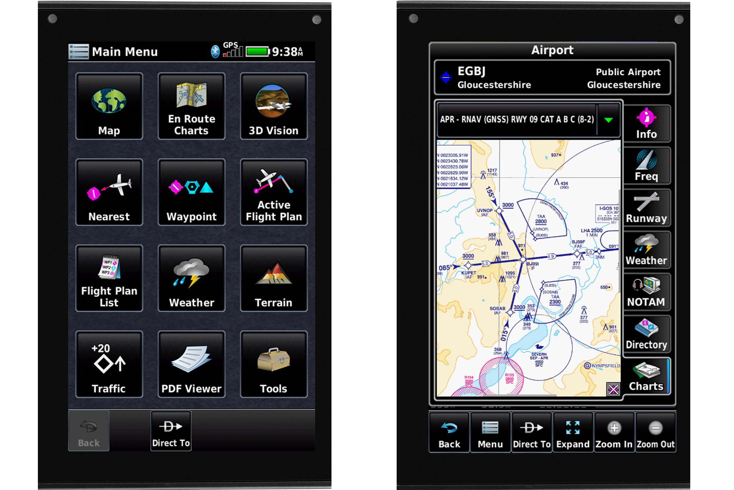
Create waypoints
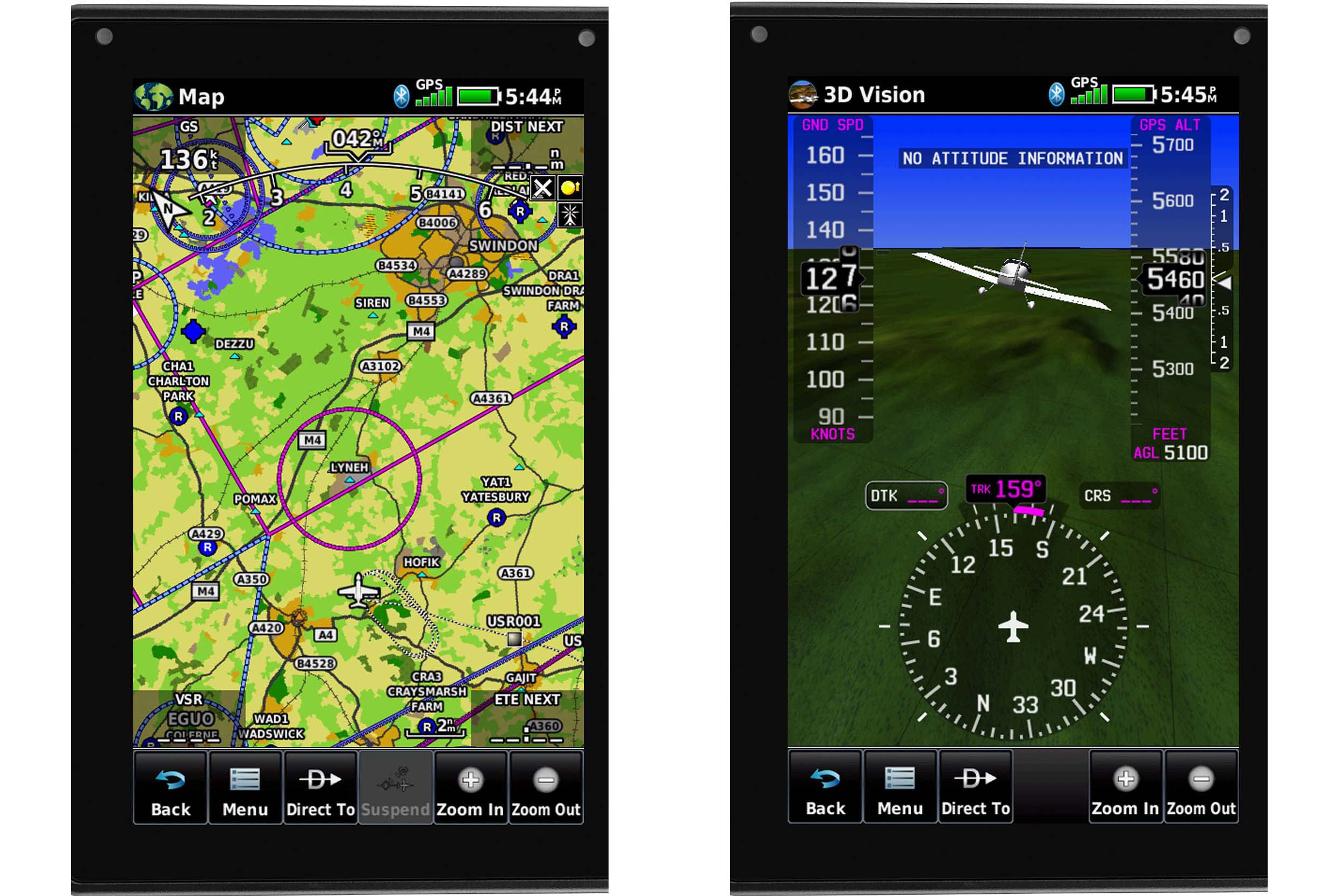
Planning a flight is done through a pretty simple text interface. If you’re routing between and over-known waypoints points then it’s all very easy, but if you want to rubber band your route around something, you’ll have to dip into the ‘Graphically Edit Flight Plan’ option in the menu, which enables you to grab legs of your route via the touch screen, and create waypoints at your new turning point. The loaded Jepp data comes with terminal procedure information, so when building your flight plan you can add instrument departures, arrivals and instrument approaches into your flight plan. You can also incorporate vertical navigation, which will set the unit up to give you descent or climb cues.
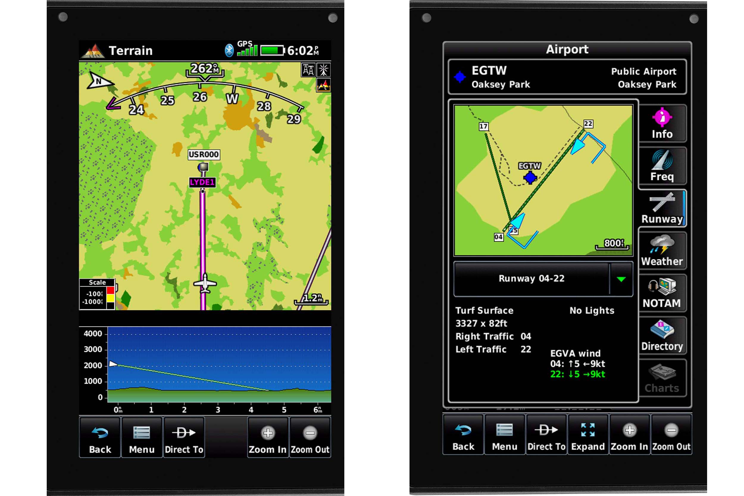
All of this is overkill for a bit of local hand flying, but surprisingly useful for a flight that might incorporate an approach, or one where you need to be at a given altitude in order to vertically avoid airspace. For airfields without an instrument approach, as with the GTN series, you can load and activate a visual approach which will give you pseudo instrument guidance to a visual runway.
No, it’s not meant to be used as a pop-up instrument approach, it’s not meant to be used in IMC, but it’s useful if you’ve ever had trouble seeing the runway in some conditions (or at night).
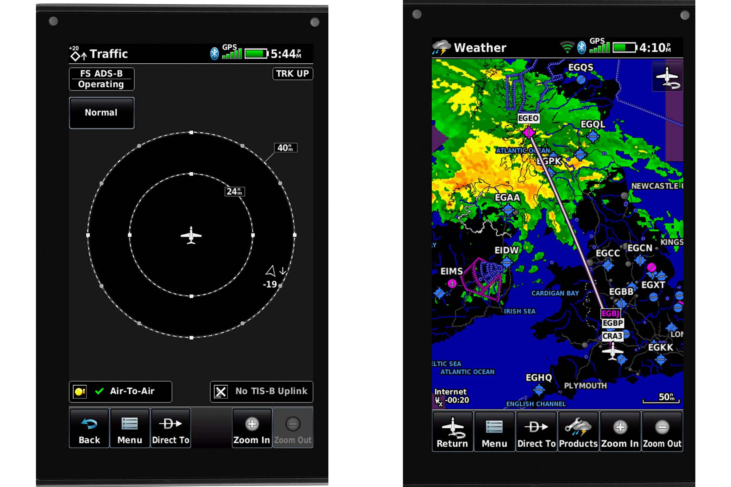
Before finishing your flight planning and heading for the airfield, if the aera is connected to WiFi, it’ll download weather for you, giving you TAFs and METARs, plus composite radar. In the US, with the correct ADS-B In equipment fitted, you can also get weather and traffic when airborne, but no such luck in the UK, well not yet, but who knows…
It’s important to note that you are not able to view Notam, which is really what’s stopping the aera from being a full pre-flight planning device. While I was testing the aera, I sat outside with my iPad and aera side by side and planned the same route, noting the lack of Notam in the aera, I picked up my iPad to take a scroll through the essential information about a light bulb being missing from a mast somewhere in Libya (Notams are serious kids, even if there is a lot of guff in there…Ed), only to find a message about it having switched itself off because it was too hot! Advantage aera…
In addition to the moving map that we’re all (I assume) used to, there’s a screen called 3D Vision that gives you synthetic vision over which is overlaid a pseudo HSI (it has no magnetometer, so only provides GPS track info) and tapes for speed, altitude and vertical speed, as well as vertical guidance when using VNAV. If you are connected (via Garmin’s Connext system) to something in your avionics stack that has a compatible attitude source, you will also see attitude information.
Easy to read
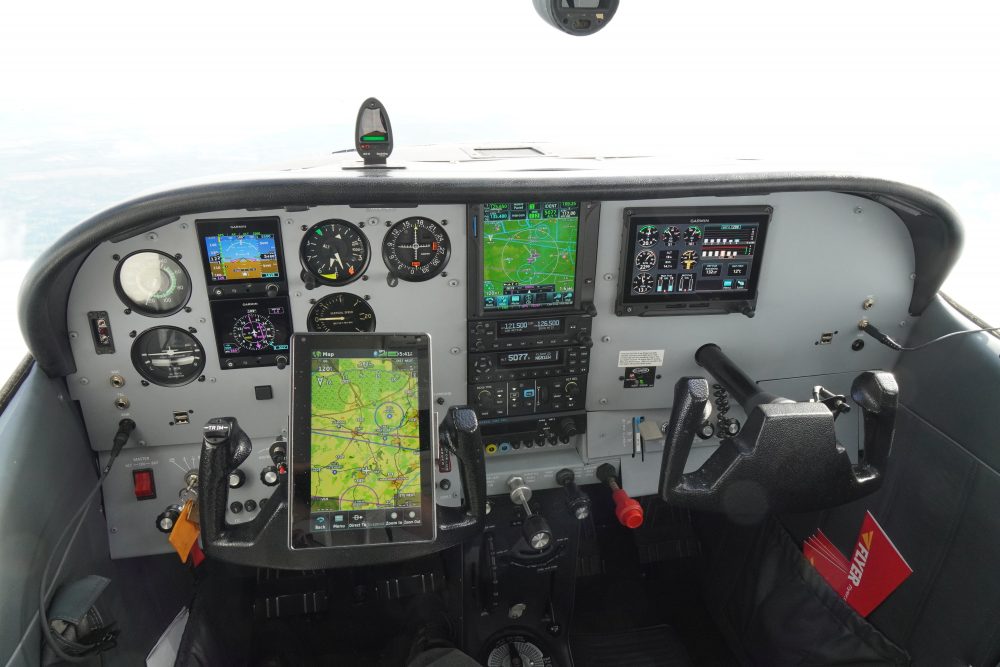
So how about in flight? I’ve already said that it is both smaller and lower resolution than an iPad, even an iPad mini, but in the cockpit the aera screen is bright and easily readable. With backlight set to 80% it is supposed to be good for four hours (not tested), but there’s a handy USB-C port through which you can power it in flight. I didn’t exactly throw it around the cockpit, nor drop it from a great (or even not-so-great) height, so I can’t guarantee its toughness, but with a rubberised back, and a tough looking and feeling exterior, my bet is that inadvertent damage to the aera is less likely than to the iPad. Used loose in the cockpit, it didn’t lose the GPS signal, even when put on the floor, but I got more out of it when on its yoke mount (which will probably require an additional purchase). I’ve got quite a bit of Garmin kit in my aeroplane (see FLYER Summer 2020), and by connecting it to Garmin’s network via Connext I was able to use the aera to amend and upload flight plans to the GTN, receive traffic information and use the aera as a dedicated traffic screen.
So, have I now figured out who’s going to buy one of these? Maybe. If you currently have nothing, and you are looking at buying your first moving map for flying, you should go and buy an iPad (or other suitable tablet) and a planning/navigation app. It’ll do more and cost less.
If you’ve already got an iPad, and you’re looking for a back-up, or an easily readable screen, or you want to guard against your iPad/tablet taking a break when it gets too hot, then an aera’s a great, if expensive, addition. It’s perhaps more compelling if you already have other Garmin equipment and a Connext network. But it really comes into its own if you’re thinking of using it in a Permit aircraft where the flight plan, including its vertical navigation element, can be used to drive Garmin’s experimental version of the brilliant GFC500 autopilot. Linked to the right radios you can select frequencies, and if it has access to gyro info you’ve got a mini removable glass cockpit in your aeroplane for a lot less than a permanently installed one would cost.
FLYER Club member? Watch extra video content on the aera 760 screens in the FLYER Club online