Godrevy lighthouse
Special feature

Eddystone, Lundy… flying round West Country lighthouses

Two pilots wanted a challenge with a difference when it came to Pooleys’ Dawn to Dusk competition. Stately homes? Reservoirs? Then, appropriately, a light bulb moment – lighthouses! 

As we crossed the threshold at Exeter and our wheels touched down we had flown the flight we had been planning and talking about for so long. The weather had been beyond perfect, one of those crystal-clear days when, for the whole day, the weather was not a concern.

As we parked up, closed down and listened to the gyros slowly spinning down, the flight had gone well and we had not messed up. The wise say, ‘plan the flight, then fly the plan’. It’s true.

We decided on this flight around the time covid seemed to be diminishing. Masks were being worn less and we no longer needed to be two metres apart, something of a problem in a DR400 cockpit. It was good to be flying again.

Most of the airfields we usually visited were starting to open up again, although many still had some sort of covid restrictions measures in place, with cafes closed or visiting aircraft not being accepted. 

Fly-outs to France had not yet restarted. As a result, most of the flying we were doing was in the local area, usually in decent weather, for about an hour. So, we wondered what we might do until European flights restarted.

We wanted something that was new, had some challenges and was intrinsically interesting.

Marie and Michael decided on the Robin DR400-120 for their adventure

That’s when the Pooleys’ International Dawn to Dusk Challenge came to mind. Having bought a new chart from Pooley’s online shop, I had seen information about the challenge. The rules are pretty straightforward and the aim is to further your flying, expand your horizons and give an excuse for the flying adventure you always wanted to have. 

Once the thought had burrowed into our minds, more research followed, including a thorough investigation of the rules. An initial thought that this was beyond pilots of our experience and background was mistaken. It became clear the challenge is very easy to enter, and the rules were not onerous. We quickly understood that this was within our grasp. As we looked back over past entrants, and the pilots involved, there was a wide range of experience, as well as in terms of hours flown and types operated. 

We thought, if we do enter, let’s do something we won’t be embarrassed with in the future! There were several things that caught us by surprise. One was how thoroughly enjoyable the process of planning and flying the flight was, and also in putting together the log and other documents. 

One of the first things we did was read the rules carefully. There is an underlying thread about safety, using threat and error management (TEM) to guide preparation, and making whatever you do enjoyable. We also looked at previous entries and were hugely impressed seeing what other pilots had achieved.

Although called ‘Dawn to Dusk’, we decided flying that length of time would be risky in terms of fatigue – and also very costly. We did not want a flight with long legs with little happening.

We preferred a flight with events taking place throughout, so finally we had to consider the aircraft we would use – a Robin DR400-120. We thought of several themes, some of which had been used before – although that would not preclude their use. National Trust houses or land, reservoirs of Devon and Cornwall, (a surprisingly large number!) or pre-Beeching railways… but after much discussion we settled on all the lighthouses in Devon and Cornwall. 

Dawn to Dusk 2022
Micheal and Marie all smiles in cockpit

Fearsome crosswinds

We went through several phases of planning. We had flown together quite a lot and already had a high degree of trust, especially when it came to fearsome crosswind landings that are the norm at Exeter. 

It was during this phase that new skills came to light, which were of huge benefit to our planning. Transferring the information from our carefully marked up half million chart into a digital format that gave accurate fuel and time predictions was central to the flight.

Integrating this with our route on SkyDemon meant we knew at any stage of the flight how much fuel we had used and whether our timings were right. The entry requires logs and evidence for the flight.

The digital method we used would provide planned – and actual times – for each leg. Another aspect of evidence we decided to provide was photographs.

We know that to get a decent aerial photo, like most things in flying, there is a good way to do this. Researching it, we found if you fly around the target as if you were on a 45° cone with its apex on the target, a constant rate turn will enable you to get decent photos with a bit of wing and not find yourself overflying or over banking.

All DR400 photos have a bit of wing in them – the cranked up tips do it! One of the threats we had identified was overbanking to keep a lighthouse in sight and then further tightening the turn leading to a spin.

We decided to practise because we wanted to spend a maximum of one turn over each lighthouse. We also tried different cameras to see how easy/difficult it was to operate them, among the charts, iPad and other kit. We found an altitude of between 1,500ft and 2,000ft worked well to make a constant rate turn without excessive bank. 

It also was very clear that one of us should do the flying and the other take the photos. Keeping a good lookout remained as important as ever. We also found that if you got the approach to the target right we might not need a full turn overhead.

The last thing we discovered was a surprise – of all the cameras we tested, our iPhone came out top. The images were crisp enough, always in focus and much easier to use. We had pouches when not using the phones – dropping them on the floor would not be good… 

Robin DR400
Chocs away – time to go!

Another decision we made was not to worry too much about reflections in the canopy. DR400s are blessed with a fantastic bubble canopy. Any reflections would add to the authenticity of the moment.

As all this was going on, the aeroplane was readied. We decided to wear immersion suits, the predicted sea temperature was forecast to be around 9°C. We had been on the GASCo ditching course at the RNLI in Poole and remembered hearing some shattering truths about survival times in cold water.

We also took a life raft, grab bag and emergency location beacon. We had some sectors where we were well out of gliding range of land – out to Lundy, crossing to the Scilly Isles, Eddystone off Plymouth. 

Then there was visiting the Bishop Rock Lighthouse off the Scilly Isles which looked as if it was halfway to America. 

Anyway, immersion suits are sufficiently itchy and uncomfortable to keep you alert and awake throughout the flight and have useful pockets for snacks as well!

One of the threats we needed to mitigate was notified airspace. We rang the different controllers, or people who managed the airspace both civil and military, and explained our mission. They were incredibly helpful, checked our frequencies and gave us good advice, when it’s good to call when airborne… all sorts of helpfulness and kindness. We emailed to confirm everything.

The airspace on the Lizard Peninsula was full of combined MATZ and Danger Areas. The controller here was particularly helpful in advising us of best times to arrive in the area and which bits were active etc. We felt a strong sense of belonging to the aviation family! All this worked really well. As we called en route we were expected, welcomed and went on our way.

Fantastic weather

The day of the flight dawned with fantastic weather. Early stratus would soon clear and a solid anticyclone was centred in northern UK. The northerly wind kept the temperature down, good news when wearing an immersion suit in cramped confines. The aircraft was ready, fully fuelled and checked over… and we were ready to go.

As the saying goes, ‘plan the flight, then fly the plan’…

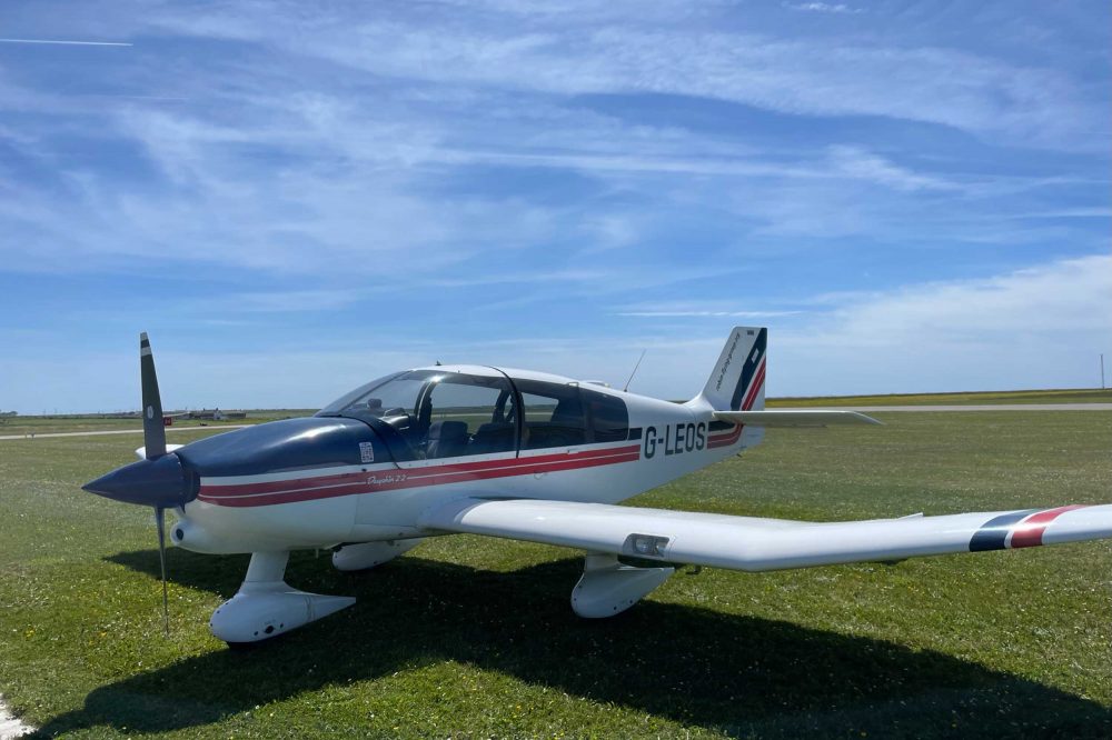
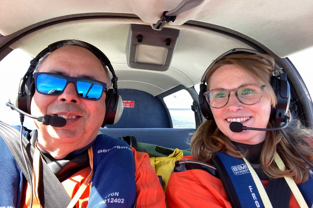
Two people getting into a DR400 and settling takes a few minutes, getting cameras stowed, Emergency Location Transmitter in place, PLOG ready, iPad set up, SkyEcho set and ATIS heard. We were ready to start and felt a little nervous and apprehensive.

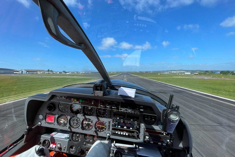
Plan the flight and fly the plan… Hearing the tower steadied our nerves a bit. Then to the holding point and moment of clearance to take off. Brakes off, and the clock started.

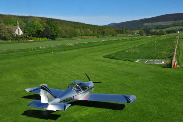
The first leg was to Lynton Lighthouse. Enough time to settle down. DR400s are funny beasts, at least that’s the excuse best used. Once trimmed they fly on rails. Not quite trimmed, they climb and descend as they feel necessary!

We got G-LEOS trimmed and set up the cockpit for the flight. iPhones in pouches, PLOG handy. iPad and Sky Demon deployed.

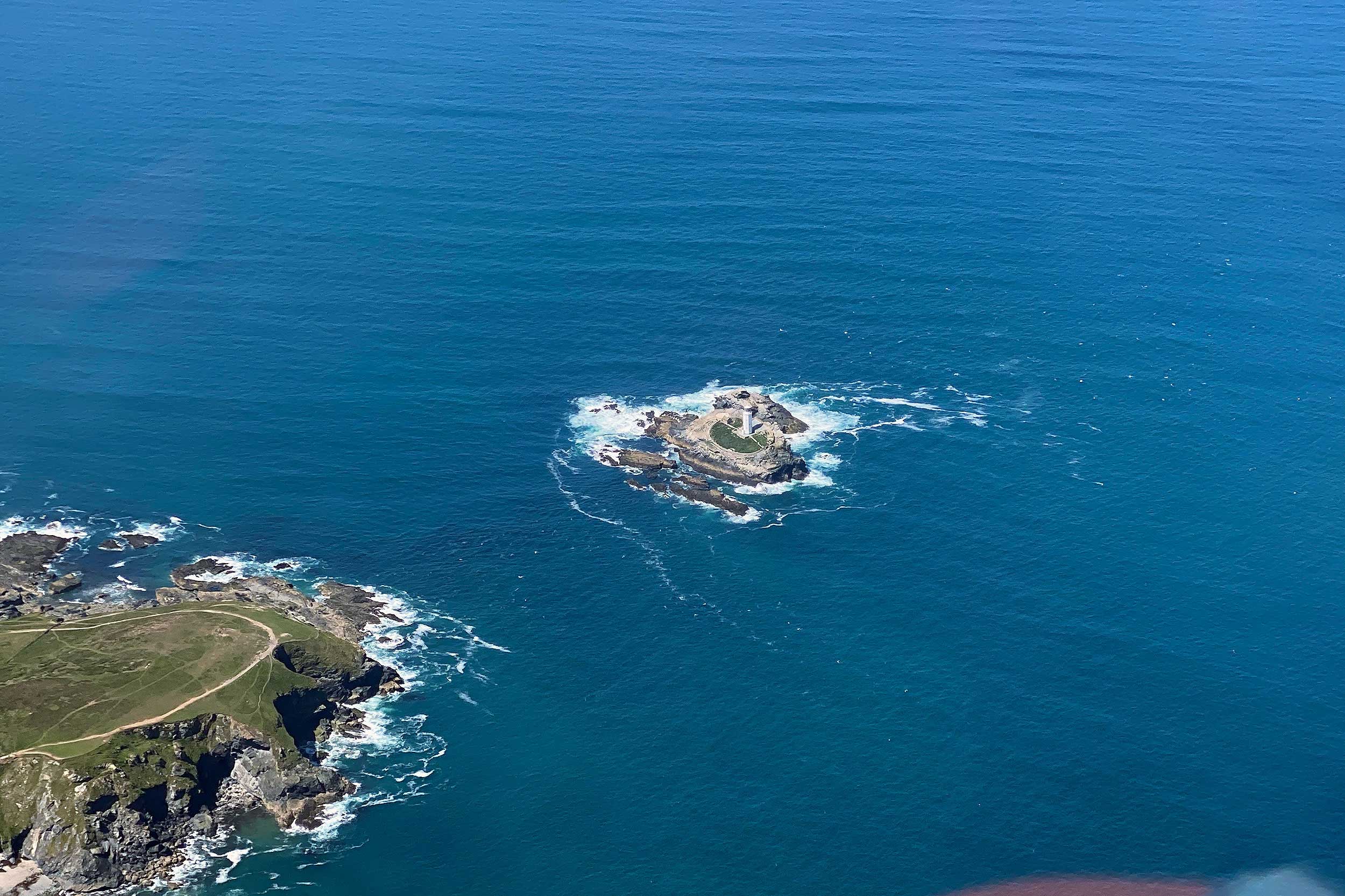
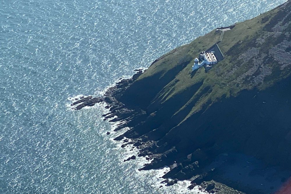
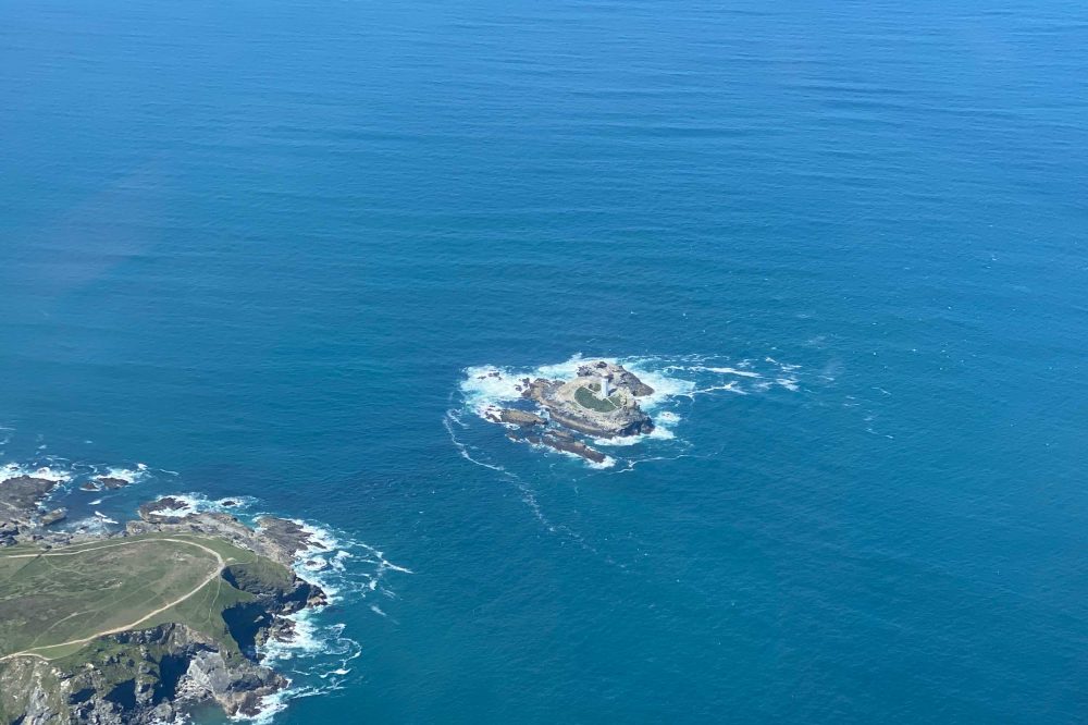
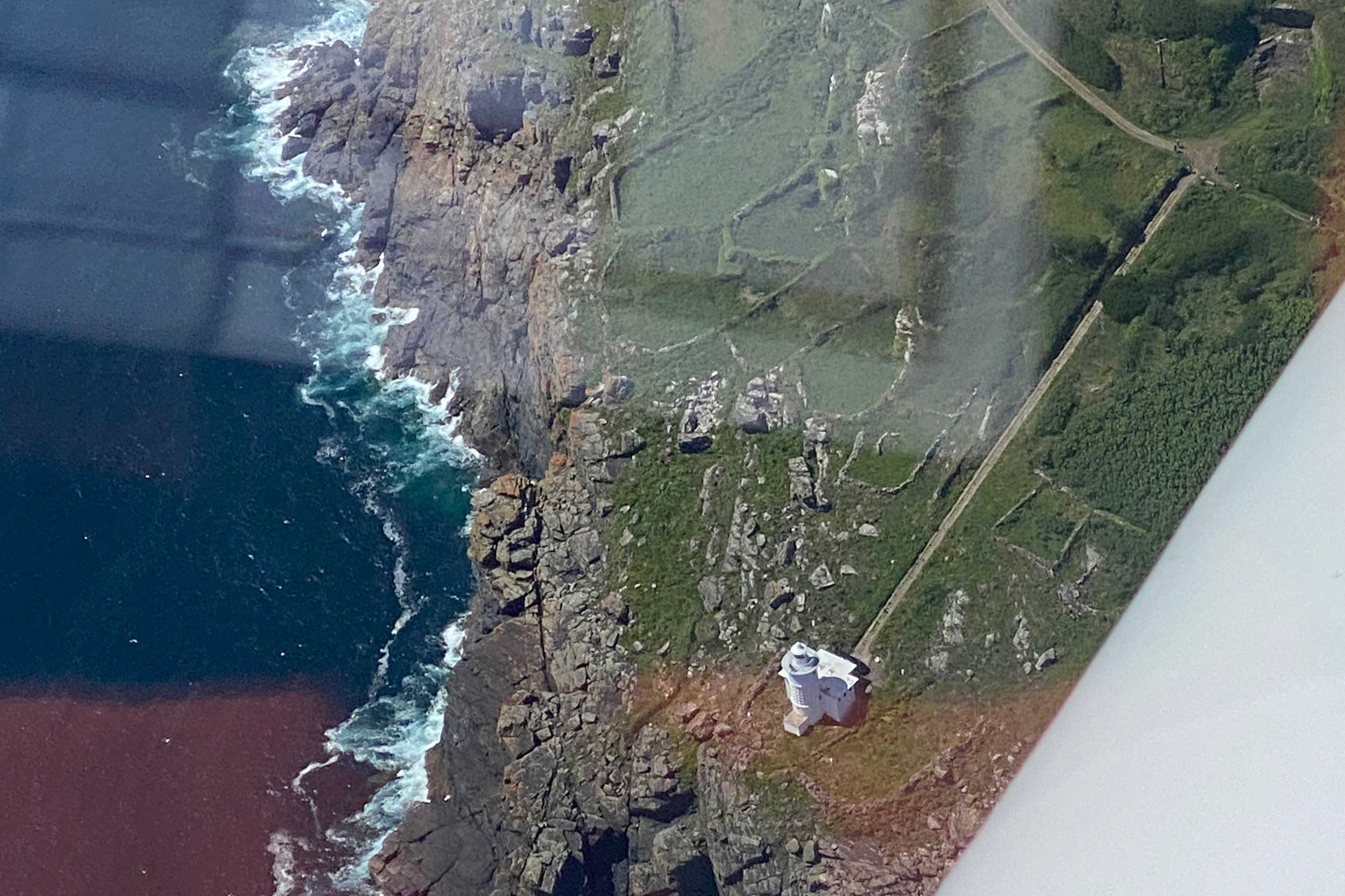
We arrived over Lynmouth not long after departure and couldn’t see the lighthouse! Deep unease ensued. Reference to the half mill chart and SkyDemon showed it on a headland to the east of the town. Looking at the headland, no lighthouse… Deeper unease.

We flew on towards the headland and a tiny white tip of the light appeared, followed by the small complex of buildings and we had the first lighthouse in sight. Memorable for so many reasons.

We had found it! In our defence, it was not a huge tower, gaining its height for its beam from the location high up on the headland cliffs. All thoughts of 45° cones vanished and I overshot badly making a decent photo impossible. The second pass was much better. This could all come together, the plan could work.

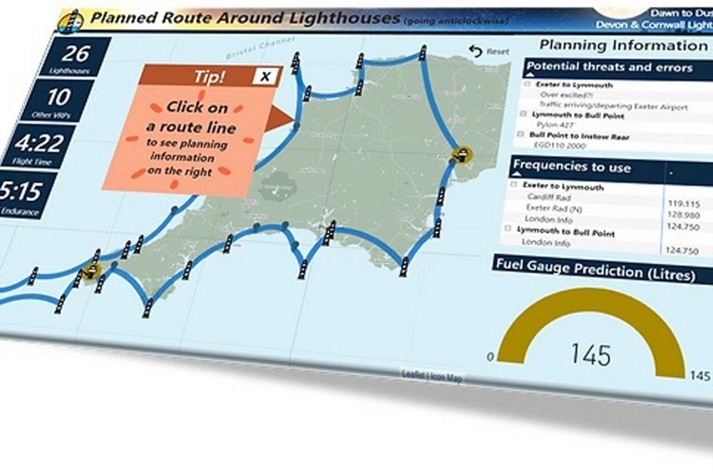
The first lighthouse was ticked off on the PLOG and as we cleared the area and set off for the next lighthouse, we changed from Cardiff Listening Squawk to London Information.

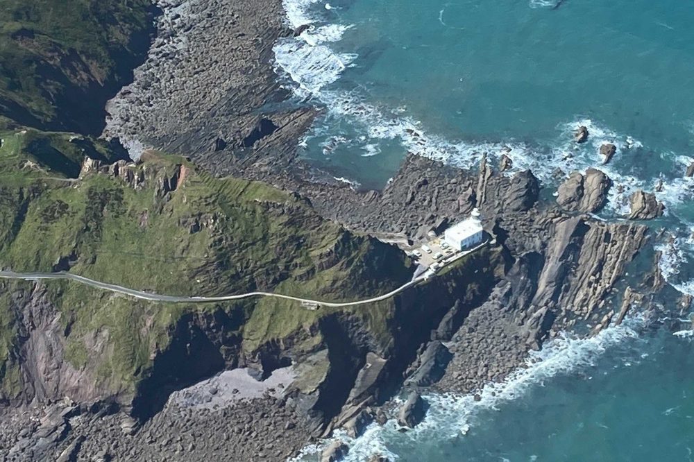
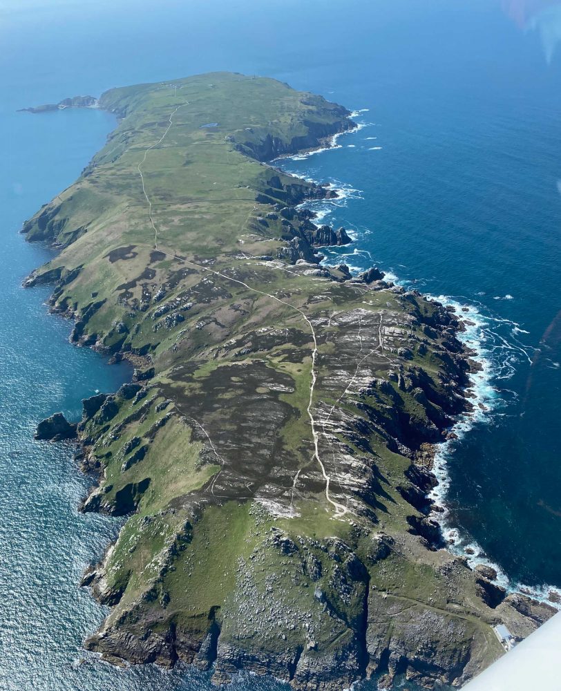
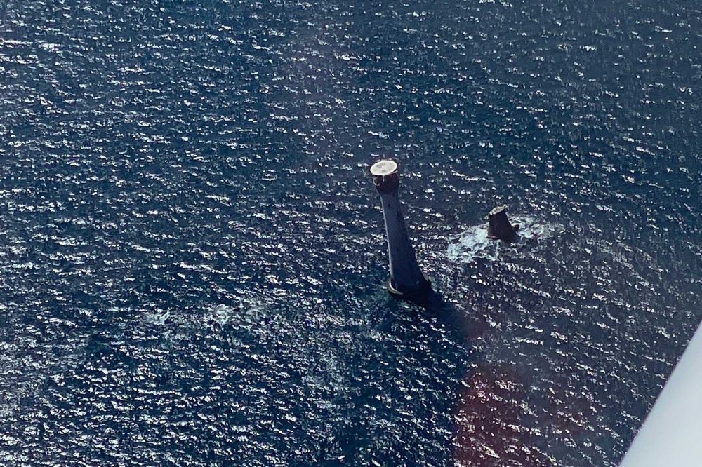
Tracking along the north coast of Devon we passed the planned lighthouses one by one. Ilfracombe, then Bull Point where the keepers came out one morning to find huge cracks had appeared outside their door. The station was in danger of collapse into the sea! A new light was built and opened in 1974. 

Lynmouth lighthouse
Lynmouth lighthouse is well tucked in the headland, and proved a tricky fine – but what a memorable discovery!
Hartland lighthouse is spectacular – a substantial tower set on the cliffs…
Lundy Island – 10 miles into the Bristol Channel

From here we turned south and the two lighthouses we missed. These were at Instow on the Torridge Estuary, between Barnstaple and Bideford. There are two lights here, more like small pylons, which we could not find from the air. After a couple of turns we took some photos of the stunning estuary and set off for Hartland.

Hartland has one of the most spectacular lighthouses. A substantial tower set on the cliffs. It was the jumping off point for visiting Lundy Island 10 miles into the Bristol Channel.

No matter how many times the coasting out checks are done, somehow the engine seems to sound different, just as we fly out of gliding range from the shore. Lundy has a lighthouse at both its north and south ends.

There is also a redundant one in the centre of the island. The reason for the redundancy was the tragic wreck of La Jeune Emma in 1828 (you can find the full story on the Trinity House website). 

A circuit of the island was what we needed. We were getting better all the time at getting our approach right and the 45° cone was right after all.

Godrevy lighthouse featured in Virginia Woolf’s novel, To the Lighthouse
Coasting out to the Scilly Isles was stunning

One by one the lights slipped by Trevose Head, guarding the Camel Estuary and Padstow. We called Newquay on time who cleared us through their centreline and looked after us right up until we changed to Scilly Isles Approach.

Then came Godrevy, (the lighthouse in Virginia Woolf’s novel, To the Lighthouse), St Ives and Pendeen near Land’s End Airport. We stayed on frequency with Newquay, who handed us over to Scilly Isles radar, who were expecting us, and as ever, welcoming and friendly, they knew our route.

Coasting out to the Scilly Isles was truly stunning and it was hard to concentrate. The skies were deep blue and tracks of aircraft setting out across the Atlantic were overhead.

The sea’s beautiful shades of blue and green, from emerald to sapphire, are quite breath-taking. The crossing is not that far, but a good lookout is needed. We needed to find the Sevenstones Lightship and just spotted it as it slipped under the wing – one of the best finds of the trip. Then Round Island on its own small crop of rock before what was one of the most exciting parts of the flight.

Heading out into the Atlantic

We headed off into the Atlantic to find the Bishop Rock lighthouse, and it was very reassuring to have SkyDemon as we did this. Awesome! Slowly, it came closer, battered by the seas that have reached at least two-thirds of the way to the top.

One of the tallest towers, now not staffed, all maintenance and repairs are completed by crews lifted by the Trinity House helicopter to the ‘top hat’ platform.

We thought Bishop Rock might be hard to beat on the spectacular scale, but not so. Heading back to the mainland (thanks Scilly Isles Radar) we passed both Wolf Rock and Longships, the scenes of hundreds of wrecks before they were established.

We took a well-earned rest at Land’s End Airport. A chance to wriggle out of immersion suits and have a coffee and sandwich from the well-stocked café there. Dehydration and fatigue were threats we had identified, so we were definitely ready for a short break.

We had established with Culdrose that its danger areas would not be active after 1400, and the ATZs and combined MATZ similarly so. Land’s End ATC kindly confirmed this before take-off. So, we were rested and ready to go, we swapped PI and photographer/radio duties and set off again.

First up, Tater Du, Cornish for black bread, refers to the cliffs nearby where basaltic volcanic outflow has solidified in what looks like black loaves! Then onward to the Lizard lighthouse, through the now closed danger areas, and on to St Anthony’s light at the head of the Falmouth Estuary.

Eddystone lighthouse lies 12 miles off Plymouth
Following the final lighthouse of our set, Teignmouth, came the Exe estuary… Exeter and ‘airfield in sight’

We reached Looe almost exactly at the time we needed to be there to go out and photograph the Eddystone lighthouse, 12 miles off Plymouth. In our preparation we knew there was a fast jet exercise in the danger area within which the Eddystone is located, but that ended at 1500. Sure enough we contacted the frequency and, as the exercise had ended, we were cleared into D009A and found the Eddystone Lighthouse.

The stump marking a previous incarnation of the light made the whole appearance much more dramatic. The previous lighthouse was dismantled and reconstructed on Plymouth Hoe and is called Smeaton’s Tower after its designer. We crossed the breakwater and circled Smeaton’s Tower – lighthouse number 23 of 26. 

Next was Start Point where the Devon coast turns north. The tidal race here was really pronounced, not a place to be close to in a vessel. Heading towards Berry Head, the land became more familiar, yet despite the number of times we had been here I had never seen Berry Head lighthouse.

Rather like Lynton, it was hard to spot, a fairly small lighthouse with a short tower but on the top of tall cliffs. Teignmouth was the last lighthouse of our set. The Exe Estuary followed and once more we called Exeter and ‘airfield in sight’.

The weather held, our Robin DR400 G-LEOS behaved magnificently, we planned the flight and flew the plan, and we were in impossibly good spirits. Somehow wearing an immersion suit for that length of time almost seemed fun.

And... home!

Post-flight: creating the D2D entry

After the delight of the flight had begun to wear off, the reality of getting an entry together sunk home. It could so easily have been a task, instead it turned into a delight. Each of us had very different strengths to bring to the table. 

The rules ask for certain things so we started there, a good log, evidence we had actually done the flight and any associated research. Trinity House, which looks after lighthouses in the UK, was incredibly helpful explaining things that seemed too technical.

We developed a digital entry that could be visited on a website and a polar opposite an analogue photo album, hand produced and handwritten. One final check to make sure we had missed nothing from the rules and we posted off the entry.

Around November 2022 we got an email from Sebastian Pooley inviting us to the Dawn to Dusk dinner in February at the RAF Club in Piccadilly, London. We were stunned to have won the Duke of Edinburgh Trophy, the top prize and £1,000. We also won the Pooleys Sword for the Best Log. Massive relief, no speeches required… if there had been, the definition of ‘incoherence’ could well have been rewritten…

Some ideas for future entrants

  • Check out the rules carefully, none are difficult, but they give a good steer on what is involved.
  • Dawn to Dusk does not have to be taken literally. Up at 0429, down 2053! As long as you meet the rules requirement for hours flown it’s OK.
  • Pick something realistic that challenges, but is within reach.
  • You may not have to go far from your base, which will keep costs down.

Pick something that interests you, if you can do this with a like-minded passenger or pilot it can be five times the enjoyment.


Footnote: Many thanks to Pooleys for organising the competition and for such a generous prize.  Also thanks to Dermot Richardson of the Robin Flying Group and to Lyn Facy, our CFI, for lending us the DR400.

If you’d like to enter the Pooleys Dawn to Dusk Challenge this year, click here

Share

Leave a Reply

Share
Topics
  • 2
  • 3
Enjoy 3 Free articles OR Join today to enjoy unlimited access to all content
Join today

We use cookies to give you the best online experience. Please let us know if you agree to all of these cookies.